Download

1 / 22
220 likes | 692 Views
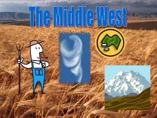
Middle West States. History of the Midwest. The Louisiana Purchase. In 1803, over 900,000 square miles was purchased for 15 million dollars by the United States from France. This purchase doubled the size of the United States and initiated the expansion of the West. The Homestead Act

E N D
The Louisiana Purchase In 1803, over 900,000 square miles was purchased for 15 million dollars by the United States from France. This purchase doubled the size of the United States and initiated the expansion of the West.
The Homestead Act of 1862 If you were a male or female citizen of the United States ( or an intending citizen) and the head of the household or over 21 years of age, you could be given l 160 acres of land as long as you agreed to stay on it and make improvements for 5 years.
The Pony Express April 3,1860- October 1861 The purpose of the Pony Express was to provide the fastest mail delivery between St. Joseph, Missouri and Sacramento, California. Horses traveled an average of 10 miles per hour. The official end of the Pony Express was due to the completion of the TELEGRAPH. Riders got a fresh horse every 10-15 miles.
The land in the central United States is the best breeding ground for the storms which produce tornadoes. The land in the Great Plains is relatively flat, which allows cold dry polar air from Canada to meet warm moist tropical air from the Gulf of Mexico. It's along the front between the two air masses that most tornadoes form. Known as Tornado Alley, the states involved are Alabama, Arkansas, Florida, Iowa, Kansas, Mississippi, Missouri, Nebraska, Oklahoma and Texas.
The Plains States The Great Plains are the most important land feature in the western part of the region. Iowa, Missouri, Kansas, Nebraska, South Dakota, and North Dakota are the called the Plains States. The land is flat, although it does rise gradually to eventually meet the Rocky Mountains.
Ozark Plateau Like the rest of southeast Kansas, the Ozark Plateau averages more than 40 inches of precipitation a year, making it one of the wettest places in the state.
The Upper Peninsula is located in the Northern 1/3rd of Michigan. The state of Michigan has roughly a population of over 9 million, yet the U.P. only has 300,000 residents. The Upper Peninsula also comprises 1/3rd of the total land mass of the state of Michigan. Upper Peninsula A "Peninsula" is an area of land whose three sides are bordered by water. The U.P. is surrounded by Lake Superior to the north, Lake Michigan to the South, and Lake Huron to the east. The U.P. also is bordered to the west by our neighboring state of Wisconsin.
Lake Itasca Lake Itasca is located in Minnesota. It is the origin of the Mississippi River.
Located in southwestern South Dakota, Badlands National Park consists of 244,000 acres of sharply eroded buttes, pinnacles and spires blended with the largest, protected mixed grass prairie in the United States. The Badlands Wilderness Area covers 64,000 acres and is the site of the reintroduction of the black-footed ferret, the most endangered land mammal in North America Badlands Badlands
Named after the dark green pine trees covering its surface, the Black Hills were long considered sacred land by the Sioux Indian tribe. Central Lowlands The only landforms in the Central Lowlands are rivers and hills. Black Hills
The name "Black Hills" comes from the Lakota words Paha Sapa, which mean "hills that are black". Seen from a distance, these pine-covered hills, rising several thousand feet above the surrounding prairie, appear black. Harney Peak, at 7242 above sea level, is the highest point in the United States east of the Rockies. Black Hills
Sculptor Gutzon Borglum began drilling into the 6,200-foot Mount Rushmore in 1927. Creation of the Shrine to Democracy took 14 years and cost a mere $1 million, though it's now deemed priceless. Mount Rushmore
The Gateway Arch, located on the riverfront in St. Louis, Mo., is a tapered curve of stainless steel. The tallest manmade memorial in the United States, the Arch was designed by Finnish-born U.S. architect Eero Saarinen and built between 1963 and 1966. Visitors can ride to the top in specially devised capsule-like tram cars. Visit the Golden Arch Golden Arch The Golden Arch stands 630 feet and spans 630 feet along the Mississippi riverfront.
Black Hills Gold Black Hills gold, the state jewelry, is created and manufactured exclusively in the Black Hills of South Dakota. Each design incorporates the traditional motif of grapes and leaves in tri-color combinations of green, rose and yellow gold. GOLD
Other Natural Resources Coal Iron Ore Used to manufacture steel. Oil and Natural Gas Water soil
Agriculture and Industry
Agricultural Products Dairy and beef cattle hogs wheat corn soybeans
Industry Vehicle Manufacturing