Download
1 / 22
220 likes | 342 Views
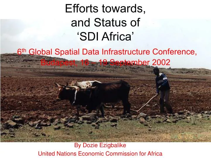
Efforts towards, and Status of ‘SDI Africa’ 6 th Global Spatial Data Infrastructure Conference, Budapest, 16 – 19 September 2002. By Dozie Ezigbalike United Nations Economic Commission for Africa. Pretoria Initiative of 1999 UNECA and the Committee on Development Information

E N D
Efforts towards,and Status of‘SDI Africa’6th Global Spatial Data Infrastructure Conference, Budapest, 16 – 19 September 2002 By Dozie Ezigbalike United Nations Economic Commission for Africa
Pretoria Initiative of 1999 • UNECA and the Committee on Development Information • CODI-2 SDI Recommendations • ECA’s SDI activities • Other relevant initiatives • Conclusion Outline
Conference of ‘Earth Data Information Systems’ (EDIS) in Pretoria in July 1999 • Workshop to consider a spatial data infrastructure for Africa • Organised by NSIF and World Bank Programme on Environmental Information Systems for SSA (now EIS-Africa) • Four Areas: • Networking • Incentives and Obstacles • Technology • Framework for African SDI Pretoria Initiative
To share, assist, participate, learn and link-up with other initiatives worldwide (GSDI) • Identified Initiatives: • The Program on Environment Information Systems in Sub-Saharan Africa (EIS) • The Food Security Programme/ Regional Remote Sensing Unit of the Southern African Development Community (SADC) • The South African National Spatial Information Framework (NSIF) Directorate – as host of the Network Networking
Money saving • Transfer of tools and knowledge among countries • Trans-boundary decisions • Disaster mitigation and prevention • Multi-disciplinary approach • Alignment of regional projects Incentives
Lack of awareness • Perceived control of SDI by national mapping agencies • Political systems and legacies • Initiatives driven by donors with different agendas • Financial constraints • Coordination of the initiative • Travel for meetings and conferences • Leadership and trust Obstacles
Need to use standards and technology endorsed by GSDI • Internet and network connectivity across Africa • Need for a test project involving traditional and non-traditional mapping agencies • Short term: Metadata and clearinghouse, with virtual nodes • Long term: Education, software access, metadata and permanent clearinghouse nodes Technology
Role of CODI-Geo recognised • Request a standing committee on African SDI • Request NSIF to provide tools and initial coordination • Interim task team until GSDI-4 in Cape Town • Bottom-up approach using existing initiatives Framework
Identified individual ‘champions’ did not necessary commit their organisations • No resources–human and financial–to run the initiative • Not enough time for activities planned before Cape Town 2000 • Outside CODI meeting cycle • No CODI meeting by time of Cape Town 2000 for report What went wrong?
Committee On Development Information • Established in 1997 by the Conference of African Ministers responsible for Planning & Development • Therefore it is one of the parliamentary organs of ECA • Makes recommendations to the Conference of ministers for implementation • Provides policy and technical guidance for the implementation of the program on “harnessing information for development” • Resolutions influence design of ECA/DISD work programmes What is CODI?
Brings together practitioners in • Statistics • Geoinformation • Libraries and documentation • Information and communications technology • Official delegates are government officials in these fields • Observers from academia, private practice, non-governmental organisations, community-based organisations, etc • Before CODI, different United Nations Regional Conferences • E.g., UN Cartographic Conference CODI …
CODI meetings have two functions • Parliamentary: • Make resolutions and recommendations for governments and ECA to implement • Educational: • Intellectual think-thank and exposure to new concepts and technology Dual Function
Divided into discipline-based subcommittee • CODI-Geo • CODI-Stats • CODI-ICT (incorporating librarians) • Targeted workgroups in subcommittee • Report back in plenary for interfaces and synergies • CODI-Geo assumes functions of UNRCCA • With information society focus on the issues • Current emphasis on SDI developments Subcommittee Structure
Priority should be given to establishment of NSDI • Also establish RSDI, with an African Geographic Database • ‘Permanent Committee’ on SDI in Africa • Participate in international developments and efforts • National GI policies should be integral part of national information and communications policy • Appropriate legal, institutional and technical framework for integrated SDI • Adapt ECA model policy guidelines CODI II Resolutionson SDI
Pre-CODI II, prepared position paper on “Future orientation of GI activities …” • Adopted by CODI II • Participation in workshops and seminars to raise awareness • FIG, AfricaGIS, UNEP meetings, GISD, US/NRC, OOSA’s disaster management and GNSS workshops, etc • Study on use of GIS in statistical offices • Study on status of SDI in Africa and way forward–ongoing • Group of experts meeting to produce SDI Africa handbook ECA Response
Planned symposium to set up regional body for coordinating SDI activities • Similar to permanent committees of Asia-Pacific and Latin America • Clearinghouse node for search and discovery of spatial data resources with African content • With country spaces for interim hosting of metadata on behalf of member states • Mapping services for dissemination of ECA information • Continuing efforts on AFREF ECA Response …
CODI Secretariat – ECA Geoinformation Team – has studied and adapted statement of PCGIAP, PC-IDEA, EUROGI and GSDI Association • Will make proposals to the ‘Way Forward’ experts meetings on structural positioning of the body • Funding and continuity are big issues • Reporting and supervisory arrangements • Symposium in 2003 to adopt recommendations • CODI-III in May 2003 to ratify and operationalise Status of ‘Permanent Committee’
EIS-Africa • Successor to World Banks EIS-SSA • Grew out of need to harmonise spatial data resources for NEAPs in the 1980 – including institutional arrangements and partnerships • UNEP’s African Environmental Information Network • FAO’s Africover project • US State Dept’s GISD • Forum on Information for Sustainable Development Other Major Initiatives
‘SDI Africa’ is on track • Slow but making progress • May or may not be called PC • Structure likely to be ratified at CODI-III • What has changed? • More understanding and communication between several initiatives • More understanding and cooperation among national mapping organisations and other national agencies • More willingness among donors to cooperate • More targeted assistance from GSDI, FGDC and FIG towards SDI initiatives in Africa and the ‘PC’ Conclusion
CODI III planned for May 2003 • Theme will be on “Information for Governance” • To feed into 4th African Development Forum (ADF IV) theme of Governance • Usual pre-meeting and side workshops and seminars • Suggestions for workshop themes welcome • Expression of interest to organise or sponsor workshop or seminar welcome CODI III
Karima Bounemra • Director, Development Information Services Division • kbounemra@uneca.org • Orlando Nino-Fluck • Team Leader, Geoinformation Team • onino@uneca.org • Dozie Ezigbalike • Development Management Officer • ezigbalike.uneca@un.org • Web site: • www.uneca.org/codi • www.uneca.org/disd/geoinfo Contacting us