Download
1 / 55
580 likes | 839 Views
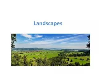
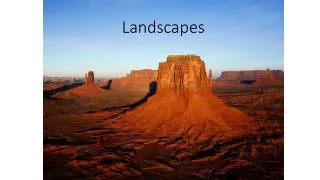
Chapter 3 Landscapes Fashioned by Water. Earth’s External Processes. Weathering, mass wasting, and erosion are all called external processes because they occur at or near Earth’s surface

E N D
Earth’s External Processes • Weathering, mass wasting, and erosion are all called external processes because they occur at or near Earth’s surface • Internal processes, such as mountain building and volcanic activity, derive their energy from Earth’s interior
Mass Wasting: The Work of Gravity • Mass wastingis the downslope movement of rock and soil due to gravity • Controls and triggers of mass wasting • Water—Reduces the internal resistance of materials and adds weight to a slope • Oversteepening of slopes
Mass Wasting: The Work of Gravity • Controls and triggers of mass wasting • Removal of vegetation • Root systems bind soil and regolith together • Earthquakes • Earthquakes and aftershocks can dislodge large volumes of rock and unconsolidated material
Water Cycle • The water cycle is a summary of the circulation of Earth’s water supply • Processes in the water cycle • Precipitation • Evaporation • Infiltration • Runoff • Transpiration
The Water Cycle Figure 3.5 Figure 16.3
Distribution of Earth’s Water Figure 3.4
Running Water • Streamflow • The ability of a stream to erode and transport materials is determined by velocity • Factors that determine velocity • Gradient, or slope • Channel characteristics including shape, size, and roughness
Running Water • Streamflow • Factors that determine velocity • Discharge—The volume of water moving past a given point in a certain amount of time • Changes along a stream • Cross-sectional view of a stream is called the profile • Viewed from the head(headwaters or source) to the mouth of a stream
Running Water • Changes from upstream to downstream • Profile • Profile is a smooth curve • Gradient decreases downstream • Factors that increase downstream • Velocity • Discharge • Channel size
Longitudinal Profile of a Stream Figure 3.8
Base Level • Base level and stream erosion • Base level is the lowest point to which a stream can erode • Two general types of base level • Ultimate (sea level) • Local or temporary
Base Level • Base level and stream erosion • Changing conditions causes readjustment of stream activities • Raising base level causes deposition • Lowering base level causes erosion
The Work of Streams • Stream erosion • Lifting loosely consolidated particles by • Abrasion • Dissolution • Stronger currents lift particles more effectively
The Work of Streams • Transport of sediment by streams • Transported material is called the stream’s load • Types of load • Dissolved load • Suspended load • Bed load • Capacity—the maximum load a stream can transport
The Work of Streams • Competence • Indicates the maximum particle size a stream can transport • Determined by the stream’s velocity
The Work of Streams • Deposition of sediment by a stream • Caused by a decrease in velocity • Competence is reduced • Sediment begins to drop out • Stream sediments • Generally well sorted • Stream sediments are known as alluvium
The Work of Streams • Deposition of sediment by a stream • Delta—Body of sediment where a stream enters a lake or the ocean • Results from a sudden decrease in velocity • Natural levees—Form parallel to the stream channel by successive floods over many years
Formation of Natural Levees Figure 3.14
The Work of Streams • Deposition of sediment by a stream • Floodplain deposits • Back swamps • Yazoo tributaries
Stream Valleys • The most common landforms on Earth’s surface • Two general types of stream valleys • Narrow valleys • V-shaped • Downcutting toward base level • Features often include rapids and waterfalls
Stream Valleys • Two general types of stream valleys • Wide valleys • Stream is near base level • Downward erosion is less dominant • Stream energy is directed from side to side forming a floodplain
Stream Valleys • Features of wide valleys often include • Floodplains • Erosional floodplains • Depositional floodplains • Meanders • Cut banks and point bars • Cutoffs and oxbow lakes
Erosion and Deposition Along a Meandering Stream Figure 3.17
Floods and Flood Control • Floods and flood control • Floods are the most common and most destructive geologic hazard • Causes of flooding • Result from naturally occurring and human-induced factors • Causes include heavy rains, rapid snow melt, dam failure, topography, and surface conditions
Floods and Flood Control • Floods and flood control • Flood control • Engineering efforts • Artificial levees • Flood-control dams • Channelization • Nonstructural approach through sound floodplain management
Drainage Basins and Patterns • Drainage networks • Land area that contributes water to the stream is the drainage basin • Imaginary line separating one basin from another is called adivide
Drainage Basin of the Mississippi River Figure 3.21
Drainage Basins and Patterns • Drainage pattern • Pattern of the interconnected network of streams in an area • Common drainage patterns • Dendritic • Radial • Rectangular • Trellis
Drainage Patterns Figure 3.22
Water Beneath the Surface • Largest freshwater reservoir for humans • Geological roles • As an erosional agent, dissolving by groundwater produces • Sinkholes • Caverns • An equalizer of stream flow
Water Beneath the Surface • Distribution and movement of groundwater • Distribution of groundwater • Belt of soil moisture • Zone of aeration • Unsaturated zone • Pore spaces in the material are filled mainly with air
Water Beneath the Surface • Distribution and movement of groundwater • Distribution of groundwater • Zone of saturation • All pore spaces in the material are filled with water • Water within the pores is groundwater • Water table—The upper limit of the zone of saturation
Features Associated with Subsurface Water Figure 3.25
Water Beneath the Surface • Movement of groundwater • Porosity • Percentage of pore spaces • Determines how muchgroundwater can be stored
Water Beneath the Surface • Movement of groundwater • Permeability • Ability to transmit water through connected pore spaces • Aquitard—An impermeable layer of material • Aquifer—A permeable layer of material
Water Beneath the Surface • Springs • Hot springs • Water is 6–9ºC warmer than the mean air temperature of the locality • Heated by cooling of igneous rock • Geysers • Intermittent hot springs • Water turns to steam and erupts
Water Beneath the Surface • Wells • Pumping can cause a drawdown (lowering) of the water table • Pumping can form a cone of depression in the water table
Formation of a Cone of Depression Figure 3.28
Water Beneath the Surface • Artesian Wells • Water in the well rises higher than the initial groundwater level • Artesian wells act as “natural pipelines” moving water from remote areas of recharge great distances to the points of discharge
An Artesian Well Resulting from an Inclined Aquifer Figure 3.29
Water Beneath the Surface • Environmental problems associated with groundwater • Treating it as a nonrenewable resource • Land subsidence caused by its withdrawal • Contamination
Water Beneath the Surface • Geologic work of groundwater • Groundwater if often mildly acidic • Contains weak carbonic acid • Dissolves calcite in limestone • Caverns • Formed by dissolving rock beneath Earth's surface • Formed in the zone of saturation
Water Beneath the Surface • Caverns • Features found within caverns • Form in the zone of aeration • Composed of dripstone • Calcite deposited as dripping water evaporates • Common features include stalactites (hanging from the ceiling) and stalagmites (growing upward from the floor)