Download
1 / 64
700 likes | 1.15k Views
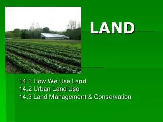
LESA: LAND EVALUATION AND SITE ASSESSMENT. A successful land classification for farmland protection A general introduction is in (van Diepen et al., 1991) pp. 191-2. The original system is presented in (U.S. Department of Agriculture, 1983a). Example

E N D
LESA: LAND EVALUATION AND SITE ASSESSMENT A successful land classification for farmland protection A general introduction is in (van Diepenet al., 1991) pp. 191-2. The original system is presented in (U.S. Department of Agriculture, 1983a). Example applications are given by (Dunfordet al., 1983, Van Horn, Steinhardt & Yahner, 1989, Wright et al., 1983). A critical examination of the first decade of LESA implementation is (Steiner, Pease & Coughlin, 1994) with a brief overview by (Coughlin et al., 1994) Coughlin, R.E., Pease, J.R., Steiner, F., Papazian, L., Pressley, J.A., Sussman, A., and Leach, J.C. 1994. The status of state and local LESA programs. Journal of Soil and Water Conservation 49(1): 6-13. Dunford, R.W., Roe, R.D., Steiner, F.R., Wagner, W., R,, and Wright, L.E. 1983. Implementing LESA in Whitman County, Washington. Journal of Soil and Water Conservation 38: 87-89. Steiner, F., Pease, J.R. & Coughlin, R.E. (ed). 1994. A decade with LESA. Ankeny, IA: Soil & Water Conservation Society. U.S. Department of Agriculture, S.C.S. 1983a. National agricultural land evaluation and site assessment handbook. Washington, DC: . van Diepen, C.A., Van Keulen, H., Wolf, J., and Berkhout, J.A.A. 1991. Land evaluation: from intuition to quantification, in Advances In Soil Science, Stewart, B.A., Editor. New York: Springer. p. 139-204. Van Horn, T.G., Steinhardt, G.C. & Yahner, J.E. 1989. Evaluating the consistency of results for the agricultural land evaluation and site assessment (LESA) system. Journal of Soil and Water Conservation 44(6): 615-620. Wright, L.E., Zitzmann, W., Young, K., and Googins, R. 1983. LESA - agricultural land evaluation and site assessment. Journal of Soil and Water Conservation 38: 82-86.
LESA: LAND EVALUATION AND SITE ASSESSMENT Objective of LESA “LESA was developed by the [US] Soil Conservation Service (SCS) to help implement the 1981 Farmland Protection Policy Act. The system’s primary purpose was to provide local decision makers with objective and consistent numerically-based system of determining which farmland should be available for development and what should be protected for farming.” (Daniels, 1990) p. 617. The basic idea is to identify the land that is ‘the best farmland’ in two senses: its inherent productive capacity and the possibility that a farm on the site can be economically and politically viable. LESA been applied to the purchase of development rights in critical farmland areas: limited money to be spent for maximum public benefit. Other important applications are in zoning permissions for non-farm and farm-related uses, the designation of agricultural districts, transfer of development rights, and property tax assessment. LESA is a procedure and framework, intended to be refined and calibrated locally. The original statement (U.S. Department of Agriculture, 1983a) is used by the Soil Conservation Service, unless superseded by locally-developed LESA systems. Daniels, T. 1990. Using LESA in a purchase of development rights program. Journal of Soil and Water Conservation 45(6): 617-621. U.S. Department of Agriculture, S.C.S. 1983a. National agricultural land evaluation and site assessment handbook. Washington, DC: .
LESA: LAND EVALUATION AND SITE ASSESSMENT Implementasi LESA DuaTahap: design of the local system: decide on factors to be used and assign weights; application of the local system to individual parcels in response to specific questions, e.g., which development rights to purchase. In the first step, all the interest groups and technical experts are involved: SCS, town and country planners, farmers, developers, agribusiness, politicians. In the second step, a smaller group representing the same interests actually makes the ratings. The first step is critical for an objective application of the system, because this is when the factors are weighted without regard to their effect on specific properties.
LESA: LAND EVALUATION AND SITE ASSESSMENT Struktur LESA Although LESA pretends to be objective and numeric, in fact it is highly subjective. However, the subjectivity is not hidden but explicit in the formulation and application of the system. Two major criteria: inherent productive quality of the land, local development pressure vs. existing agricultural economy, the first usually contributing 100 points and the second 200-points to a maximum score of 300 points (the mix can be adjusted for a local LESA system). Note that the geographic and geo-economic factors (the site) are twice as important as the inherent productivity of the land. The evaluation unit is usually the farm but could be individual fields. The planners either set hectarage targets and include the best lands up to that target, or set a minimum score that must be achieved by a farm to be considered for preservation. Although the absolute scores are without real meaning, the ranks should be consistent, and this is all that is usually needed.
LESA: LAND EVALUATION AND SITE ASSESSMENT ‘Land evaluation’ (LE) Criterion (1) or land evaluation (LE) (note this is a very restricted use of the title of this course!) is basically implemented as yield estimates for a reference crop using standard technology of the area. There is not too much controversy here, and standard SCS rating tables are almost always used as-is. Local calibration: which reference crop, which technology? Yield estimates are from historical data or soil survey interpretations (note: in the US, all county-level soil surveys include yield estimates for the major field crops). Problem: what about nonreference crops that may be high-value and hard to replace, e.g. orchards? The system works well in areas where cash grains are predominant. (These reference yields are often expressed by the soils potential rating)
LESA: LAND EVALUATION AND SITE ASSESSMENT ‘Site assessment’ (SA) Criterion (2) or site assessment (SA) is much more complicated and controversial. A local committee considers and weights factors that favor agriculture such as ‘size of farm’, ‘proportion of class 1 and 2 farmland on farm’, ‘proximity to support services (such as feed and fertilizer dealers)’, and those that favor development, such as ‘extent of non-agricultural development within ... km’, ‘current zoning’, ‘proximity to municipal services’. The SA factors are grouped into categories such as (1) economic viability of farming, (2) existence of policies supporting agricultural use, (3) lack of development pressure. Under category (1) are included the existence of infrastructure (e.g., machinery repair) and markets (e.g., a grain elevator). In a study of LESA implementations, (Coughlin et al., 1994) report that a typical SA uses 10 to 20 factors, many of which are fairly subjective. Some of the factors are correlated, so there may be bias in the final SA rating. Conclusion: a very subjective system with respect to the site assessment, yet transparent (all the assumptions and weightings are mad explicit). Coughlin, R.E., Pease, J.R., Steiner, F., Papazian, L., Pressley, J.A., Sussman, A., and Leach, J.C. 1994. The status of state and local LESA programs. Journal of Soil and Water Conservation 49(1): 6-13.
LESA: LAND EVALUATION AND SITE ASSESSMENT LESA dan GIS LESA is a natural for a GIS implementation (Williams, 1985) since so many of the factors are geographic: e.g. adjacency to farm or non-farm properties, fragmentation of the landscape, distance to agricultural or urban infrastructure. Some of these are too difficult for routine determination without a GIS. Also, as the weights are changed, the local committee can see interactively the changes in the areas to be preserved or abandoned to development. The LESA scores of an entire area can be summed to give an index of ‘farm friendliness’, and this score can be evaluated for different development scenarios. Sumber:
LESA: LAND EVALUATION AND SITE ASSESSMENT HubungannyadenganEvaluasiLahan FAO A specific question to be asked of LESA could be considered a Land Utilization Type, e.g., land to be included in an agricultural district. The LE and SA could be considered to be two land qualities, the first including all in-situ, and the second all geographic, factors. However, the factor groups of SA could also be considered individual LQs. The diagnostic factors (e.g., productivity index, distance to agricultural support services, adjacency to existing development) could be considered as diagnostic land characteristics. Sumber:
LESA: LAND EVALUATION AND SITE ASSESSMENT Sumber: ftp://ftp-fc.sc.egov.usda.gov/NSSC/land_use/LESA_Handbook.pdf
LESA: LAND EVALUATION AND SITE ASSESSMENT The LESA system is designed to determine the quality of land for agricultural uses and to assess sites or land areas for their agricultural economic viability. The LESA system can be used to facilitate decision making by State and local planners, landholders, developers, and governing officials. Sumber: ftp://ftp-fc.sc.egov.usda.gov/NSSC/land_use/LESA_Handbook.pdf
LESA: LAND EVALUATION AND SITE ASSESSMENT The LESA system consists of two parts: Land evaluation. In agricultural land evaluation, soils of a given area are rated and placed into groups ranging from the best to the worst suited for a stated agricultural use, i.e., cropland, forest land, or rangeland. A relative value is determined for each group: the best group is assigned a value of 100 and all other groups are assigned lower values. The land evaluation is based on data from the National Cooperative Soil Survey. Site assessment. Site assessment identifies important factors other than soils that contribute to the quality of a site for agricultural use. Each factor selected is stratified into a range of possible values in accordance with local needs and objectives. This process provides a rational, consistent, sound basis for making land use decisions. Sumber: ftp://ftp-fc.sc.egov.usda.gov/NSSC/land_use/LESA_Handbook.pdf
LESA: LAND EVALUATION AND SITE ASSESSMENT The LESA agricultural land evaluation system should meet the following objectives: It should determine land quality for agricultural uses. It should distinguish between classes of land of differing quality to enable decision makers to select lands to be protected for agricultural uses. It should be consistently applicable within a given area. It should be technically sound and compatible with national land classification systems. It should be flexible to accommodate differences among areas. It should be useful to agricultural land protection programs, land use planning, and agricultural tax assessment programs. It should be stable and not subject to change as interest rates, yields, and farming methods change. It should establish relative land quality for a long time (20 to 25 years). Interest rates, yields, and prices used should reflect long-term averages. Sumber: ftp://ftp-fc.sc.egov.usda.gov/NSSC/land_use/LESA_Handbook.pdf
LESA: LAND EVALUATION AND SITE ASSESSMENT LESA land evaluation procedures have been developed for three recognized land uses, defined as follows: Cropland includes all agricultural lands that are not included in forest land or rangeland. Forest land includes land stocked by at least 10 percent forest trees of any size or formerly having had such tree cover and not currently developed for nonforest use. Also included under forest land are areas to be protected for forest land. Rangeland includes land on which the climax vegetation (potential natural plant community) is predominantly grasses, grasslike plants, forbs, or shrubs suitable for grazing and browsing. Also included under rangeland are areas to be protected for rangeland. Sumber: ftp://ftp-fc.sc.egov.usda.gov/NSSC/land_use/LESA_Handbook.pdf
LESA: LAND EVALUATION AND SITE ASSESSMENT Lands To Be Considered One of the duties of the local committee is to clearly define the planning area for the land evaluation. In most cases, the planning area will be countywide, parish-wide, statewide, or township-wide. Crops, forest, and rangeland often occupy specific areas within a county or State. In such cases, a land evaluation can be prepared for a specific part of the whole area. In some cases, all or part of the planning area may be occupied by urban land or other nonagricultural land use and cities may have expanded onto important farmlands. In all cases, land not available to the specified land use, i.e., cropland, forest land, or rangeland, may be excluded from the planning area. Any soils in the proposed planning area that are known to be unavailable for the proposed land use may be excluded from further consideration. For example, consider excluding State lands, Federal lands, and urban lands. Total acreage and percent extent for each mapping unit shown in the land evaluation procedure should represent land that is available for the specific use in question. This means that the computer printout may need to be adjusted with regard to soils, productivity index, and acreage and extent. Rerun the computer program to obtain data applicable to only those soils known to be available for the specific land use. Sumber: ftp://ftp-fc.sc.egov.usda.gov/NSSC/land_use/LESA_Handbook.pdf
LESA: Land Evaluation for Cropland (1) Land capability classification (see exhibit 605.2). The use of the USDA land capability classification system identifies for local planners the degrees of agricultural limitation that are inherent in the soils of a given area. Planners can use the system to plan and implement programs at regional and State levels. (2) Soil productivity (see exhibit 605.2). The use of soil productivity in the land evaluation system enables planners to consider the local agricultural industry from the standpoint of soil productivity for a specified indicator crop. Using both soil productivity and land capability classification should permit estimation of relative net income expected from each category of soils. (3) Soil potentials (see exhibit 605.2). When they are available, soil potentials for specified indicator crops are used in the land evaluation system in place of soil productivity. Soil potentials rate soils according to a standard of performance, taking into account the costs of overcoming soil limitations plus the cost of continuing limitations, if any exist. The use of these ratings enables planners to consider the local agricultural industry. (4) Important farmland classification (see exhibit 605.3). The use of important farmland definitions as part of a local land evaluation system enables planners to consider national efforts to protect prime and other important farmland. It enables planners to identify prime and other important farmlands at the local level. Use of the national criteria for definition of prime farmland provides a consistent basis for comparing local farmland with farmland in other areas. Sumber: ftp://ftp-fc.sc.egov.usda.gov/NSSC/land_use/LESA_Handbook.pdf
LESA: Land Evaluation for Cropland Land capability class and subclass. List soils in capability class 1 first, followed by 2e, 2w, 2s, 2c, 3e, 3w, etc., through capability class 8. The computer printout has the soils of a planning area arranged in that order, which has the advantage that "groups" of soils may be most readily perceived. Class and subclass listed should be the same as in the Soil Data Mart or on the computer printout if the printout was obtained by using the Web soil survey. Discrepancies or changes should be noted and documented for future reference Sumber: ftp://ftp-fc.sc.egov.usda.gov/NSSC/land_use/LESA_Handbook.pdf
LESA: Land Evaluation for Cropland Important farmland determination. List the assigned important farmland class based on the approved list for the State and planning area, i.e., "prime," " unique," "statewide importance," "local importance," or "other“ Sumber: ftp://ftp-fc.sc.egov.usda.gov/NSSC/land_use/LESA_Handbook.pdf
LESA: Land Evaluation for Cropland Capability classes, the broadest groups, are designated by numbers 1 through 8. The numbers indicate progressively greater limitations and narrower choices for practical use. The classes are defined as follows: (1) Class 1 soils have few limitations that restrict their use. (2) Class 2 soils have moderate limitations that reduce the choice of plants or that require moderate conservation practices. (3) Class 3 soils have severe limitations that reduce the choice of plants or that require special conservation practices, or both. (4) Class 4 soils have very severe limitations that reduce the choice of plants or that require very careful management, or both. (5) Class 5 soils are not likely to erode but have other limitations, impractical to remove, that limit their use. (6) Class 6 soils have severe limitations that make them generally unsuitable for cultivation. (7) Class 7 soils have very severe limitations that make them unsuitable for cultivation. (8) Class 8 soils and landforms have limitations that nearly preclude their use for commercial crop production. Sumber: ftp://ftp-fc.sc.egov.usda.gov/NSSC/land_use/LESA_Handbook.pdf
LESA: Land Evaluation for Cropland Capability subclasses are soil groups within one class; they are designated by adding a small letter e, w, s, or c to the class numeral, for example 2e. The letter e means that the main limitation is risk of erosion, unless close-growing plant cover is maintained; w means that water in or on the soil interferes with plant growth or cultivation (in some soils, the wetness can be partly corrected by artificial drainage); s means that the soil is limited mainly because of inherent soil properties; and c, used in only some parts of the United States, means that the chief limitation is climate that is too cold or too dry. Class 1 has no subclasses because the soils of this class have few limitations. Class 5 contains only the subclasses indicated by w, s, or c because the soils in class 5 are subject to little or no erosion, though they have other limitations that restrict their use to pasture, rangeland, forest land, wildlife habitat, or recreation. Sumber: ftp://ftp-fc.sc.egov.usda.gov/NSSC/land_use/LESA_Handbook.pdf
LESA: Land Evaluation for Cropland Soil productivity is perhaps more an economic than a soil science concept. It is the capacity of a soil to produce a specified plant or sequence of plants under a physically defined set of management practices. It is measured in terms of inputs of production factors in relation to outputs or yields. Thus, soil productivity is not itself an inherent quality of the soil. All the chemical, physical, and biological properties of a soil, together with the associated climate, determine its response to management inputs of labor and materials. Modern soil surveys predict, for locally grown crops, yields that are possible to achieve under specified high-level management. Differences in yields of a specific crop on different soils provide a measure of comparison among the soils. Sumber: ftp://ftp-fc.sc.egov.usda.gov/NSSC/land_use/LESA_Handbook.pdf
LESA: Land Evaluation for Cropland Soil potential ratings are classes that indicate the relative quality of a soil, compared with other soils in the area, for a particular crop. Considered are predicted yields, the relative cost of applying modern technology to minimize the effect of any soil limitation, and the adverse effects of continuing limitations, if any, on social, economic, or environmental values. Sumber: ftp://ftp-fc.sc.egov.usda.gov/NSSC/land_use/LESA_Handbook.pdf
LESA: Land Evaluation for Cropland The classes developed for soil potential ratings are based on a soil potential index developed for each soil. The soil potential index (SPI) is a numerical rating of a soil's relative suitability or quality for a specified crop or use. The SPI can be expressed by the equation: SPI = P - (CM + CL) where P = index of performance or yield as a locally established standard CM = index of costs of corrective measures to overcome or minimize the effects of soil limitations CL = index of costs resulting from continuing limitations Soil potentials are developed by personnel of the Natural Resources Conservation Service for various land uses or individual crops. Sumber: ftp://ftp-fc.sc.egov.usda.gov/NSSC/land_use/LESA_Handbook.pdf
LESA: Land Evaluation for Cropland Important farmland is land that has the best combination of physical and chemical characteristics for producing food, feed, forage, fiber, and oilseed crops and is also available for these uses (the land could be cropland, pastureland, rangeland, forest land, or other land, but not urban built-up land or water). It has the soil quality, growing season, and moisture supply needed to economically produce sustained high yields of crops when treated and managed, including water management, according to acceptable farming methods. The categories for important farmland are prime farmland, unique farmland, and lands of statewide and local importance. Sumber: ftp://ftp-fc.sc.egov.usda.gov/NSSC/land_use/LESA_Handbook.pdf
LESA: Land Evaluation for Cropland Farmland soil map units. Soil map units with component(s) of prime farmland are 1) prime where 50 percent or more of the component(s) in the map unit is prime; 2) of statewide importance where less than 50 percent of the component(s) in the map unit is prime but a combination of lands of prime or statewide importance is 50 percent or more of the map unit; and 3) of local importance where less than 50 percent of the component(s) in the map unit is of prime or statewide importance but the total of land of prime, statewide, or local importance is 50 percent or more of the map unit. All other soil map units should be shown as not important farmland unless they are unique. Sumber: ftp://ftp-fc.sc.egov.usda.gov/NSSC/land_use/LESA_Handbook.pdf
LESA: Land Evaluation for Cropland Important farmland determination. (1) List the assigned important farmland class based on the approved list for the State and planning area, i.e., "prime," " unique," "statewide importance," "local importance," or "other" (see exhibit 605.3 for definitions). (2) ―Prime.‖ Complex mapping units should be classified as "prime" if more than half of the mapping unit is prime as verified by the Soil Data Mart. For any map unit classified "prime" but with a qualifying statement, use the following guidelines: (i) For ―where irrigated‖: If 50 percent or more of a given prime soil in the planning area is irrigated, consider all of that soil in the area to be "prime." The class for areas not irrigated will be adjusted during site assessment. (ii) For ―where drained‖: If 50 percent or more of a given prime soil in the planning area is drained, consider all of that soil in the area to be "prime." The class for areas not adequately drained will be adjusted during site assessment. (iii) For ―where protected‖: If 50 percent or more of a given prime soil in a planning area is protected from flooding or does not flood during the growing season, consider all of that soil in the area to be "prime." The class for areas not protected will be adjusted during site assessment. (See part 601.20, Adjustment for Local Conditions.) Sumber: ftp://ftp-fc.sc.egov.usda.gov/NSSC/land_use/LESA_Handbook.pdf
LESA: Land Evaluation for Cropland Important farmland determination. (3) Unique. The use of "unique" should be approved by the state soil scientist. The reasons for this classification should be documented in both field office location files and the state soil scientist's files. (4) Statewide importance. This classification is based on a determination made by appropriate State agencies and approved by the state conservationist. Local importance. This classification is based on a determination made by local agencies and approved by the state conservationist. Other. Soil in this class is usually of little or no importance to agriculture. "Other“ includes all map units not assigned to a higher class. Sumber: ftp://ftp-fc.sc.egov.usda.gov/NSSC/land_use/LESA_Handbook.pdf
LESA: Land Evaluation for Cropland Soil productivity index of soil potentials. In areas where a soil potential index (SPI) has been prepared for the specified indicator crop(s), it should be shown in column 6. If the SPI exceeds 100 for any soil, that SPI should be converted to 100 and all other SPIs should be converted to an index relative to 100. Example: High SPI of 110 is converted to 100. Then an SPI of 90 would be equal to the ratio of 90/110 = 0.82 x 100 = 82. Column 6 should also be used to record a local or statewide soil productivity index if one has been prepared for the specified indicator crop(s). Column 7 should be used to record the soil productivity index for the specified indicator crop(s) as developed on the computer printout for individual soils based on Soil Data Mart data. In any of the cases noted above, the index for soils in the planning area should range from 100 for the best soils to some lower value for soils having low yields. Documentation for the local soil productivity index used, or soil potential index developed, should be kept in the local NRCS files. Where more than one crop was used to develop a local index, documentation should show the crops used and how the data were combined. Sumber: ftp://ftp-fc.sc.egov.usda.gov/NSSC/land_use/LESA_Handbook.pdf
LESA: Site Assessment The LESA site assessment technique provides a system for identifying important factors, other than soils, that affect the economic viability of a site for agricultural use. Each factor selected is stratified into a range of possible values in accordance with local concerns, objectives, and policies. Agricultural economic viability of a site cannot be measured in isolation from the existing and impending land use needs of the surrounding area. Factors other than the value of the land for crop production must be measured. Sumber: ftp://ftp-fc.sc.egov.usda.gov/NSSC/land_use/LESA_Handbook.pdf
LESA: Site Assessment Site assessment is not mathematically precise. The numbers used are general guidelines that should be modified to suit the unique set of land use values that apply in each community. The criteria to be considered also may vary. However, the objective remains the same—to guide governmental decision makers in a comprehensive consideration of land use questions. The decision should be fair (and equitable) in the eyes of a majority of the citizens; responsive to local, area-wide, and even national needs; and within the bounds of legislative and legal authority. Assisting land use decision makers in meeting these criteria constitutes a significant contribution to the protection of important agricultural lands. Sumber: ftp://ftp-fc.sc.egov.usda.gov/NSSC/land_use/LESA_Handbook.pdf
LESA: Site Assessment The purpose of site assessment must be determined, some possible goals are: (1) Assessing agricultural economic viability of given sites. Site assessment for this purpose should include consideration of factors that support agriculture, including investments. The lack of urban support systems should also indicate agricultural economic viability. (2) Assessing alternative sites. Site assessment can be used to determine which of several alternative sites proposed for conversion will, if converted, have the least impact on agricultural activities. (i) One system will be adequate to assist in assessing either agricultural economic viability or alternative sites. (ii) The same system can also be used to determine whether local, State, or Federal funds should or should not be used to fund projects that convert agricultural lands. Sumber: ftp://ftp-fc.sc.egov.usda.gov/NSSC/land_use/LESA_Handbook.pdf
LESA: Site Assessment The purpose of site assessment must be determined, some possible goals are: (3) Planning, regulating land use, and establishing protective districts. Where protection of agricultural land is the goal, local government may need the LESA system to assist in reviewing plans and zoning. The existence of urban support services and the need for additional land for uses being considered may be important factors. Acquiring development rights. Site assessment for purchase or transfer of development rights may involve consideration of factors other than those noted above. The procedure may need to identify key farms in the local agricultural industry that are subject to conversion. It may identify farms that are large enough to support commercial farming and are likely to stay in farming. The site assessment may also be designed to identify sites that do not have development rights (such as those on flood plains, in wetlands, or under easements) so as to avoid purchase of rights where none exist. Sumber: ftp://ftp-fc.sc.egov.usda.gov/NSSC/land_use/LESA_Handbook.pdf
LESA: Site Assessment Data Needed The information should include: A. A comprehensive plan for the community; B. Maps showing topography, population distribution, natural resource conditions, etc. of existing conditions and trends; C. Current land use data; D. Land use regulations; E. Farmland protection and other pertinent policies applicable to the planning area; F. Sewerage, water, and transportation facilities, existing and proposed; G. Case files involving local agricultural land protection decisions; and Other pertinent data. Sumber: ftp://ftp-fc.sc.egov.usda.gov/NSSC/land_use/LESA_Handbook.pdf
LESA: Site Assessment Selecting Factors A. Site assessment factors included in a LESA system should be those determined by local people to be important in making decisions about protecting agricultural land. B. Factors selected by local areas may differ to reflect local values and to implement local policy. Where agricultural land protection is already being considered in local land use decisions, some site assessment factors already exist to help guide decisions. In most cases these factors have not been placed in a formal list or assigned values or weights. However, local officials can use them in deciding to protect or not protect a given agricultural site. (1) In selecting factors, review existing plans, policy, and guidelines to identify any site factors already in use. (2) Review case files of decisions to protect or not protect a given agricultural site. Identify the factors considered in making the decision. (3) The local committee or work group should review the factors identified in (1) and (2) above. The committee should identify any additional factors to be considered. Draft a list of factors selected for inclusion in the local system. The list may contain as few as six or as many as forty factors. Sumber: ftp://ftp-fc.sc.egov.usda.gov/NSSC/land_use/LESA_Handbook.pdf
LESA: Site Assessment The following factors have been used in several committees in the LESA site assessment procedure. Local committees may identify other factors. Any of the listed factors may or may not be needed or used in the design of any local LESA system. (1) Land use/agricultural. (i) Percentage of area in agricultural use within (__) miles. (ii) Percentage of site farmed in (__) of the last (__) years. (iii) Land use adjacent to site. (2) Agricultural economic viability. (i) Size of farm. (ii) Agricultural support system (infrastructure). (iii) Land ownership. (iv) Onsite investments (barns, storage, conservation measures, etc.). (v) Impact of proposed conversion on retention of other farmland and the agricultural infrastructure. (vi) Conservation plan. Sumber: ftp://ftp-fc.sc.egov.usda.gov/NSSC/land_use/LESA_Handbook.pdf
LESA: Site Assessment The following factors have been used in several committees in the LESA site assessment procedure. Local committees may identify other factors. Any of the listed factors may or may not be needed or used in the design of any local LESA system. Land use regulations and tax concessions. (i) Zoning for site. (ii) Zoning for area around site. (iii) Use of agricultural value assessment or other tax benefits. (iv) Agricultural districts—right-to-farm legislation. (4) Alternatives to proposed use. (i) Unique siting needs for proposed use. (ii) Suitability of site for proposed use. (iii) Availability of less agriculturally productive lands with similar attributes for proposed use. (iv) Number of undeveloped and suitable alternative sites. (v) Need for additional land for proposed use. Sumber: ftp://ftp-fc.sc.egov.usda.gov/NSSC/land_use/LESA_Handbook.pdf
LESA: Site Assessment (5) Impact of proposed use. (i) Compatibility of proposed use with surrounding existing land uses. (ii) Impact on flooding. (iii) Impact on wetlands. (iv) Impact on historical areas. (v) Impact on recreation and open spaces. (vi) Impact on cultural features. (vii) Impact on unique vegetation. (viii) Impact on water quality. Sumber: ftp://ftp-fc.sc.egov.usda.gov/NSSC/land_use/LESA_Handbook.pdf
LESA: Site Assessment (6) Compatibility with comprehensive development plans. (i) Local, municipal, and county. (ii) Regional. (iii) Economic/social importance of proposed use to the community. (7) Urban infrastructure. (i) Distance to urban area. (ii) Central water-distribution system (within ___ miles). (iii) Central sanitary sewerage system (within ___ miles). (iv) Investment for urban development. (v) Transportation. (vi) Distance to other urban infrastructure (job centers, schools, shopping, etc.). (vii) Emergency services. Sumber: ftp://ftp-fc.sc.egov.usda.gov/NSSC/land_use/LESA_Handbook.pdf
LESA: Site Assessment Determining Values and Limits for Factors A. It is necessary to stratify each site assessment factor and assign values and limits to each possible condition. B. In most systems, maximum points are assigned when onsite conditions support continuation of agricultural use. C. It is recommended that each factor be stratified into conditions rated from 0 to 10. Zero would represent the lowest value of the particular factor and 10 would represent its best or highest value. For example, for the factor "percent of area in agriculture": 95 to 100 percent of area in agriculture = 10 points 75 to 95 percent of area in agriculture = 8 points 50 to 75 percent of area in agriculture = 6 points 25 to 50 percent of area in agriculture = 4 points 10 to 25 percent of area in agriculture = 2 points 0 to 10 percent of area in agriculture = 0 points Sumber: ftp://ftp-fc.sc.egov.usda.gov/NSSC/land_use/LESA_Handbook.pdf
LESA: Site Assessment Determining Values and Limits for Factors D. The local committee or work group should assign the point values for each factor to reflect local values and conditions. For example, if the best condition in a local area is "50 to 75 percent of area in agriculture," the committee should assign this condition 10 points. Conditions of other percentages of area in agriculture would have fewer points assigned. E. The local committee should document the conditions under which points are assigned. Documentation should be detailed enough to permit users to clearly understand the reason for assigning a given number of points to a given set of conditions. In many cases, existing plans, policy, or guidelines may be cited to support point values assigned. Sumber: ftp://ftp-fc.sc.egov.usda.gov/NSSC/land_use/LESA_Handbook.pdf
LESA: Site Assessment Explanation of Selected Factors A. Percentage of area in agriculture. This factor increases in value as the amount of land in agricultural uses increases. Areas that are all agricultural are more viable for agriculture than areas that are 50 percent urban and 50 percent agricultural. The area to be considered should be determined by local planners and could range from ¼ mile to 10 square miles or could be an entire farm area, valley, etc. Example: (10) – 95 percent of area in agriculture --- – 50 percent of area in agriculture (0) – 10 percent of area in agriculture Sumber: ftp://ftp-fc.sc.egov.usda.gov/NSSC/land_use/LESA_Handbook.pdf
LESA: Site Assessment Explanation of Selected Factors B. Land use adjacent to site. If all the land adjacent to a site is in agricultural use, the site is more viable for agriculture than if the land surrounding it is urban. Example: (10) – All sides of site in agriculture --- – One side of site adjacent to nonagricultural land --- – Two sides of site adjacent to nonagricultural land --- – Three sides of site adjacent to nonagricultural land (0) – Site surrounded by nonagricultural land Sumber: ftp://ftp-fc.sc.egov.usda.gov/NSSC/land_use/LESA_Handbook.pdf
LESA: Site Assessment Explanation of Selected Factors C. Size of farm. In some areas, equipment size and crops grown present problems in farming small fields or farm units. If this item is used, local planners need to determine the feasible farm size. A farm unit at or above the optimum size level should be assigned a value of 10, and the value should decrease as the size of the site assessed decreases. Example: (10) – 120 acres or more --- – 80-120 acres --- – 40-80 acres --- – 20-40 acres --- – 5-20 acres (0) – Less than 5 acres Sumber: ftp://ftp-fc.sc.egov.usda.gov/NSSC/land_use/LESA_Handbook.pdf
LESA: Site Assessment Explanation of Selected Factors D. Agricultural support system. Where agriculture and its support systems are decreasing, the long-term agricultural outlook may be poor. Where agriculture is very strong and the support systems are improving, the agricultural outlook should be excellent. Where the support system is strong, assign a value of 10, and where the support system has started to disintegrate, use a lower value. Example: (10) – Support services present --- – Some limitation on support services (0) – Severe limitation on support services Sumber: ftp://ftp-fc.sc.egov.usda.gov/NSSC/land_use/LESA_Handbook.pdf
LESA: Site Assessment Explanation of Selected Factors E. Zoning. Sites and surroundings zoned for "exclusive agricultural use," as distinct from "agricultural/low-density residential," are most valuable. (10) – Site and all surrounding sides zoned for exclusive agricultural uses --- – Site and one side zoned for nonagricultural use --- – Site and two sides zoned for nonagricultural use --- – Site and three sides zoned for nonagricultural use (0) – Site zoned on all sides for nonagricultural use Sumber: ftp://ftp-fc.sc.egov.usda.gov/NSSC/land_use/LESA_Handbook.pdf
LESA: Site Assessment Explanation of Selected Factors F. Availability of less productive land. Where there is a large amount of land with limitations for agriculture, but suitable for urban use, there is no need to use better farmland. The value of a site for agriculture should increase when substantial amounts of less productive land are available for urban growth according to the comprehensive plan. Example: (10) – Large amount of less productive land available --- – Medium amount available (0) – None available Sumber: ftp://ftp-fc.sc.egov.usda.gov/NSSC/land_use/LESA_Handbook.pdf
LESA: Site Assessment Explanation of Selected Factors G. Need for additional land. If large amounts of urban land within the area are vacant and available for urban use, assign a high value. If there is little or no urban land vacant, assign a lower value. Values are based on realistic projections of urban growth. This factor promotes the concept of infilling. Example: (10) – Vacant buildable land available (0) – Little vacant land remaining Sumber: ftp://ftp-fc.sc.egov.usda.gov/NSSC/land_use/LESA_Handbook.pdf
LESA: Site Assessment Explanation of Selected Factors H. Compatibility with comprehensive development plans. If the site is in an area planned for agriculture and the local government strongly adheres to its comprehensive plan, assign a high value. Example: (10) – Proposed use is compatible with the comprehensive plan (0) – Proposed use is incompatible with the comprehensive plan Sumber: ftp://ftp-fc.sc.egov.usda.gov/NSSC/land_use/LESA_Handbook.pdf
LESA: Site Assessment Explanation of Selected Factors I. Distance to urban area. A site adjacent to a city or urban area is less viable for agriculture than a site located many miles from the nearest urban area. Larger cities justify a wider range in the distance factor. The distance and value assignment should be modified to meet local conditions. Example: (10) – More than 2 miles --- – 1 mile --- – ½ mile (0) – Adjacent Sumber: ftp://ftp-fc.sc.egov.usda.gov/NSSC/land_use/LESA_Handbook.pdf
LESA: Site Assessment Explanation of Selected Factors J. Central water-distribution system. A site with municipal water in sufficient quantity is less viable for agriculture than a site far removed from a municipal water supply. Example: (10) – No water within 1 mile --- – Water within 2,000 feet (0) – Water at site Sumber: ftp://ftp-fc.sc.egov.usda.gov/NSSC/land_use/LESA_Handbook.pdf
LESA: Site Assessment Explanation of Selected Factors K. Central sanitary sewerage system. If a municipal sanitary sewer line of sufficient capacity is available at a site, the site is less viable for agriculture than a site located several miles away from the line with no extensions planned. Example: (10) – No sewer line within 1 mile --- – Sewer line within 2,000 feet (0) – Sewer line adjacent to site Sumber: ftp://ftp-fc.sc.egov.usda.gov/NSSC/land_use/LESA_Handbook.pdf