Download
1 / 35
350 likes | 472 Views
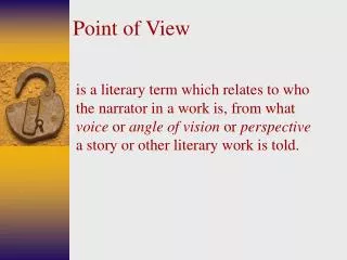
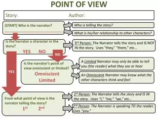
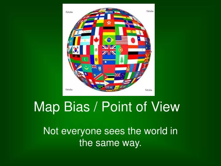
Map Bias / Point of View. Not everyone sees the world in the same way. Consider the following quotes. Why is there disparity between the two? Point of View. Just as Documents need to be analyzed, so do maps.

E N D
Map Bias / Point of View Not everyone sees the world in the same way.
Consider the following quotes Why is there disparity between the two? Point of View
Just as Documents need to be analyzed, so do maps. • Author/Publisher -- Knowing who created the map may offer hints as to the map's bias or biases. Does this person or organization have a vested interest in how the map is perceived by the map reader? For example, "town plats," maps created by western promoters, were aimed at attracting prospective settlers. Often they were purely propaganda. • Place of Publication -- In what country or city was the map published? What language(s) does the map employ? This could provide insights into potential nationalistic biases.
Date -- When the map was constructed helps to place the map in its chronological context. Does the map reflect true facts? Post-1990 maps of Europe should show one Germany, not two. • Audience -- Who was the intended audience? What message did the mapmaker want to send? Why was the map produced? • Source of Data -- If the map uses secondary data sources, such as census material, knowing the source of the data will help in assessing the appropriateness of the data and thereby the map.
Origin -- Was the map drawn? printed in limited numbers? mass-produced? This is often related to the date the map was initially created. • Context -- How does the map fit with earlier and later maps? How does the map reflect new discoveries?
Also, consider Simplification. • Just as historians cannot record every minute detail of an event, cartographers cannot show all aspects of a place. In the case of maps, more details about the world are omitted as the map's scale becomes smaller. This process is called map simplification.
Consider those elements when looking at the following maps. Then determine the Point of View for the Map Maker
This Mercator Map has great detail near the Equator, but the Poles are distorted.
This is a Peter’s World Map – it shows the world’s land masses in correct size. Notice Greenland – it really is only 1/6 the size of South America. However direction is distorted on this map.
This is a Watterman Butterfly map. Obviously this map is great for size and shape, but sailing using this map would be difficult.
As well as distortion, there is also Point of View…. for many years, the US was the main publisher of maps. It was not unusual to find maps (especially in textbooks) with the US in the middle. This American view is not seen as much today.
Most of our mental maps look something like this…. That is because the Prime Meridian is often in the middle. The Greenwich Meridian was chosen as the Prime Meridian of the World in 1884. Forty-one delegates from 25 nations met in Washington DC for the International Meridian Conference. By the end of the conference, Greenwich (London, England, UK) had won the prize of Longitude 0º by a vote of 22 to 1 against (San Domingo), with 2 abstentions (France and Brazil). Greenwich was widely used as zero prior to this conference because of Britain’s power, but this is when it became official.
What if we centered the world near where most of the people live? This is the Asian view of the world.
Similar to Australia – this is the African view of the world.
Why would a cartographer center a map this way???? This would be a great map projection for showing the slave trade.
Who makes the final decisions on borders, etc? National Geographic would be a good idea, but they have no real authority. That is why some countries borders look different. And then there is the area in yellow where there are oil deposits – this is Abyei. It is claimed by both Sudan and South Sudan. This is South Sudan. The world’s newest country, but…. Sudan doesn’t agree.
Korean point of view Japanese point of view ?
This is a map of Israel from the Israeli point of view. This is the Palestinian point of view. These orange areas are “Occupied Territories”
Iran, Iraq, Turkey and parts of Syria have swallowed up this region that was once an area ruled by the Kurds. Here is the country of Kurdistan – the only problem…… No country recognizes them as independent.
This is Western Sahara. The only problem? Morocco invaded in 1976 and continues to occupy the country. Morocco says it annexed the area for the people’s best interest….
Slovenia wants access to international waters…. Italy says, “too bad!”
That’s right… China claims Taiwan is the 23rd province (state) of China. Taiwan believes it is an independent nation – the Republic of China This is an English version of a Chinese map. Notice all of the provinces…..
Kosovo became an independent and recognized country in 2008, but Serbia does not recognize Kosovo’s independence. Serbian point of view Kosovo point of view
The Falkland Islands. In fact, when Argentina invaded in 1982 the British went to war over ownership of these islands. Britain won. These are the Islas Malvina. They belong to Argentina…… According to Argentina. The people that live there are British descendants. They believe they live in….
Indian point of view…. Pakistani point of view…..
Kashmir & Jammu would like to be independent of both Pakistan and India.
Size doesn’t matter – it’s location. This is Gibraltar. It is owned by the UK. This gives them access to the Strait of Gibraltar and the possibility of blocking the strait. Military control of chokepoints is of strategic importance. Spain claims this land.
So, you are making the map….. The Kuril Islands are disputed between Russia and Japan. Who do you give them to on your map???
What about here? These islands are disputed between Taiwan, Philippines, Malaysia, Brunei Vietnam, and China
And last, but not least….. Who owns Mt. Everest? Nepal or China?