Download
1 / 43
430 likes | 623 Views
Validated Stage 1 Science Maturity Review for OMPS Total Column Ozone EDRs. Presented by L. Flynn, NOAA September 3, 2014. Outline. Algorithm Cal/Val Team Members Product Requirements Evaluation of algorithm performance to specification requirements

E N D
Validated Stage 1 Science Maturity Review for OMPS Total Column Ozone EDRs • Presented by • L. Flynn, NOAA • September 3, 2014
Outline • Algorithm Cal/Val Team Members • Product Requirements • Evaluation of algorithm performance to specification requirements • Evaluation of the effect of required algorithm inputs • Quality flag analysis/validation • Error Budget • Documentation • Identification of Processing Environment • Users & User Feedback • Conclusion • Path Forward
OzoneCal/Val Team Membership Raytheon team members with major contributions include Derek Stuhmer and Daniel Cumpton.
~ 2% ~ 3%
Data Product Maturity Definition Validated Stage 1: Using a limited set of samples, the algorithm output is shown to meet the threshold performance attributes identified in the JPSS Level 1 Requirements Supplement with the exception of the S-NPP Performance Exclusions
Nine Things to Know about the OMPS Total Ozone EDR • The algorithm uses information at 22 wavelengths obtained from 44 macropixels (20 or more spatial pixels) x 35 cross-track measurements. • Channels are combined three at a time to generate ozone, reflectivity and wavelength dependence of reflectivity (e.g., aerosol effects) estimates. • A single triplet is used to generate the heritage Version 7 ozone estimate. • A single triplet (317, 331 and 336 nm)is used to generate the SO2 Index. It shows the effect of inter-channel biases and its use is problematic at high Solar Zenith Angles. • Internal comparisons monitoring cross-track variations in ozone, reflectivity, aerosol and SO2 Index values provide direct information on inter-channel biases. • Absolute calibration of the reflectivity channels is tested by vicarious methods by using Greenland and Antarctic ice fields, cloud-free equatorial Pacific ocean, and minimum land values. • Absolute calibration of ozone sensitive channels can be set to agree with the validation “truth” data set of choice. • The First Guess IP and EDR products have been converging. • Partial Cloud calculations are the same except for the use of differing Snow/Ice information • Identical logic for cloud fractions and input for cloud top pressures • Snow/Ice for NRT VIIRS in EDR is still erroneous – Snow/Ice tilings in 1st Guess are very good climatology; These will be updated daily starting in 2014 • Temperature data options – Climatology, NCEP, CrIMSS (and correction On/Off) • Need to bring forecasts for the stratosphere into IDPS and turn on the correction for the IP. • The total ozone column products do not currently meet requirements; soft calibration adjustments to remove inter-channel and cross-track calibration errors in the SDR are necessary to achieve the performance.
Evaluation of algorithm performance to specification requirements • Improvements since Provisional • Algorithm Improvements • Restricted extrapolation of Profile Mixing Fraction • Implemented stray light corrections in SDR • Implemented Intra-orbital wavelength scale in SDR • LUT / PCT updates • Regular weekly updates of Dark corrections • Cal/Val Activities for evaluating algorithm performance: • Ground truth and Satellite data sets
Evaluation of the effect of required algorithm inputs • Required Algorithm Inputs • Primary Sensor Data • Stray light including out-of-range contributions are now well corrected • Measurement based intra-orbit wavelength scale adjustments are implemented • New Day 1 and wavelength scale in testing • Calibration Factor Earth (CFE) Soft Calibration in preparation • One-percentile reflectivity • OMI Ozone • Aerosol and SO2 free regions • Ancillary Data • The TC EDR and First Guess IP have been converging in their use of external data. NRT products from VIIRS and CrIS are being replaced with Internal Calculations, Forecasts and UV specific climatologies. • LUTs / PCTs • RT LUTs are stable. Measurements radiance/irrradiance ratios are interpolated to table channel wavelengths. Corrections for SO2 absorption coefficients. • Weekly dark updates are continuing. • Bi-annual Solar reference diffuser measurements show a very stable instrument. • Evaluation of the effect of required algorithm inputs • SDR Performance for most attributes meets requirements.
Important EDR/SDR Changes • DR7387/CCR1879 (SDR) TC SDR TC Stray Light Out-of-Range LUT update • DR4266/CCR411 Implemented partial cloud logic; • DR4955/CCR736 Replace cloud top pressure with UV-based climatology; Mx7.0. • DR4918/CCR829 Replace SO2 absorption coefficients. • DR7310/CCR1215 Restrict the profile mixing fraction in the OMPS NM EDR; • Turn on temperature corrections for the IP; can be done out of build. CCRs actions include updates to appropriate documents, e.g., ATDBs.
Differences in Temperature Corrections using NCEP Forecast versus CrIMSS Profiles
Internal Consistency and Vicarious Calibration/Validation DR 7314 OMPS TC EDR: Generation of soft calibration coefficients (CFE) – Use Equatorial Pacific Box, Minimum Reflectivity = 4%, no aerosol, no SO2, Toz set to OMI TOz. Reduce SO2 sensitivity if necessary. Weekly average Effective Reflectivity, Total Column Ozone, Aerosol Index and SO2 Index values, for June 2014 for a latitude / longitude box in the Equatorial Pacific versus cross-track pixel. SO2 exclusion
SO2 Map After Removal of Cross-Track Biases High Solar Zenith Angles These features were removed with the change in SAA dark correction process.
Comparison of cross-track and orbital patterns of estimated Earth radiance scales relative to the current day 1 solar from the proposed method using 346 nm to 380 nm with those from an analysis in an SO2 product formulation. The two sets of results agree well in both along orbit and cross track variations. The results for every tenth scan are used to create the figures.
Comparison of Results for Test Granule SOMTC_npp_d20130205_t1500128_e1500502_b06615_c20130205221511027836_noaa_ops.h5 SOMTC_npp_d20130205_t1500128_e1500502_b06615_c20130812180617128986_ssec_cspp.h5
INCTO/OOTCO Error and Quality Flags • Error Flag • Bit1 0 good, 1 large residual; Bit2 1 large SO2 Index&; Bit3 1 triplet inconsistency; Bit4 1 ozone out of range; Bit5 1 surface reflectivity out of range. • Quality Flag 1 • Bit1/Bit2 Quality 0 no retrieval, 1 low, 2 medium, 3 high; Bit3 1 input data quality is not good; Bit4 1 triplet selection is not consistent; Bit5 1 inconsistent residuals; Bit6/Bit7 0 SZA<80, 1 80<SZA<88, 2 SZA>88 • Quality Flag 2 – Duplicates other flags or information • Bit1 1 snow/ice present; Bit2 1 sun glint geometry over open water; Bit3 1 solar eclipse in FOV; Bit4 1 TOZ<50 or TOZ>650; Bit5/6 0 TOZ> 450*, 1 250<TOZ<450, 2 TOZ<250, 3 not used; Bit7 1 Aerosol Index Too Large, AI> 0.5; Bit8 Spare • South Atlantic Anomaly Flag – Climatological intensity • 0 0-10%, 1 10-20%, 2 20-30%, 3 30-40%, 4 40-50%, 5 50-60%, 6 60-70%, 7 70-80%, 8 >80% • Scene Condition Flag • Bit1 0 Descending, 1 Ascending^; Bit2 1 Snow/Ice present #; Bit3 1 Troposheric Aerosols present; Bit4 1 Snow/Ice Fraction > 0; Bit5 1 Solar Zenith Angle (>80º); Bit6 1 Surface Reflectivity (>1.2 or <-0.05) See references on in the Provisional Presentation for more details on these flags. &EF B2 the SO2 Index is affecting performance as data with SO2 incorrectly estimated as greater than 6 DU are flagged as poor retrievals. *QF2 B5/6 can be 0 when the condition is not checked in addition to when the total column ozone is greater than 450 DU. It is not affecting the algorithm performance. ^SCF B1 was not currently set properly according to the orbital A fix was implemented with Mx7.1 in June 2013. path, i.e., by checking the changes in latitude during a measurement. It was almost always set to 1, except for the first and last granules in a sequence of measurements as processed at IDPS. It did not affect the algorithm performance. #SCF B2 is not currently set properly. It is set to snow/ice present almost everywhere. It is inconsistent with SCF B4 Snow/Ice Faction > 0. It is not affecting the algorithm performance.
Bad Snow/Ice from VIIRS NRT. Figure shows results for a day in July 2014. Top is for VIIRS NRT product. Bottom is for Weekly tilings
Comparisons among Total Column Ozone Products for MetOp-A/B GOME-2, NASA EOS Aura OMI and S-NPP OMPS (First Guess IP)
Current S-NPP OMPS (First Guess IP) products for July 3, 2014. Total Column Ozone, Effective Reflectivity and Aerosol Index.
Comparisons of INCTO to three very good Dobson ground stations 1/2012 to 6/2013.Notice the shift in biases in June 2012 with the introduction of new solar flux and wavelength scales. INCTO and Dobson Mauna Loa 2012/2013 INCTO and Dobson Boulder 2012/2013 INCTO and Dobson Lauder, NZ 2012/2013
Blue OMI V8 Red OMPS INCTO Red OMI V8 Blue OMPS INCTO
Nine Things to Know about the OMPS NM SDR • System linearity is stable and well-corrected. • Dark currents continue to trend higher but measurement signal-to-noise ratios remain high – weekly dark updates are flowing into the system and have good accuracy. The SAA dark strategy has been revised. • The offset biases are actually variable but the current constant corrections are superfluous unless they create negative radiances. They have intentionally been set to lower values to avoid zero truncation of negative intermediate quantities. • Stray light corrections are in place and an improvement for out-of-range contributions has been provided. Remaining errors are small. • Intra-orbital wavelength scale drifts have been identified and are related to variations in thermal gradients. A measurement-based approach to providing better estimates for each granule has been implemented. Day 1 solar wavelength scales will be set at the averages of the orbital excursions. • Transient spikes are affecting a very small fraction of smear calculations. Possible solutions are under discussion. • A second round of Day 1 Solar spectra with soft calibration adjustments is under development. • Soft calibration adjustments will remove much of the inter-triplet imprecision and cross-track biases and provide a zero-mean SO2 index. • The two and a half years of solar measurements show good long-term stability of instrument throughput and wavelength scales.
Instrument Performance – OMPS NM # After new analysis for Day 1 wavelength scale. ^ After ground-based correction for TOz algorithm channels. * After intra-orbit adjustments. C. Pan
Documentation • The following documents will be updated and provided to the EDR Review Board before AERB approval: • ATBD • 474-00029 Joint Polar Satellite System (JPSS) OMPS NADIR Total Column Ozone Algorithm Theoretical Basis Document (ATBD) 20110422 • OAD • 474-00066 Rev E: Joint Polar Satellite System (JPSS)Operational Algorithm Description (OAD)Document for Ozone Mapping and Profiler Suite (OMPS) Total Column (TC) Environmental Data Records (EDR) Software • Updating Provisional README file for CLASS
Identification of Processing Environment • IDPS Mx8.6 (with planned revision for Mx8.8 February 2015) • The algorithm version is the Multiple Triplet IP and EDR algorithm. • The EDR and First Guess IP have been converging in their use of external data. NRT products from VIIRS and CrIS are replaced with internal calculations, forecasts and UV specific climatologies. • IDPS Build: I1.05.08.05 (Mx 8.5) • EDR version: Mx 8.5 • LUT Version: PS-1-O-CCR-13-0829-JPSS-DPA-002-PE • PCT Version: N/A • Environment for testing: Linux (ADL Mx 8.x) and AIX (ADA Mx 8.x)
Users & User Feedback • Users list • NCEP, NASA, NRL, Environment Canada, EuMetSat • Feedback from users • BUFR product in testing at NCEP, EC, and EuMetSat • Downstream product list • NCEP assimilation (UV Index and weather) • Ozone Hole Monitoring (Stratospheric Summaries) • Ozone Layer Assessments • Reports from downstream product teams on the dependencies and impacts • Calibration bias creates offsets with OMI total ozone products • Request for V8TOz algorithm for consistency with OMI, GOME-2 and SBUV/2.
Total Column Ozone: Aug 31, 2014 OMPS NM TOTAL OZONE OMI TOTAL OZONE SBUV/2 v8 SH TOTPRO OMPS NP v6 SH TOTPRO
Conclusions • Cal/Val results summary: • Team recommends Validated Stage 1 Maturity • Products in OOTCO (EDR) flagged with snow/ice present should not be used until VIIRS input is replaced. Products in INCTO (First Guess IP) are good. • Data will have small changes in performance when CrIMSS temperature products are replaced with forecasts. • Products will meet performance requirements after three Key SDR CCRs are implemented.
Path Forward • Planned further improvements • Implement V8TOz with true SO2 retrieval using the OMI Linear Fit algorithm. • Adapt system to process smaller FOV products. • Planned Cal/Val activities / milestones • December 2014 Demonstrate reduced bias (and better cross-track consistency) of OMPS Column Ozone products with improved SDR versus OMI and SBUV/2 • March 2015 complete global validation with corrected snow/ice fields and forecast temperatures for Validated Stage 2. • July 2015 demonstrate validation for annual variations and stability of products for Validated Stage 3.
Brief mapping of sensor and algorithm performance Pixel to pixel calibration will contribute to both Accuracy and Precision error budgets. Notice that this allocation is at the 0.5% level.
Requirements (1 slide) Product Requirements from JPSS L1RD
Error Budget Compare analysis/validation results against requirements, present as a table. Error budget limitations should be explained. Describe prospects for overcoming error budget limitations with future improvement of the algorithm, test data, and error analysis methodology.
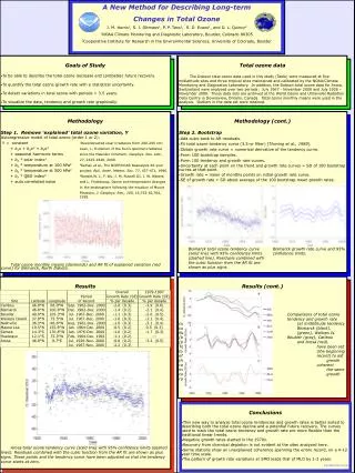
Provisional Maturity for S-NPP OMPS EDR products Supports the CLIMATE Mission and the WEATHER & WATERGoals • The Ozone Mapping & Profiler Suite (OMPS) was launched on the Suomi National Polar Partnership (S-NPP) satellite on October 28, 2011. The OMPS is the next generation of operational ozone sensors for NOAA. Its products will replace existing ones from the Solar Backscatter Ultraviolet (SBUV/2) instruments. • NOAA/NESDIS has provided validation and analysis of the Total Column and Nadir Profile operational ozone products from the Interface Data Processing Segment (IDPS) to justify their advance to Provisional Maturity. This will be applied retroactively to the products as of March 1, 2013. Findings presentations & ReadMe files are provided with the products at CLASS. • Total Ozone (DU) from S-NPP OMPS (top left), NASA EOS Aura OMI (top right) and MetOp-A GOME-2 (lower left) total ozone maps for October 4, 2012. Ozone Hole conditions (< 220 DU) are present at the southern tip of South America. The two figures on the right compare the OMPS Limb Profiler and Nadir Profiler ozone profiles for September 6, 2012. They show the zonal mean mixing ratios at pressures from 100 to 1 mbars versus Latitude. The Limb data has been smoothed vertically to be similar to the Nadir resolution. Refinements of both products are continuing. (Limb Profiler data and figures are from the NASA OMPS NPP Science Team.) Significance: The OMPS instruments provide the measurements to continue monitoring atmospheric ozone. Slide courtesy of L. Flynn; Maps by W. Yu.
New Products from S-NPP OMPS Supports the CLIMATE Mission and the WEATHER & WATERGoals • The Ozone Mapping & Profiler Suite (OMPS) was launched on the Suomi National Polar Partnership (S-NPP) satellite on October 28, 2011. The OMPS is the next generation of operational ozone sensors for NOAA. Its products will replace existing ones from the Solar Backscatter Ultraviolet (SBUV/2) instruments. • NOAA/NESDIS are now providing BUFR versions of the OMPS Nadir Ozone Profile and Total Column maps to users in NRT from the NDE system. This format is compatible with applications for the NWS and other operational users. • A newer version of the combined UV/IR total ozone maps (called TACO) using information from the CrIS Ozone product in place of HIRS is now in operational production at OSDPD. As soon as the OMPS Ozone Profile product advances to validated maturity, it will use that information in place of the SBUV/2 data. The two figures on the right compare the current TOAST Product using HIRS and SBUV/2 (top) with the new (TACO) one using CrIS and SBUV/2. Validation studies confirm that the CrIS ozone product information is superior to the HIRS single channel retrievals. Significance: The OMPS instruments provide the measurements to continue monitoring atmospheric ozone. Slide courtesy of L. Flynn; Maps by J. Niu.
Total Ozone Path to Validation • New Day 1 solar spectra are under development to improve the corrections for intra-orbit wavelength scale variations. • Soft calibration adjustments are also under development to correct for cross-track calibration uncertainties and SO2 sensitivity. • Both problems show repeatable behaviors that are now well-characterized. • The Total Ozone products from OMPS will be validated by the end of the year.
Current Total Ozone Deficiencies 4% The wavelength quadruplet chosen for the SO2 index is too sensitive to calibration uncertainties. This leads to a large number of false positives. Small uncertainties in the calibration produce a cross-track dependence in the total ozone with satellite view angle The figures show weekly averages for June 2014 for a latitude/longitude box in the equatorial Pacific. The horizontal axes are cross-track position. These patterns are repeatable and will be removed with soft calibration adjustments.
Future Refinements for the Total Ozone Product • The total ozone product algorithm will be upgraded to the Version 8 TOMS algorithm currently in use at NOAA to produce operational products from the SBUV/2 and GOME-2 instruments. • The new algorithm will include an improved SO2 product for detection of volcanic eruptions.
Wavelength shifts can be determined from Earth measurements The cross-track and triplet differences in these changes contribute to both the accuracy and precision error budget. (DONE)
Comparison of INCTO Ozone wo/w wavelength scale knowledge BEFORE AFTER Notice the reduced striping – better cross track consistency