Download
1 / 16
160 likes | 274 Views
Wallowa Whitman Forest Collaborative. Nils D. Christoffersen Wallowa Resources. 2,392,508 acres 3 states 10 counties bordered by the Umatilla and Malheur NFs Elevation varies from 9,985 to 875 feet Four ranger districts, one national recreation area, and four wilderness areas. Origins.

E N D
Wallowa Whitman Forest Collaborative Nils D. Christoffersen Wallowa Resources
2,392,508 acres 3 states 10 counties bordered by the Umatilla and Malheur NFs Elevation varies from 9,985 to 875 feet Four ranger districts, one national recreation area, and four wilderness areas
Origins • Various collaborative efforts at county levels, including 17 year effort in Wallowa County • Three NE Oregon Counties extended the initial invitation to explore value in larger forest level collaborative. • First meeting 7 June 2012. 48 participants from 29 different stakeholders. Agreed on value to form and proceed.
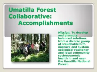
Collaborative Purpose To improve the social, economic, and ecological resiliency of the Wallowa-Whitman National Forest and local communities through collaboration by a diverse group of stakeholders.
Structure • WR Project Manager – Fiscal Agent • NFF and DFZ funds • SNW Facilitator • 10 Member Operating Committee • State and County • Forest products • Environmental groups • OSU Extension • Local community and private landowners
Collaborative has met 9 times including its formative meeting Average of 37.4 participants per meeting (337 participant days) Also held one field trip in fall 2012 – Lower Joseph Creek Second field trip scheduled this week – East Face Project
Accomplishments • Building collaborative relationship amongst stakeholders. • Operations Manual Approved – 22 Signatories to date • General findings and recommendations for restoration of the Lower Joseph Creek Watershed Approved. • 5th HUC Integrated Resource Assessment • Recommendations across resource areas • Initiated stand level confirmation of implementation opportunities • Completed 3,000 acres – confirmed 2,515 acres • Initiating work on new project in Whitman District (Baker County) – potential pilot partnership with ODF, ODFW and Comprehensive Wildfire Strategy • Secured funds for Year 2 staffing.
Year 2 Targets • Expand and maintain diverse collaborative membership • Complete NEPA for Lower Joseph Creek Projects • Advance work on East Face Project • Explore opportunities for Landscape Learning • Model effects of different management scenarios on wildlife and fish habitat, fire regime condition classes, stand treatments in identified biophysical groups – moisture/temperature regimes, and riparian areas. • Explore opportunities for coordination and efficiency in staffing / facilitation with other Blue Mountain Collaboratives.
Average Annual Fire Suppression Cost 1986-2007: $6.7 million per year
Haypen 3 stewardship contract Biomass – (1.0”-4.9”) 23% of cut trees per acre. Pulp fiber – (5.0”-6.9”) 33% of cut trees per acre.
Lower Joe Integration • Forests and Fuels • Range • Wildlife • Riparian and Fisheries • Roads and Recreation • Cultural • Social and Economic