Download
1 / 16
160 likes | 169 Views
Soil Surveys and Maps. Maps of “soils” have been made for a long time - 1790’s agricultural maps of England - first pedological map in Russia in 1865 Eugene Hilgard was the American pioneer in soil survey and tried to make it a Federally funded enterprise. Eugene Hilgard and Soil Surveys.

E N D
Soil Surveys and Maps Maps of “soils” have been made for a long time - 1790’s agricultural maps of England - first pedological map in Russia in 1865 Eugene Hilgard was the American pioneer in soil survey and tried to make it a Federally funded enterprise
Eugene Hilgard and Soil Surveys Born in Germany Raised in American frontier (Illinois) in intellectually oriented family Received PhD at University of Heidelberg Agricultural chemistry and geology Accepted position as Assistant State Geology of Mississippi in 1855
Hilgard in Mississippi Not a glamorous job Became head geologist after first geologist fired Recognized his future with state lie not with geology but agriculture Produced a landmark document (next slide) with half geology and half soils Published work as Civil War broke out Work remained in storage until 1866 Hilgard worked for state and confederacy during war
The Mississippi Report Geology Detailed discussion of soil formation and soil chemistry “soil” map of state….
Hilgard’s Agricultural Map Somewhat analogous to modern generalized soil map Map units based on geology and vegetation Each map unit had several soil types described in detail in text
Hilgard Moves to California Recruited by UC president in 1874 Replaced first chair of agriculture (who was fired) Reason for coming to California was his “health” Hilgard and his wife both enjoyed and expected dynamic intellectual and cultural life……..
Berkeley when Hilgard arrived…. He and his wife walked through mud to Oakland for concerts So much water and “effluvia” in his South Hall office that he vacated it Despite cultural isolation Hilgard seized opportunty to expand College of Agriculture (now CNR) and make soils a national issue
Hilgard and John Wesley Powell (USGS) Hilgard cultivated friendships with the rich and powerful US congressman, senators, govenors Communicated with premier scientists of his day and generation Began by proding his east coast connections to make USGS include soil survey in their activities based on their 1880 charter……….. The leader of USGS at that time was John Wesley Powell……
John Wesley Powell and USGS Powell grew up in midwest and developed interest in geology and science Civil War hero who lost arm via cannon After war, negotiated with congress for funds to explore geology and natural history of last unknown segment of USA - the Colorado River Basin Became second head of USGS (as well as serving in role of Dep/Div. of Ethnology)
Powell’s Plan for the Arid West (‘beyond the 100th meridian”) Classification of land according to economic potential (Hilgards point) Modification of homestead acreage to account for aridity Abandonment of rectangular topographic surveys Federal aid for construction of irrigation projects Development of communal irrigation districts (based on his experience with Morman settlers)
Hilgard and Powell in 1880’s Hilgard continually lobbied Powell and Hilgards friends to make soil survey part of USGS activities Powell tried to hire Hilgard to head soils division in USGS but Hilgard dismissed the overture In late 1880’s, new federal department was being organized (USDA) Hilgard was asked to be second in command His role would be to start soil survey in USGS He thought it should be in USGS, but relented to concept Powell then sought to move USGS into USDA Hilgard was formally nominated and approved by congress and the president He then submitted his resignation letter to UC Board of Regents…..
Results of Hilgard Rejecting Offer to Move to USDA Political mess in Washington with Hilgards friends Powell left in Dept. of Interior and attacked by opponents of his rational land use plan Hilgard’s arch scientific enemy (Milton Whitney) put in charge of soil survey Hilgard believed soil chemistry is important to science and practical uses Whitney (for reasons that only be viewed as unexplainable) thought the only important soil property was texture. First soil survey in 1899 Whitney suppressed scientific publications he disagreed with Employees were afraid to bring in novel ideas (Russian pedology and factors of soil formation) Novel ideas brought in only after his death
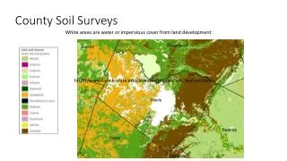
Soil Survey Today Far removed from 1899 methods A national program in which all arable land has been mapped and remaining non-arable areas presently being surveyed Most recent movement is Bush administration attempt to “privatise” the Survey by opening soil mapping to private bidding