Download
1 / 15
150 likes | 297 Views
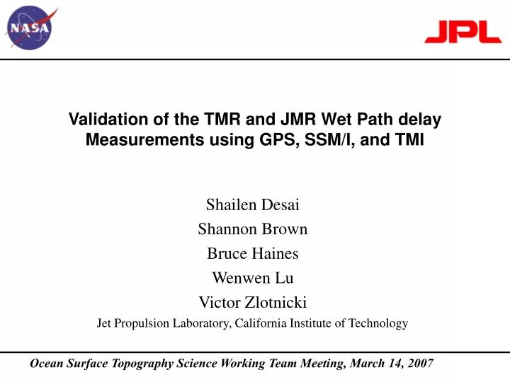
Validation of the TMR and JMR Wet Path delay Measurements using GPS, SSM/I, and TMI. Shailen Desai Shannon Brown Bruce Haines Wenwen Lu Victor Zlotnicki Jet Propulsion Laboratory, California Institute of Technology. Ocean Surface Topography Science Working Team Meeting, March 14, 2007.

E N D
Validation of the TMR and JMR Wet Path delay Measurements using GPS, SSM/I, and TMI Shailen Desai Shannon Brown Bruce Haines Wenwen Lu Victor Zlotnicki Jet Propulsion Laboratory, California Institute of Technology Ocean Surface Topography Science Working Team Meeting, March 14, 2007
Objective • Independent validation of wet path delay (WPD) measurements from Topex and Jason microwave radiometers. • SSM/I • Special Sensor Microwave Imager on Defense Meteorological Satellite Program (DMSP) satellites. • Available for duration of Topex/Poseidon and Jason-1 missions. • TMI • Tropical Rainfall Measuring Mission’s Microwave Imager. • Available 1998-present (T/P cycle 193 onwards). • Coastal GPS sites • 1-87 sites available for Topex/Poseidon (presently on original ground track only). • ~30 of 87 sites available for each cycle of Jason-1 mission. • Characterize: • Temporal stability • Scale errors • Geographically correlated errors Ocean Surface Topography Science Working Team Meeting Cal/Val Splinter Session
TMR Replacement Product • Released Dec 13, 2006. • Drift removed (< 0.05 mm/yr) • Yaw state dependence reduced to < 1 mm. • TMR RP is drier than TMR-MGDRB by ~ 3 mm. • TMR-GPS is biased ~-9 mm from TMR-SSMI and TMR-TMI. Validation of TMRMGDRB and Replacement Product • TMR from MGDRB • 0.8 mm/yr drift from cycle 30-240 • ~5mm peak-to-peak dependence on satellite attitude regime (yaw state). Ocean Surface Topography Science Working Team Meeting Cal/Val Splinter Session
TMR from Replacement Product • Yaw state errors removed. Daily Averages of TMR vs. SSMI and TMI • TMR from MGDRB • Systematic yaw state errors distinct in daily averages. Ocean Surface Topography Science Working Team Meeting Cal/Val Splinter Session
Recalibration of JMR • In preparation for Version C GDRs. • Will be ~3mm drier than version B GDRs. • Scale error corrected. • JMR-ECMWF drift reduced to -0.25 mm/yr • May have contribution from < 2 mm shifts after cycle 136 and 179 safeholds. • Will be corrected in Version C. Validation of JMRVersion B and Ongoing Recalibration • JMR from GDRB • All 4 comparisons agree to within 3.2 mm. • Residual (< 3mm) yaw state dependence may remain after cycle 100. • JMR-ECMWF has a drift of -0.3 mm/year. Ocean Surface Topography Science Working Team Meeting Cal/Val Splinter Session
Scatter of JMR versus ECMWF JMR from GDRB JMR from Ongoing Recalibration • Comparison to ECMWF suggests scale error of ~2% in JMR from Version B GDR. • Error consistent with known changes to pre-launch calbration coefficients. • Can be corrected by dividing JMR(GDRB) by 1.023 • JMR on version C GDRs will correct this error. Ocean Surface Topography Science Working Team Meeting Cal/Val Splinter Session
Temporal variation of standard deviations of recalibrated TMR and JMR very consistent at 3 mm. • Random noise ~ 2mm. TMR versus JMR(Temporal Stability) • Attitude dependence evident in TMR (MGDRB). • Removed in TMR (RP). • TMR (RP) and JMR(Recal.) drier than TMR (MGDRB) and JMR(GDRB) by ~3 mm. • Effect of correcting scale error. Ocean Surface Topography Science Working Team Meeting Cal/Val Splinter Session
Scatter of TMR vs JMR (GDRB) TMR(MGDRB) vs JMR(GDRB) TMR(RP) vs JMR(GDRB) • Significant reduction of outliers in TMR-JMR differences from recalibration and reprocessing of TMR. Ocean Surface Topography Science Working Team Meeting Cal/Val Splinter Session
TMR versus JMRGeographically Correlated Differences • As previously shown, banding around continents in TMR-JMR differences. • Differences with island and continental GPS sites suggested TMR as source. • Still present in recalibrated TMR and JMR. • < 1 mm effect from 200 km out to open ocean. • -3.5 mm from 200 to 50 km. Ocean Surface Topography Science Working Team Meeting Cal/Val Splinter Session
Average of Differences w.r.t. Independent Measurements • JMR comparisons to SSMI, TMI, and GPS statistically identical. • TMR comparisons to GPS are biased by ~ -9 mm versus SSMI and TMI. • Separation of GPS comparisons by island and continental sites shows large discrepancy for TMR, but not for JMR. • TMR likely dominant source for errors near continents. Ocean Surface Topography Science Working Team Meeting Cal/Val Splinter Session
Summary • TMR recalibrated and reprocessed. • Provided as TMR Replacement Product (Dec. 13, 2006) • Provided on Topex Retracked GDRs. • Drift and yaw state effects corrected. • Coastal effect remains. • ~3.5 mm wetter as approaching coast from 200 km out. • JMR (GDRB) corrects large shifts observed in version A GDRs. • < 2mm shifts may be present after cycle 136 and 179 safeholds. • Will be corrected in Version C GDRs. • Scale error of ~2% present in JMR (GDRB) • Will be corrected in Version C GDRs. • Can be corrected by dividing JMR(GDRB) by 1.023. Ocean Surface Topography Science Working Team Meeting Cal/Val Splinter Session
Senatosa TMR wetter or JMR drier between land masses. Ocean Surface Topography Science Working Team Meeting Cal/Val Splinter Session
Scatter of TMR(RP) vs JMR Ocean Surface Topography Science Working Team Meeting Cal/Val Splinter Session
Mean Offsets w.r.t. Independent Measurements • JMR comparisons to SSMI, TMI, and GPS statistically identical. • TMR comparisons to GPS are biased by ~ -9 mm versus SSMI and TMI. • Separation of comparisons to island and continental GPS shows large discrepancy for TMR, but not for JMR. • TMR likely dominant source for ~4 mm errors near continents. Ocean Surface Topography Science Working Team Meeting Cal/Val Splinter Session