Download
1 / 39
390 likes | 556 Views
US National Grid Update to the FGDC Coordination Group. Harnessing a national grid as a language of location ... … optimized for local applications. 2006/01/09V1. FGDC Homeland Security Working Group USNG-Implementation Subgroup (USNG-ISG).

E N D
US National Grid Update to the FGDC Coordination Group Harnessing a national grid as a language of location ... … optimized for local applications. 2006/01/09V1
FGDC Homeland Security Working Group USNG-Implementation Subgroup (USNG-ISG) Formed to facilitate implementation of the FGDC US National Grid standard To participate, contact: Tom Terry terryng@hqmc.usmc.mil (703) 695-3118
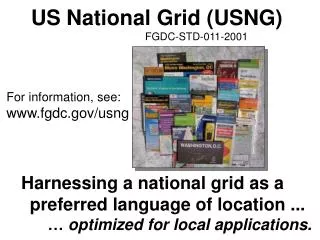
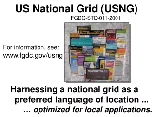
-How it came about. - Where it’s going. United States National Grid FGDC-STD-011-2001 www.fgdc.gov/usng
Non-Standard Grids Problems & Impact We’ve long used use map grids. We simply haven’t used a standard map grid until now, one that works with GPS, GIS, etc! Same street names, but different grids. A Survey of Washington, DC Commercial Street Maps Found 35 different maps… … with 31 different grids. None worked with GPS receivers.
A Standard Grid… presentation format. Telephone: (202) USNG Grid: 18S UJ Point of Interest Street Address Subway Sandwich & Salads 2030 M St., NW 2256 0826 223-2587 Subway Sandwich & Salads 430 8th St., SE 2698 0567 547-8200 Subway Sandwich & Salads 3504 12th St., NE 2740 1120 526-5999 Subway Sandwich & Salads 1500 Benning Rd, NE 2815 0757 388-0421 - A communications enabler. - Geoaddress - Universal Map Index. - An enabler… a bridge. - Frictionless interoperability
“Lack of a uniform method for describing incident locations has long been a major impediment to rapid and effective emergency response in diverse metropolitan and rural areas... …the immediate impact of USNG will be to ensure that GPS is directly usable with properly gridded map products to quickly enable multi-agency and multi-jurisdictional emergency responders, and the public in general, to precisely identify geolocations in the real world. …the USNG will be a principal integrating mechanism to create spatial interoperability nationwide...among multi-jurisdictional civil emergency response organizations and when necessary, between those organizations and the military to support any and all domestic emergency response and disaster relief operations.” - Appendix E Spatial Interoperability Defense Science Board Task Force on the Future of the Global Positioning System, October 2005.
KATRINA Lessons Learned: “3. The implementation of a standardized reference system. We recommend the use of the US National Grid (USNG). We made the mistake of initially improvising a search and rescue grid and then modifying that grid for local use. Hundreds of copies of each were published. The USNG is a readily available standard that is yet to be adopted by emergency response agencies due to lack of education.” From proposed: Joint Emergency Mapping System for Mississippi (JEMS), Center for Interdisciplinary Geospatial Information Technologies Delta State University, Mississippi 19 November, 2005 Six months to hurricane season again... ...and we first learned this in Hurricane ANDREW.
- Our Federal Quandary - “We should promote voluntary standards that enhance the effective coordination of disaster responses, such as the U.S. National Grid map standard for geospatial information system;” - The Honorable John H. Marburger, III Director, Office of Science and Technology Policy. Testimony of Dec 5, 2001 before the Subcommittee on Science, Technology and Space Committee on Commerce, Science, and Transportation, United States Senate. - 2006: USNG not integrated in GOS2 - 2006: Montana funding $45K for USNG implementation in Lewis & Clark County.
Part of NCR initiative. DC GIS users can 1) lookup the USNG value for a street address or 2) zoom to a location with a USNG value. Auto-complete capability. Data is in MD SPCS, USNG functions for public.
- Our Federal Quandary- Inconsistency Default format on The National Map: Lat/Long D.D - Of over 53,000 maps in the USGS map sales office, NONE are compatible with this Lat/Long D.D.
St. Louis, MO GIS Web Site Street address look up... Functions like a Universal Map Index
Relevant URLs DC Atlas http://dcgis.dc.gov/ DC Atlas Street Address Lookup http://dcgis.dc.gov/mar_client_sample/ USNG: 2331 0803 1620 L St NW St. Louis, MO Parcel Data by Address http://stlcin.missouri.org/citydata/newdesign/index.cfm http://stlcin.missouri.org/citydata/newdesign/addressparser.cfm?addresssearch=&previouspage=data The National Map http://nmviewogc.cr.usgs.gov/viewer.htm Geospatial One Stop2 http://gos2.geodata.gov/wps/portal/gos FGDC resource site: http://www.fgdc.gov/usng
Communities and the US National Grid Interest or Implementation 126° 66° 96° 102° 84° 120° 108° 90° 78° 72° 114° Not all inclusive.
Progress continues... - Commercial implementations - Consumer GPS receivers: Now implemented (Garmin, etc) - Digital map applications (Delorme, National Geographic) - Paper maps. Several vendors ready, awaiting Fed, state, and local government policy implementations. - Excellent response at URISA Street Addressing Conferences. - Answers a recognized need in many local communities... ...but local governments cannot pay for custom development. - Need a full up, implemented community. NCR is focus. - Basis for “How to Manual” on implementation. - GMUNational Information & Support Center for Geoaddressing - Biggest impediment... …need for full implementation in major GIS application. - Areas Federal Government can impact: - Full implementation in GOS2. - Better information support for software writers. - Full up demonstrations. Education and outreach.
Federal Progress... - Partial implementation in The National Map - USGS implementation on revised 1:24,000 quads. (Excludes 20% controlled by USFS.) - National Geodetic Survey support (excellent) - Federal Rail Road Administration. (rail crossings) - NGA RRL 240: Unit request for NGA to interact with civil community on need for implementation. - Validated and co-sponsored by US Army, USMC, USN, USAF, USNORTHCOM, OSD - National Fire Academy. - Army TEC & USGS MAP2PDF initiative for 1:24,000’s - Pentagon Force Protection Agency (PFPA) and NCR focused initiatives. - www.fgdc.gov/usng But implementation policies and action required: - GOS2, parts of FEMA, not others, NIMS lacking, etc.
USNG brief main points and take away... - Progress continues with implementation - Continued validation at local government level. - Point of main focus is NCR… … but with good national cross section. - From full up NCR implementation demonstration… - “How to” manual for communities. - No technical problems, but there are cultural issues. - How to help? $ is good, but consistent policy is force multiplier.
Questions? Comments? Analog-----------------Bridge--------------------Digital
How to read the USNG… U UTM/USNG Grid Zone Designations 48°N 126° 66° 96° 102° 84° 120° 108° 90° 78° 72° 114° T 40°N S 18S 32°N R 24°N 10 19 11 18 12 17 13 16 14 15 08/27/98 Jefferson Pier: 18S UJ 2337 0651 (NAD 83) MGRS Grid Zone Designations
Jefferson Pier:18S UJ 2337 0651 U.S.National Grid 100,000m Square Identification 78°W GZD: 17T GZD: 18T GZD: 17S GZD: 18S 600 400 700 300 4400 4400 PD UJ QD TJ 500 4300 4300 NC VH PC QC TH UH 300 400 4200 4200 KB LB MB VG NB PB QB TG UG 4100 4100 KA LA MA VF UF NA TF PA QA 4000 4000 300 400 500 400 600 700 300 Grid Zone Designation 18S Grid Zone Designation 17S 78°W
The Power of Truncated USNG Values Jefferson Pier, Washington, DC Grid: UJ23370651 = repeat of UJ23370651 Each 2 letter/8 digit USNG value (10-m posting) in the outlined area is unique.
Reading Grid Coordinates… “ Read Right, Then Up.” The Jefferson Pier is located at grid 2337 0651 18SUJ23370651 (think 2337 / 0651) Principal Digits 4-digit: 23 06 = 1,000m 6-digit: 233 065 = 100m 8-digit: 2337 0651 = 10m 10-digit: 23371 06519 = 1m precision 24 22 23 07 07 Read RIGHT to grid line 23 Then measure right another 370-meters. Jefferson Pier 06 06 Grid: 2306 4305000mN 18S UJ 2337 0652 05 24 23 322000mE Datum: NAD 83 USNG: 18S UJ UTM values. 0 1,000-m Scale Then, read UP to grid line 06, and measure UP another 510-meters.
US National Grid TJ UJ 10 35 95 15 20 25 30 40 05 300 90 285000mE 4325000mN 25 20 20 15 15 10 10 05 05 UJ TJ TJ UJ 4300 4300 UH TH TH UH 95 95 90 90 85 4285000mN 90 95 05 10 15 30 300 85 20 25 35 345000mE TH UH Datum: North American Datum 1983 (NAD 83) Scale: Grid Zone Designation: 18S Jefferson Pier: 18S UJ 2337 0651
Physical Implementations of Geoaddresses
Arlington Co. VA 9-1-1 Operator; ‘We can’t use a GPS coordinate.” Motorcycle accident, Sept 10, 2003, 7:55AM. USNG readout for cursor
Think of it as a “street sign-in-a-box” Threshold Automobile GPS Initiative TAGI
Situations the US National Grid will remedy... Miami, FL -- The story of a lady’s drowning quickly gained National coverage after she dialed 9-1-1 on her wireless phone from her sinking car in a Miami, FL canal. Not able to escape the car and with dispatchers unable to locate the accident scene, the woman perished before emergency help could reach her. Fort Lauderdale, FL – A lady was forced to wait seven minutes and make three separate 9-1-1 calls from her cellular phone before help was dispatched after her daughter was impaled by a three-foot steel rod that had crashed through their windshield. The lady was forced to exit the interstate and find a major intersection in order to give the dispatchers her location. From National Emergency Number Association web site and other sources.
Day County, SD – A lady spent 40 hours in temperatures that dropped to -30° F when a blizzard stranded her in her pickup truck. Although she was able to dial 9-1-1, she was unable to tell her rescuers where she was. While the Day County Sheriff’s office was eventually able to locate the car, it took them five hours to place the vehicle within a 35-mile radius. Rural Michigan – A lady was rear-ended and suffered minor damages while driving in rural Michigan. While no one was injured, she did call 9-1-1. She informed the dispatcher of her location and then waited 30 minutes for the cruiser to arrive. When he failed to materialize, she called again. The two roads that she had given to the dispatcher to help them locate her actually crossed twice, and the cruiser was looking at the wrong intersection.
Washington, DC – In 2001, a visitor to the FDR Memorial was struck with a heart attack. A passing police officer and the dispatcher could not agree on an appropriate address for the incident location at this large campus like memorial. Eventually an intersection several blocks away was selected, but the ambulance was never able to find the incident. Arlington County, VA. - In 2003, a motorcyclist was seriously injured after being thrown over the guardrails of an overpass. A pedestrian nearby immediately called 9-1-1 but had trouble determining an address for the incident. He did have a GPS receiver, and finally asked in frustration if the 9-1-1 operator could use a coordinate from it. The operator replied that no, they did not use that technology. From National Emergency Number Association web site and other sources.
Fairfax County, VA – A caller to 9-1-1 reported having been stung by a bee, and was beginning to have trouble breathing. The 9-1-1 operator could see clearly on the map where the caller was located with Phase II wireless location technology, but had no actionable way of describing the caller’s location in the 493 acre park to first responders. From National Emergency Number Association web site and other sources.
Legend Four Pillars of Implementation • Maps • with USNG grids. • (hard copy • & digital) - Education. Community Consensus Done FGDC’s US National Grid (Public/Business/Government) - User Friendly GPS/ Internet and Wireless Connectivity - Geoaddress Availability US National Grid
Impediments... Cultural: All impediments are cultural, not technical… - The “All digital/GIS” Mindset - The “Not invented here” Mindset - The FGDC Cafeteria Mindset Education: Civil community dealing with new concepts and functions... - ‘Geoaddress’ - Universal Map Index - Nationally consistent language of location
Two perspectives on using coordinates... In Rhode Island, cell phones equipped with GPS chip sets can be rapidly located to within 15-m of true position. 9-1-1 organizations remain focused on conventional addresses, yet only about a fifth of the street addresses have been correlated to a coordinate. For incidents where the provided coordinate cannot be correlated to a street address there is no way to readily communicate a location to first responders who can only use street addresses to find places. As the Rhode Island 9-1-1 Director Ray LaBelle stated, "If I give an ambulance driver latitude and longitude coordinates, he's going to tell me where to go." (Lagesse, 2003). “...In Iraq, Coalition Forces (particularly the U.S. Govt and U.S. Military) are using MGRS coordinates almost exclusively. They have GIS software and data that allows them to search for a particular address (building #, street # and house #) within the 9 districts of Baghdad and in a few other cities/regions of Iraq. The operators in the field will get intel about a person of interest being located at a particular address. We will use the GIS sw/data to locate that address on a map or imagery of the city. Then, using our data, we can provide an MGRS coordinate for that location. The operator can then plug that coordinate into his GPS and easily navigate to the building of interest in order to do surveillance.” - US Government person, December 2005
Example: dcgis.dc.gov/mar_client_sample/ Low-end High-end
Geoaddress A two-dimensional earth referenced address based on the U.S. National Grid (USNG) that supplements conventional one-dimensional street addresses. Geoaddresses unambiguously communicate the surface location at which an organization or person can be reached, and act as a universal map index for properly gridded topographic, street, highway, and general purpose maps. Geoaddresses may serve a temporary (i.e.reporting an accident location), or permanent purpose, (i.e. associated with cultural features). Away from the road network, or in the event of major disaster, geoaddresses may be the only readily usable ‘address’. Geoaddresses enable the widespread use of the Global Positioning System (GPS) in society, and enhance the use of web based/digital and hardcopy maps. Example: USGS National Center 18S TJ 9473 1361
Value of a Standardized Grid • User friendly way to describe precise locations for all users. Easier to use than lat/long. Reduced training requirements. • Provides a cross check between a street address and geoaddress to ensure information is not garbled in transmission. • Increase the speed and accuracy with which places can be identified on a map or in a GIS. No ambiguity.Includes all places--not just roads. • Enables creation of a universal map index of places and facilities. • Improves navigation to, and within, incident areas by responding external forces/mutual assistance situations. • Sets a presentation format standard. USNG does not replace GIS data storage formats or SPCS in survey and engineering operations. • Improves coordination between different responding agencies (to include local, state, federal, and general public). • Nonproprietary standard facilitates rapid implementation by commercial maps and software applications. • Facilitates use of simple, digital, communications systems such as Short Messaging Service (SMS) when cell phone voice circuits are overloaded during crisis. • ENABLES THE USE OF GPS!USNG now used in commercial GPS.
Driving Factors and Impetus…. Improved 911 & emergency services. Improved business processes. Enables use of geospatial info tech. - Improved consequence management. - Web mapping and other uses. - Orthoimagery - Paper maps (properly gridded). Enables use of GPS. (and TAGI)
National Information & Support Center for Geoaddressing (NISCG) of George Mason University Fairfax, Virginia Will serve as a community link to a body of knowledge on the practical issues of implementing the USNG. http://usgrid.gmu.edu think US National Grid… the national language of location.
USNG Related URLs The National Map sponsored by US Geological Survey http://nmviewogc.cr.usgs.gov/viewer.htm Federal Geographic Data Committee (FGDC) www.fgdc.gov/usng National Geodetic Survey downloadable USNG conversion software. http://www.ngs.noaa.gov/TOOLS/usng.html FGDC Hazards Map site http://www.hazardmaps.gov/atlas.php XY Project – How to read the grid http://www.xyproject.org/How%20To%20Read%20USNG/How%20to%20read%20USNG.htm GMU National Information and Support Center for Geoaddressing (NISCG) http://usgrid.gmu.edu PALANTERRA palanterra.nga.mil