Download
1 / 35
350 likes | 473 Views
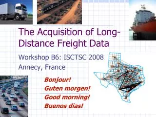
Analyzing long-distance truck travel for Statewide Freight Planning in Ohio. TRB Planning Applications Conference Columbus, OH May 7, 2013. Presented by: Gregory D. Erhardt, Parsons Brinckerhoff With: Rolf Moeckel, Parsons Brinckerhoff Gregory Giaimo, Ohio Department of Transportation

E N D
Analyzing long-distance truck travel for Statewide Freight Planning in Ohio TRB Planning Applications Conference Columbus, OH May 7, 2013 Presented by: GregoryD. Erhardt, Parsons Brinckerhoff With: Rolf Moeckel, Parsons Brinckerhoff Gregory Giaimo, Ohio Department of Transportation Zhuojun Jiang, Mid-Ohio Regional Planning Commission Howard Wood, Parsons Brinckerhoff
Freight Modeling • 2 percent of all trips, but 1/3 of all VMT • Most freight flows travel long-distance • Ohio deals with a lot of through trips (I-80/I-90) • Employment is only a poor substitute for truck trip generation • Goods shipments explain most truck traffic, but some trucks travel empty • Mode share is based on long-term contracts • Highly limited data availability
Outline Part 1: Methods and Data • Statewide model • Freight Analysis Framework 3 (FAF3) • Empty truck modeling • Combining statewide model and FAF3 Part 2: Planning Questions • How do we define a truck network? • Which bottlenecks most affect freight movements in Ohio? • What if we build new intermodal terminals? • What if we increase truck weight limits?
Methods Let’s model freight!
Statewide Model Maps show TAZs: Green=Ohio; Blue=Halo
Freight Flow Disaggregation FAF data US county Employment Freight flows between 3,241 counties Payload factors O/D matrix of loaded truck trips Empty trucks Truck trip O/D matrix including empty trucks
Empty Truck Trips -2 trucks +0 trucks -5 trucks +10 trucks +3 trucks 3 empty trucks Zone B 10 trucks 5 trucks -10 trucks +5 trucks -8 trucks +5 trucks -8 trucks 0 trucks 2 trucks 8 trucks Zone A -5 trucks +8 trucks -0 trucks +2 trucks +5 trucks 5 trucks Zone C 5 empty trucks
Combining Statewide Model & FAF3 1. FAF – Determine commodity flows by TAZ, in tons 2. ACOM – convert to truck trips
How do we define a truck network? Which trucks matter?
Trucks by Flow Direction External-to-External Internal to Internal
Trucks by Flow Direction Internal-to-External External-to-Internal Internal-to-Internal Internal-to-External External-to-Internal
How do we define a truck network? How many trucks are there?
Which bottlenecks matter? Where are the bottlenecks and what commodities move through them?
Following slides show Ohio-based truck flows by commodity group • Only trips with at least one trip end within Ohio are included • The background color shows number of trucks generated and attracted per acre by county, i.e. truck trips are counted twice (at their origin and destination) • Bottlenecks are shown in yellow (identical for every slide, not commodity-specific) • Scale on every slide changes. The relative distribution of truck flows can be compared across different commodities, but not the absolute bandwidth/color
What if we build new intermodal terminals? How much traffic would divert from trucks to intermodal?
What if we increase truck weight limits? How many fewer trucks would be on the road?
Conclusions What did we learn?
Conclusions Part 1: Methods and Data • Freight needs to be modeled on a large (national) scale • Data matters • Statewide model needed for auto flows • Questions about how much sensitivity to allow Part 2: Planning Questions • Freight forecasting is not “plug-and-chug” • Creativity needed in framing the questions and searching for insights
Acknowledgements Many thanks to: • Joe Bryan • Carlee Clymer • Mark Locker • Rebekah Anderson
Questions? Greg Erhardt Parsons Brinckerhoff 415-307-6974 erhardt@pbworld.com