Download
1 / 30
310 likes | 435 Views
Geography Handbook. pp. 1-13. 5 Themes of Geography. Location Place Human/environment interaction Movement Regions. *6 Essential Elements* pp. 1-3. Element 1: The World in Spatial Terms Where is a place located? Location = a starting place …awareness of the world around you

E N D
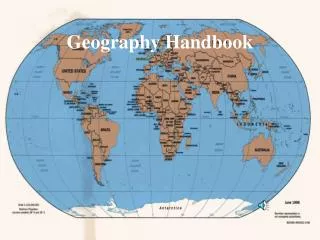
Geography Handbook pp. 1-13
5 Themes of Geography • Location • Place • Human/environment interaction • Movement • Regions
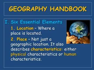
*6 Essential Elements* pp. 1-3 Element 1:The World in Spatial Terms • Where is a place located? • Location = a starting place • …awareness of the world around you Element 2: Places and Regions • Place is not just geographic location • Place includes physical characteristics (mountains, lakes, etc) • regions: places grouped together by common characteristics
Element 3: Physical Systems • how hurricanes, volcanoes, etc. shape the earth’s surface • plants’ and animals’ dependence on each other and their surroundings
Element 4: Human Systems • the way people shape the earth • Boundaries • Settlement patterns • Movement of people ideas and goods
Element 5: Environment and Society • Relationship between people and their natural surroundings
Element 6: Uses of Geography • Understanding relationships among people, places, and environments over time • Understand the past (written records, artifacts, fossils) and prepare for the future
USING MAPS AND GLOBES(p. 4) Hemispheres: • Imaginary lines that criss-cross the globe and are used to locate places on Earth Equator: (east to west)—circles the globe like a belt • Divides Earth into “half spheres” or hemispheres • North of the equator = N. Hemisphere • South of the Equator = S. Hemisphere
Hemispheres (cont.) Prime Meridian: • Runs from north to south • Divides the earth into “half spheres” or hemispheres in the other direction • Everything E. of the Prime Meridian for 180 degrees = E. Hemisphere • Everything W. of the Prime Meridian for 180 degrees = W. Hemisphere
Latitude and Longitude • Crisscross globes and maps • Help easily locate places • Form pattern called a grid Latitude: • Parallels (latitude lines) circle Earth parallel to the equator in • Measure distance N. or S. of the equator in degrees • Equator = 0 degrees latitude • North Pole = 90 degrees N Longitude/Meridians: • Circle the the earth from pole to pole • Measure dostamces East or West of the starting line (Prime Meridian) • Prime Meridian = 0 degrees longitude Absolute location: • Possible because of grid formed by latitude and longitude lines • Place located at a specific crossing of latitude and longitude
Globes to Maps (p. 6) Globe-round scale model of Earth • Gives a true picture of the relative sizes of landmasses and bodies of water • Accurately show distance and direction Map-flat drawing of all or part of the earth’s surface • Show small areas in great detail: political boundaries, population densities, and voting returns
Globe to map challenges: • Difficult to draw round surface to flat map • Cartographers (mapmakers) use math formulas to transfer info to map • Distortion occurs • Solution=great circle: imaginary line that follows the curve of the earth • Example: line drawn along the equator • great circle route- traveling along the great circle • used by pilots because it is the shortest distance between cities • Map: route doesn’t appear to be shortest distance • Globe: route appears as shortest route
Mapmaking Technology GIS (geographic information systems): software that layers data from satellite images printed text, and statistics
Mapmaking Technology GPS (global positioning system): helps locate places based on coordinates broadcast by satellites
Common Map Projections projections:-ways of showing Earth on a flat piece of paper • Goode’s Interrupted Equal Area: shows continents close to their true shapes and sizes • Helpful to compare land areas among continents
2. Robinson Projection: • Minor distortions • E. and W. are close to globe • North Pole and South Pole are most distorted
3. Winkel Tripel Projection: good overall view of continents’ shapes
Mercator Projection: shows direction and size pretty well, but areas far from the equator are very distorted
Parts of Maps • map key-explains lines symbols and colors Example: =city; =capital city scale bar:
Compass Rose: symbol that tells cardinal directions (N, S, E, W)
Map Types (p. 9-10) General Purpose: wide range of general information (physical and political) Physical maps: show landforms and water features • Relief: flat or rugged land • Elevation: height of an area above sea level Political Maps: show names and boundaries of states/countries • Cities, human made features
Map Types (p. 9-10) Cont. Contour Maps: physical map that shows elevation • Contour lines-one for each level of elevation Special Purpose Maps (thematic maps): specific topics in detail • Climate, population density, battle sites
Charts and Graphs • Study Charts and Graphs Pages 11-13 • Coming Soon Chart/Graph Activities!!