Download
1 / 30
300 likes | 457 Views
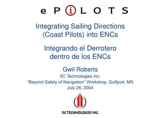
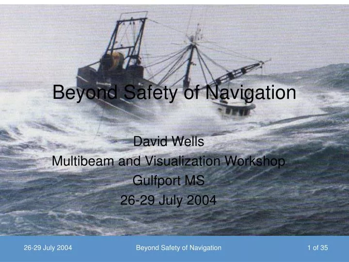
Beyond Safety of Navigation. David Wells Multibeam and Visualization Workshop Gulfport MS 26-29 July 2004. Workshop Theme. “Beyond Safety of Navigation” Beyond in intended uses (new applications) Beyond in capability (high density data) Beyond in data management strategies

E N D
Beyond Safety of Navigation David Wells Multibeam and Visualization Workshop Gulfport MS 26-29 July 2004 Beyond Safety of Navigation
Workshop Theme • “Beyond Safety of Navigation” • Beyond in intended uses (new applications) • Beyond in capability (high density data) • Beyond in data management strategies • Beyond in method of presentation (visualization) Beyond Safety of Navigation
Data acquisition • Sensors, platforms, systems • Communications, logging • Pre-analysis, planning, design Hydrography Data management • Reference frames & geo-referencing • Optimized spatial data structures • Point, raster, vector feature attributes • Spatial correlations & topology • Interpretation, analysis & enhancement tools • Visualization modes (2D, 3D, animation) • Presentation aesthetics, colour, perception Data utilization • Decision making, planning • Resource & facilities management • Spatial feature placement Beyond Safety of Navigation
“Intended purposes” of hydrography • Originally • [and still according to Chapter V of the Safety of Life at Sea (SOLAS) Convention] • “hydrographic surveying is carried out, as far as possible, adequate to the requirements of safe navigation” • Is this the only “intended use” in the 21st century? Beyond Safety of Navigation
Hydrography defined (1979) Hydrography is the science of measuring and depicting those parameters that are necessary to describe the precise nature and configuration of the sea-bed its geographical relationship to the landmass the characteristics and dynamics of the sea. The parameters encompass bathymetry, geology, geophysics, tides, currents, waves, and certain other physical properties of sea water. United Nations (1979) Report of the group of experts on hydrographic surveying and nautical charting, 2nd United Nations Regional Cartographic Conference for the Americas, Mexico City. 33p. Quoted almost verbatim in the first paragraph of Angrisano, Leech & Bermejo (1999) National Maritime Policies and Hydrographic Services, IHO Publication M2, 46 pages. Beyond Safety of Navigation
More “intended uses” (1979) • Coastal hydrography is concerned with • Development of ports and harbours • Coastal erosion problems • Utilization of harbour and coastal conservation services • Especially, the safety of navigation in coastal waters • Off-shore hydrography is concerned with • The provision of hydrographic data as an extension of the coastal zone normally encompassing the continental shelf, • The development of mineral deposits, including hydrocarbons • Provision of data for fisheries management • Oceanic hydrography is concerned with • Acquisition of hydrographic data in the deep ocean areas for the depiction of sea-floor geomorphology Beyond Safety of Navigation
Moore’s Law • In 1965, just four years after the first planar integrated circuit was discovered, Intel co-founder Gordon Moore predicted that the number of transistors per integrated circuit would double every 18 months. He forecast that this trend would continue through 1975. Here’s what really happened: • 4004 1971 2,250 • 8008 1972 2,500 • 8080 1974 5,000 • 8086 1978 29,000 • 286 1982 120,000 • 386 1985 275,000 • 486 1989 1,180,000 • Pentium 1993 3,100,000 • Pentium II 1997 7,500,000 • Pentium III 1999 24,000,000 • Pentium 4 2000 42,000,000 Beyond Safety of Navigation
200 nm Exclusive Economic Zone Beyond Safety of Navigation
Changes since 1979 • Enabling technologies • Microelectronics • Communications bandwidth • New acquisition technologies • DGPS for positioning • High density, near 100% coverage bathymetric tools • Digital hydrographic information • Spreads automatically via Internet • Can be processing in many ways, tailored to specific needs • Many more services and applications possible Beyond Safety of Navigation
Hydrographic information user groups In 1979 definition Marine transportation Coastal zone management Exploration & exploitation of undersea resources Other groups Transoceanic fiber optic cable routes Marine environmental management Military and national security Beyond Safety of Navigation
More “intended uses” (1999) • Safe and efficient maritime transport control • Coastal Zone Management • Exploration and Exploitation of Marine Resources • Environmental Protection and Management • Marine Science • National Spatial Data Infrastructure • Maritime Boundary Delimitation • Maritime Defence • Tourism • Recreational Boating Angrisano, Leech & Bermejo (1999) National Maritime Policies and Hydrographic Services, IHO Publication M2, 46 pages. Beyond Safety of Navigation
IMCA S-003 MBES Guidelines (November 2001) intended uses • Order 1 – Site surveys requiring high quality seafloor definition (Template or jacket installations; Detailed route engineering surveys; Route surveys in confined areas; Surveys in ports and harbours; Dredging and inshore engineering surveys) • Order 2 – Less stringent site surveys (Route reconnaissance surveys; Geo-Hazard and clearance surveys; Coastal engineering surveys; Deepwater geophysical and engineering surveys conducted by remote vehicle) • Order 3 – General bathymetric surveys (Continental shelf cable route surveys; Continental shelf charting surveys; Export pipeline route surveys) • Order 4 – Reconnaissance surveys (Deepwater cable route surveys; Deepwater charting surveys; Surveys for Exclusive Economic Zone assessments and delineation) Beyond Safety of Navigation
More intended uses • Depth & location of rocks, sandbars, and wrecks, for navigationchannel & salvage • Dredge for harbour deepening, maintenance, mineral recovery, navigation access • Evaluate sedimentation & erosion for coastline protection and offshore structures • Measure siltation & scouring to determine effects on water quality and existing structures, such as bridge abutments and storm sewage outfalls • Provision of recreational facilities such as beaches and marinas • Submarine cable & pipeline routes & landfall locations • Determine pollution sources • Evaluate effects of corrosion • Determine extents of wetland areas • [Kavanagh: Introduction to surveying] Beyond Safety of Navigation
Non-navigation ENC uses Fisheries habitat GIS (smelt distribution mapping) GIS map databases (MapInfo & QuikMap) Sewage outfall siting Confederation bridge environmental monitoring GIS Passamaquoddy coastal zone mapping pilot program Lake Ontario hydrodynamic & pollution transport model Maugerville to Gagetown hydrotechnical study Coastal current sedimentation deposition model Base map for delimiting dredging limits DEM base map to delimit potential dumping grounds Nova Scotia amphibious natural resources maps From http://ndi.nf.ca/ndi/toplevel/oth_uses.htm Beyond Safety of Navigation
New (2001) Definition of Hydrography • Hydrography is the total set of spatial data and information, and the applied science of its acquisition, maintaining and processing, necessary to describe the topographical, physical and dynamical nature of the hydrosphere and its borders to the solid earth, and the associated facilities and structures. • Task: data acquisition (but not just bathymetry) • Purpose: distributing information (for informed decision making), rather than constructing products. • Horst Hecht, Federal Maritime and Hydrographic Agency of Germany (Bundesamt für Seeschiffahrt und Hydrographie), May 2001: Beyond Safety of Navigation
Standards & intended purposes • The word “standard” implies something which can be used as a basis for comparison, such as a model or a set of rules, or an authorized measure of some kind. • Along these lines, the International Organization for Standards (ISO) defines the term “standards” as • Rules, guidelines, and definitions of characteristics, which ensure that materials, products, processes and services are fit for their intended purposes. Beyond Safety of Navigation
“Fit for intended use” • Data must support “informed decision making” for each intended use • This requires data coverage and data uncertainty management strategies • Uncertainty management depends upon data redundancy • [More on this on Wednesday] Beyond Safety of Navigation
Deep water data density • In 3000 m of water • Method Soundings / hr Mbytes / hr • Leadline 1 0.000008 • Echosounder 900 0.0072 • Multibeam 68,760 10.5 (with ss) Beyond Safety of Navigation
Higher densities • In 100 m of water • Method Soundings / hr Mbytes / hr • Leadline 10 0.00008 • Echosounder 21,600 0.1728 • EM-1000 324,000 27.9 (with ss) • EM-3000 1,500,000 79.8 (with ss) Beyond Safety of Navigation
In really shallow water • In 5 m of water • Method Soundings / hr Mbytes / hr • Echosounder 432,000 3.5 • EM-3000 17,000,000 450 (with ss) • 200 kHz Lidar 720,000 720 • 1200 kHz Lidar 4,320,000 4320 Beyond Safety of Navigation
ECDIS goal Provide real-time information support for precision navigation and decision making Capture, manage, select & display an integrated flow of information from various sources [IMO Performance Standard, 1994] Beyond Safety of Navigation
Digital Information • Integrates bathymetry, radar, navigation information, etc. in powerful, flexible displays. • Use for route planning, route following, and to trigger safety warnings. Beyond Safety of Navigation
Minas Channel • Integration of land-based remote sensing images and seabed acoustic image Beyond Safety of Navigation
Minas Channel gravel waves • Waves 2 - 20 m wavelength, 0.5 - 1.5 m high. • repeat surveys in August 1992 and 1993 • monitored how much wave field changed over one year created by John Hughes Clarke from multibeam data collected on Creed Beyond Safety of Navigation
Waves 50 - 150 m wavelength, 2 - 15 m high Beyond Safety of Navigation
Sydney Beyond Safety of Navigation
Take-home message Digital methods are replacing traditional data management methods • Digital, high density bathymetry has many non-navigation applications • New methods for data management and visualization are being employed • The business case is stronger for maintaining a public-service hydrographic service that serves more than SOLAS users • Some public service Hydrographic Offices are developing new, non-SOLAS markets, tailoring new products to new applications • Private sector suppliers are moving aggressively to meet market needs for hydrographic information Beyond Safety of Navigation