Download
1 / 24
250 likes | 386 Views
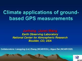
Climate applications of ground-based GPS measurements. Junhong (June) Wang Earth Observing Laboratory National Center for Atmospheric Research Boulder, CO, USA. Collaborators: Liangying (Liz) Zhang (NCAR/EOL ), Aiguo Dai (NCAR/CGD ) . Outline. Motivation

E N D
Climate applications of ground-based GPS measurements Junhong (June) Wang Earth Observing Laboratory National Center for Atmospheric Research Boulder, CO, USA Collaborators: Liangying (Liz) Zhang (NCAR/EOL), Aiguo Dai (NCAR/CGD)
Outline • Motivation • GPS measurement and analysis techniques, and GPS PW dataset • Climate applications: • Validations of radiosonde data • Diurnal variations • Climate variability • Summary and Challenges
Challenge: Large variability Gaffen et al. (1995)
Comparisons of water vapor measurement techniques • Diurnal variation • Climate extremes Validations of other measurements Climate trends
How does GPS estimate precipitable water? Total delay = Ionosphere + dry + wet Noise (geodesy) Signal (meteorology) ZTD = ZHD + ZWD ZWD = ZTD - ZHD PW = * ZWD = f (Tm)
Feb. 1997 to Dec. 2010 • 2 hourly (0100, 0300, …, 2300 UTC) • 380 IGS, 169 SuomiNet, 1223 GEONET • Accuracy: < 3 mm • Ps, Tm, ZHD and ZWD also available • Request data: junhong@ucar.edu A global, 12-year, 2-hourly PW dataset from ground-based GPS measurements(Wang et al. 2007, JGR)
Challenge of radiosonde data for water vapor trends Real change False change Wang et al. (2001)) Lithium Cloride Humicap Carbon Hygristor
Capacitive Carbon hygristor Goldbeater’s skin median -1.67 1.97 0.81 S.D. 1.72 4.15 1.93 Systematic errors – mean biases Wang and Zhang (2008a)
Temporal inhomogeneity of radiosonde PW data carbon hygristor capacitive with cover capacitive carbon hygristor Goldbeater’s skin Carbon hygristor Miami, U.S.A Suwon-Shi, Korea Relative PW differences (% Radiosonde-GPS) Beijing, China Wang and Zhang (2008)
PW comparison (Radiosonde-GPS) Homogenization of global radiosonde humidity data Improved RS2-91 RS2-91 RSII-80 RH wet bias corr. at T<0C RSII-56
Global PW diurnal anomaly from GPS (Wang and Zhang, 2009, Journal of Geodesy) Globe S. H. N. H. • The diurnal cycle is less than 5% of annual mean PW • Larger magnitude in summer than in winter • Peak around late afternoon to early evening • An order of magnitude smaller than seasonal variation
Seasonal variations of diurnal and sub-monthly variability over Europe GPS NCEP/NCAR JRA ERA-40 Wang and Zhang (2009) mm
PWV diurnal cycle & seasonal evolution Corrected radiosonde profiles (May 2006) 00 06 AEJ 12 18 drying moistening qu qv q • Night (00 -> 06): moisture flux strengthens in the low levels and moistens the column Strong diurnal cycle during pre-monsoon period: NWP models • Day (12 -> 18): vertical dilution by turbulence and horizontal export by AEJ dries the column Bock et al., AGU, 2010
PW Anomaly in 2010 Mears et al. (2010) Mears et al. (2011)
Change in PW Anomaly from Jan-Jun to Jul-Dec 2010 Mears et al. (2011)
Hurricane Ernesto (24 Aug – 1 Sep. 2006)
Foster et al. 2003 Connections between water vapor and precipitation extremes • Ka’ū storm, Big Island of HI, Nov. 1-2 2000; • > 100mm/hr (~4”/hr) maximum hourly rain rate • Most intense, widespread rain event in 20 years • $70 M property damage • Impacts on roads and other infrastructure for weeks afterward • Using GPS PW data to predict rain rate and validate model results
Review on GPS PW Trend Studies summer winter winter summer
Long-Term PW Variability El Nino La Nina Mears et al. (2011)
Challenges for Trend analysis 2-hrly combined to 5-min PPP-derived ZTD products Relative to absolute antenna phase model BRMU MAC1
The GCOS Reference Upper Air Network • Provide long-term high-quality upper-air climate records • Constrain and calibrate data from more spatially-comprehensive global observing systems • Fully characterize the properties of the atmospheric column GRUAN GNSS-PW Task Team
Summary The GPS PW data have been approved very useful for various climate studies, including quantifying systematic errors in global radiosonde data, studying PW diurnal, inter-annual and long-term variations. However, the temporal inhomogeneity of the GPS-PW data is introduced by changes in instruments, data processing algorithms and other factors. This raises concerns on long-term stability of GPS-PW data and its usefulness for validating other water vapor data. There is a urgent need to consistently reprocess the GPS-PW data for climate studies, and better manage changes in the future, including maintaining complete metadata on changes and always evaluating the impacts of changes before they are implemented.