Download
1 / 1
10 likes | 131 Views
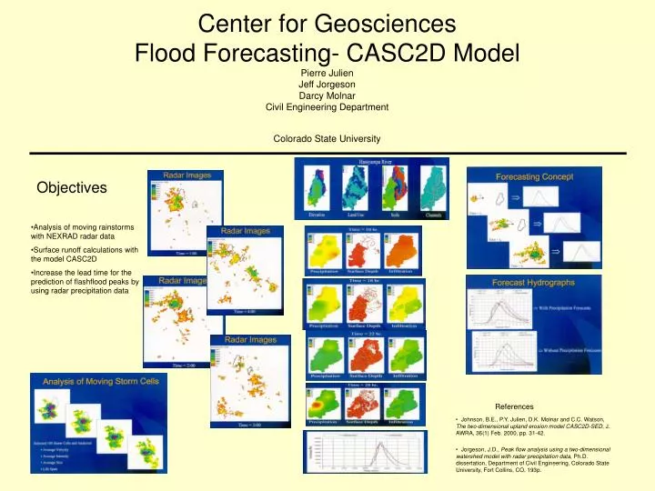
Center for Geosciences Flood Forecasting- CASC2D Model Pierre Julien Jeff Jorgeson Darcy Molnar Civil Engineering Department Colorado State University. Objectives. Analysis of moving rainstorms with NEXRAD radar data Surface runoff calculations with the model CASC2D

E N D
Center for GeosciencesFlood Forecasting- CASC2D ModelPierre JulienJeff JorgesonDarcy MolnarCivil Engineering DepartmentColorado State University Objectives • Analysis of moving rainstorms with NEXRAD radar data • Surface runoff calculations with the model CASC2D • Increase the lead time for the prediction of flashflood peaks by using radar precipitation data References • Johnson, B.E., P.Y. Julien, D.K. Molnar and C.C. Watson, The two-dimensional upland erosion model CASC2D-SED, J. AWRA, 36(1) Feb. 2000, pp. 31-42. • Jorgeson, J.D., Peak flow analysis using a two-dimensional watershed model with radar precipitation data, Ph.D. dissertation, Department of Civil Engineering, Colorado State University, Fort Collins, CO, 193p.