Download
1 / 17
170 likes | 292 Views
The physical environment of INDIA. Political geography. twenty eight states (further subdivided into districts) seven union territories : Andaman and Nicobar Islands Chandigarh Dadra and Nagar Haveli Daman and Diu Lakshadweep National Capital Territory of Delhi Puducherry.

E N D
Political geography • twenty eight states (further subdivided into districts) • seven union territories: • Andaman and NicobarIslands • Chandigarh • Dadra and Nagar • Haveli • Daman and Diu • Lakshadweep • National Capital Territory of Delhi • Puducherry
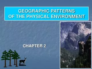
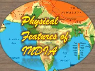
Indian subcontinent Position: 8°4' and 37°6' north latitude 68°7' and 97°25' east longitude Territory: 3,287,240 square km Borders with • China, • Nepal, • Burma, • Pakistan, • Bhutan, • Bangladesh.
Geological development • Indian tectonic plate • Collision with Asia – 55 mln yrs • Current movement – 5 cm/yr
Physiographic regions • The northern mountains • Northern Plains • The Peninsular Plateau • Thar desert • The Coastal Plains
Mountains • The Himalayan range • The Karakoram • The Patkai, or Purvanchal, • The Vindhya range • The Satpura Range • The Aravali Range • The Western Ghats • The Eastern Ghats
Water bodies • The Himalayan rivers (the Indus, Jhelum, Chenab, Ravi, Beas, and Sutlej) • the Ganges (+Brahmaputra, Meghana) • Deccan rivers (Mahanadi River , Godavari River, Krishna River and Kaveri River) • Gulf of Cambay, Gulf of Kutch, and the Gulf of Mannar • the Palk Strait, the Ten Degree Channel, and the Eight Degree Channel • The Arabian Sea, the Laccadive Sea and the Andaman Sea • the Bay of Bengal • the Indian Ocean • Sambhar Lake
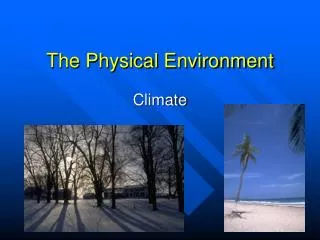
Weather and climate six major climatic subtypes: • arid desert in the west, • alpine tundra and glaciers in the north, • and humid tropical regions supporting rainforests in the southwest • the island territories. The nation has four seasons: • winter (January–February), • summer (March–May), • a monsoon season (June–September) • a post-monsoon period (October–December)
Natural resources • the production of coal - the 3rd highest in the world • the production of iron ore - the 4th • 5.4 billion barrels in oil reserves • 17th trillion cubic feet of natural gas • uranium • 400 medium-to-high enthalpy thermal springs • production of mica blocks and mica splittings • production of barites and chromites - the 2nd • production of bauxite and crude steel - the 5th • production of manganese ore - the 7th • production of aluminium - the 8th • titanium ore • diamonds • limestone • 24 % of world’s thorium
Home assignment 1. Pronunciation of all Indian states/territories and their capitals 2. Search-and-Find in the map of India 3. Presentations: • Indian wildlife • Indian campaign of Alexander the Great 4. Discussion: Why do some traditions pale into insignificance? 5. Film: Mountains of the Monsoon (English Documentary)