Download
1 / 35
350 likes | 486 Views
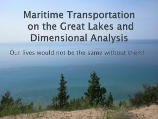
INTERMODAL TRANSPORTATION INSTITUTE. Data Expansion Efforts in the Great Lakes Maritime Information Delivery System. Peter S. Lindquist GLMRI Affiliates Meeting September 23, 2010. GREAT LAKES MARITIME INFORMATION DELIVERY SYSTEM. CURRENT PROJECT GOALS

E N D
INTERMODAL TRANSPORTATION INSTITUTE Data Expansion Efforts in the Great Lakes Maritime Information Delivery System Peter S. Lindquist GLMRI Affiliates Meeting September 23, 2010
GREAT LAKES MARITIME INFORMATION DELIVERY SYSTEM CURRENT PROJECT GOALS l To increase the volume of data in the GLMIDS Repository l To enhance network databases with new connections, attributes l To acquire, store and manage data acquired by automated methods (AIS, USACE MD+, etc.) l To furnish prepared information on project web site l To develop a new, improved data delivery system to replace Midwest FreightView l To focus on specific com- modity movements in the region (e.g., Coal)
GREAT LAKES MARITIME INFORMATION DELIVERY SYSTEM CURRENT PROJECT GOALS, continued l To continue managing this comprehensive database relating: mEconomic activity among all sectors mRegional population patterns mImport and export flows mIntra-regional flows mSystem capacity among all modes mIntermodal connectivity l To continue towards the development of a regional database that can support freight modeling efforts.
GREAT LAKES MARITIME INFORMATION DELIVERY SYSTEM Data Residing in Repository to Date Network Data: l ORNL CTA North American Highway Network l NHPN (FAF) Highway Network l Integrated Highway Network lUpdated ORNL CTA North American Rail Network l North American Transportation Atlas Data (NORTAD) l BTS Intermodal Terminals (Enhanced), Ports, Airports l USACE Dock Data (Master Docks Plus Database) l USACE lock performance data (U.S. side) l FAF Zones and Centroids l Weather station data (NOAA, to approx. 60 Miles Inland)
GREAT LAKES MARITIME INFORMATION DELIVERY SYSTEM Data Residing in Repository to Date Economic/Population Data: l US Census of Agriculture / NASS Data (County-Level) l Demographics Plus 2003 Business Counts—Tract+ l US Census 2000 Long Form Database—Tract + l Geographic Data: Counties, Census Tracts, ZIP Code Areas, Congressional Districts, MSAs, Urban Areas l County-Level Employment by 3-Digit NAICS classification (Sources: BLS ES/202, County Business Patterns, supplemented with Minnesota IMPLAN Group, Inc. data) l Satellite imagery / aerial photography of dock facilities
GREAT LAKES MARITIME INFORMATION DELIVERY SYSTEM Data Residing in Repository to Date Economic/Population Data: l Establishments and employment by 2-6 Digit NAICS classification among counties, MSAs (Minnesota IMPLAN Group, Inc. l Individual Establishments in 10-State MVFC study region (Dun and Bradstreet/Harris InfoSearch) l BEA gross domestic product by metropolitan area and by sector and by Year l BEA regions in ESRI Shapefile format l Coal Mine Database (Keystone, etc.) l Power Plant Database (eGRID, etc.)
GREAT LAKES MARITIME INFORMATION DELIVERY SYSTEM • Data Residing in Repository to Date • O/D Flow Data: • lImport/Export Flows (GTIS), 1999+, by State, Customs Gateway • lFAF 2002 OD Flows (National Scale) • lFAF2 2007 Provisional OD Flows (National Scale) • l Flows across international boundaries • l MARAD international vessel movements & USACE Vessel • Entrances and Clearances • l USACE Waterborne Commerce Database Part III (Great Lakes) • l National County Commodity Flow Data • Delivery System (UIC)
GREAT LAKES MARITIME INFORMATION DELIVERY SYSTEM • Data Residing in Repository to Date • Traffic Flows by Link: • lHighway Truck Traffic Volume (AADTT) • lAir Freight Flows • lWaterborne Traffic Volumes by Commodity (Great Lakes) • lRailroad Traffic Volumes Class I Links (Public Waybill) • Transportation Facilities: • lIntermodal Terminals lPorts • lAirports lRail Yards • l Weigh Stations lToll Facilities • lCustoms Stations Documentation lMetadata lData Dictionary lTechnical Documentation lUser Guides / Manuals
GREAT LAKES MARITIME INFORMATION DELIVERY SYSTEM Data Delivery System: Documentation Improving the documentation of existing information on the Toledo project web page: l Manuals and related documentation for use of the system. l Formalized documentation of the contents of the database including l detailed inventory of the database l metadata l technical appendices l Furnish secure direct access to the MWFV data viewer.
GREAT LAKES MARITIME INFORMATION DELIVERY SYSTEM Project Web Site Access at: http://maritime.utoledo.edu
GREAT LAKES MARITIME INFORMATION DELIVERY SYSTEM The Atlas of Great Lakes Maritime Commerce
GREAT LAKES MARITIME INFORMATION DELIVERY SYSTEM Current Work in GLMIDS: Additions to the Database in Progress l Integrated Network—Great Lakes Waterway, Highway, Rail linked to Commercial Docks, Locks l Updated US Highway Network mSpeed / Estimated Travel Times mToll gates / weigh stations mAdd ESRI Traffic Counts to integrated highway network mAdd ATRI Travel Time Data (by time of day, day of week) mLink highways to Rail Network through Intermodal Sites l Link BEA Regions/BEA GDP Data to Public Rail Waybill Data l Encode EPA eGRID Power Plant Database, Keystone Coal Mine Database; linkages to Rail and Waterway Networks
GREAT LAKES MARITIME INFORMATION DELIVERY SYSTEM Current Work in GLMIDS: Additions to the Database in Progress l Assign USACE Foreign Traffic Vessel Entrances and Clearances to Network l Assign USACE Waterborne Commerce Data to Network l County-to-County Mileage and Impedance Tables: mHighway mRail mWater Useful for Analytical Tools—Accessibility, Location Analysis, etc. l Automated Data Collection: mAIS collection in cooperation with BoatNerd mUSACE Master Docks Plus Data Exchange Agreement
GREAT LAKES MARITIME INFORMATION DELIVERY SYSTEM Current Work in GLMIDS: Parallel Projects Impacting GLMIDS l FINDE: Federal Integrated Navigation Data Enhancement mAutomated Data Gathering for Port Calls mDevelopment of GIS Database at Docks, NPIs mAIS-Data Acquisition referenced to GIS Dock Locations mJoint Project with USACE, US Customs, IRS, BTS US Coast Guard l Development of New Data Viewer to Replace ArcView m Streamlined Data Viewer m User Friendly Query Functions m Example: National County Commodity Flow Data Delivery System
GREAT LAKES MARITIME INFORMATION DELIVERY SYSTEM National County Commodity Flow Data Delivery System (UIC / UT Partnership) lContents of the database consist of 43 2-digit SCTG (Standard Classification of Transported Goods) Categories lData managed in the following formats m County-level inflow tonnage totals (kton)--all modes m County-level outflow tonnage totals (kton)—all modes m County-level combined inflow/outflow volumes m County -to-County OD flow tonnage (trucks only) lAccess to the site by permission only: User Ids, Passwords, issued by University of Illinois Chicago Research Team
GREAT LAKES MARITIME INFORMATION DELIVERY SYSTEM National County Commodity Flow Data Delivery System Query / Data Retrieval Functions lData retrieved by selections on pull-down menus l Users select SCTG Codes, Inflows, Outflows, Counties lGenerate Data Tables for Inflows, Outflows, OD Flows lData tables in CSV format for import into Spreadsheets or database software
GREAT LAKES MARITIME INFORMATION DELIVERY SYSTEM Access provided at Web Portal http://midwestfreightdata.utoledo.edu
GREAT LAKES MARITIME INFORMATION DELIVERY SYSTEM
GREAT LAKES MARITIME INFORMATION DELIVERY SYSTEM
GREAT LAKES MARITIME INFORMATION DELIVERY SYSTEM
GREAT LAKES MARITIME INFORMATION DELIVERY SYSTEM Conclusions l Emphasis on continued acquisition of data l Value Added within existing databases through data enhancement l Continued efforts to acquire data through automated methods l Replacement of Midwest FreightView with streamlined acquisition system that provides download and basic viewing capabilities l Development of more comprehensive Atlas function on Project Web Page: Maps, Enhanced Port Image Displays, Graphics, Tables l Increased focus on specific commodity movements in the region (e.g., Coal) l Emphasis on the development of a regional database that can support freight modeling efforts
INTERMODAL TRANSPORTATION INSTITUTE GREAT LAKES MARITIME INFORMATION DELIVERY SYSTEM Thank you