Download
1 / 53
530 likes | 744 Views
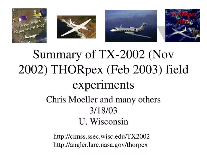
Summary of TX-2002 (Nov 2002) THORpex (Feb 2003) field experiments. Chris Moeller and many others 3/18/03 U. Wisconsin. http://cimss.ssec.wisc.edu/TX2002 http://angler.larc.nasa.gov/thorpex. TX-2002 Objectives. Terra Cloud Top Properties and thin cirrus detection (Nov 24, 27, 29, Dec 10)

E N D
Summary of TX-2002 (Nov 2002) THORpex (Feb 2003) field experiments Chris Moeller and many others 3/18/03 U. Wisconsin http://cimss.ssec.wisc.edu/TX2002 http://angler.larc.nasa.gov/thorpex
TX-2002 Objectives • Terra Cloud Top Properties and thin cirrus detection (Nov 24, 27, 29, Dec 10) • Aqua L1B assessment (Nov 21, Dec 5-6) • ARM SGP surface emissivity mapping (Nov 22) • Terra nighttime cloud detection/properties • First Aqua Cloud validations (Dec 7, 11) • Multilayer Cloud studies (Dec 10, 11) • SHIS/NAST-I comparisons • Louisiana coast sediment mapping (Nov 23) • Cloud Properties over ARM SGP (Nov 29)
TX-2002 ER-2 Payload NPOESS Atmospheric Sounder Testbed (NAST-I) Video Imaging System (VIS) Dual RC-10 Camera Scanning High Resolution Interferometer Sounder (S-HIS) Cloud Physics Lidar (CPL) MODIS Airborne Simulator (MAS) • MAS - 50 channel VIS/IR spectrometer, 50 m res., 36 km swath • S-HIS - Scanning MWIR/LWIR interferometer, 2 km res, 36 km swath • NAST-I – Scanning MWIR/LWIR interferometer, 2km res, 40 km swath • CPL – micropulse dual polarization lidar, 15 m res, nadir only • RC-10 - b/w and false color IR photo, 1-5 m res., 15 x 15 km coverage • VIS video imaging system - color video CCD camera; continuous
TX-2002 Sunday Monday Tuesday Wednesday Thursday Friday Saturday Nov 22 23 17 18 19 20 21 03-9015 Aqua sediment 03-9014 Terra L1B Sfc Emiss. ER-2 03-9013 Aqua L1B Ferry to SAT 24 25 26 27 28 29 30 03-9016 Terra Cloud 03-9018 Terra Cloud 03-9017 Terra Cloud Dec 1 2 3 4 5 6 7 03-9020 Aqua Cloud 03-9019 Aqua L1B 8 9 10 11 14 12 13 03-9021 Terra Cloud 03-9022 Aqua Cloud ER-2 . Ferry to DFRC
MAS Quicklooks flight leg 5 0.65mm 1.90mm 3.74mm 11.01mm RGB Aqua MODIS/AIRS L1B Assessment 11/21/2002, 19:40 UTC (daytime) Gulf of Mexico Sub-satellite track MODIS cloud mask (green is confident clear) exact ER2 / Aqua time coincidence ER2 Flight leg 5
PRELIMINARY MAS calibration
Nov 21, 2002 Flt 03-9013
AIRS / MODIS comparisons using Tb histograms Nov 21, 2002 • Approach using Aqua MODIS and AIRS granule data • convolve AIRS spectra from AIRS granule 196 with MODIS SRFs • Compute Mean and variance of MODIS observations within each AIRS FOV. (AIRS FOVs currently represented as circles, as with the condensedMODIS cloud algorithm). • Screen data based on cloud flag, MODIS variability, scan angles, and compare observed brightness temperatures
AIRS MODIS Granule 196 Band 27 (~6.8 mm)
AIRS MODIS Granule 196 Band 28 (~7.3 mm)
AIRS MODIS Granule 196 Band 32 (~12.0 mm)
AIRS MODIS Granule 196 Band 33 (~13.4 mm)
AIRS MODIS Granule 196 Band 34 (~13.7 mm)
AIRS MODIS Granule 196 Band 35 (~13.9 mm)
AIRS MODIS Granule 196 Band 36 (~14.2 mm)
Terra Cloud Top Properties Assessment Nov 24, 2002
Terra Cloud Top Properties Assessment Nov 29, 2002
Aqua MODIS Nighttime Cloud Detection Dec 5-6, 2002 Gulf Coast Stratus Clouds with ER-2 Flight Track Aqua MODIS Band 22 Dec 6, 2002 07:55 UTC
Aqua MODIS Nighttime Cloud Mask Dec 5-6, 2002 Green Conf. Clear Cyan Prob. Clear Red Uncertain White Cloud
Aqua Dec 6, 2002 Night Flight
Aqua MODIS Thin Cirrus Detection Dec 7, 2002
Reverse Scale 0.66um 1.6 3.75 11 RGB Thin Cirrus observations by ER-2 coincident with Aqua Thin Cirrus Aqua
Aqua on Dec 7, 2002, 1940 UTC Thin cirrus cloud (inside green box) observed by Aqua and ER-2
THORpex EOS Objectives • Aqua Cloud Top Properties and thin cirrus detection (Feb 24, 26, Mar 10, 12) • Aqua L1B warm scene assessment and atmospheric profiles validation (Mar 3, 10) • Aqua Nighttime Cloud detection/properties • ITCZ cirrus properties w/Aqua • SHIS/NAST-I comparisons (many) • ICESat/GLAS validation (Feb 26, Mar 1, 10) • Coincident observations of MOBY w/Aqua
THORpex ER-2 Payload Cloud Physics Lidar (CPL) RC-10 Camera LaRC Ozone Probe NPOESS Atmosperic Sounder Testbed - I/M (NAST-I/M) MODIS Airborne Simulator (MAS) Scanning High Resolution Interferometer Sounder (S-HIS) • MAS - 50 band VIS/IR, 50 m spatial res., ± 43°offnadir scanning, 38 km swath • S-HIS – MWIR/LWIR interferometer, 2 km res, ± 35° offnadir, 32 km swath • CPL - 3 Wavelength, micropulse dual polarization Lidar (1064 nm) • NAST – MWIR/LWIR interferometer, 2km res., ± 45 offnadir scan, 40 km swath • FASTOZ - LaRC Ozone probe (in situ) • RC-10 - b/w photo, 1-5 m res., 15 x 15 km coverage
NOAA G-IV • Dropsondes from nominal altitude of 41 to 45 K ft • Aeronomy Lab (e.g ozone concentration)
THORpex Sunday Monday Tuesday Wednesday Thursday Friday Saturday 16 17 18 19 20 21 22 Thorpex 03-6015 subtrop jet Thorpex 03-6014 (cold soak) ER-2 Feb Ferry 23 24 25 26 27 28 1 Aqua/Glas 03-6018 low cld/clr Aqua 03-6016 hi cloud Aqua/Glas 03-6017 hi cloud 2 3 4 5 6 7 8 Aqua 03-6019 low cld/clr Mar 9 10 11 12 13 14 15 Thorpex 03-9032 data cube Thorpex 03-9033 jet streak Thorpex 03-9035 jet streak (Ferry) Aqua/Glas 03-9031 jet streak Thorpex 03-9034 winds . “We are here to serve” ER-2 only ER-2 w/ G-IV coordination
Aqua Cloud Top Properties Assessment Feb 26, 2003
00:20 00:10 00:00
00:05 00:15
00:20 00:10 00:00
00:00 00:10 00:20 00:00 00:10 00:20
00:20 00:10 00:00