Download
1 / 15
210 likes | 545 Views
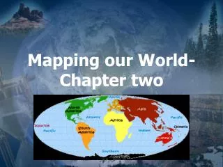
Mapping our world. Chapter 2. Section 2.1 Latitude and Longitude. Cartography is the science of mapmaking, where cartographers use an imaginary grid of parallel lines and vertical lines to locate exact points on Earth.

E N D
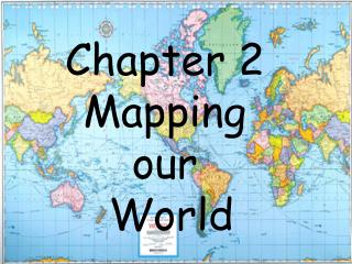
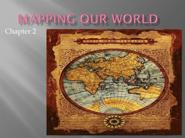
Mapping our world Chapter 2
Section 2.1Latitude and Longitude Cartography is the science of mapmaking, where cartographers use an imaginary grid of parallel lines and vertical lines to locate exact points on Earth. On this grid, the equator (an imaginary parallel splitting the Earth in half at 0o) separates the Northern and Southern hemispheres.
Latitude Longitude • Refers to lines that measure distances north and south of the equator, running east and west. • Each degree of latitude is about 111km on the Earth’s surface. • To locate positions more exactly, degrees of latitude are broken into smaller units called minutes • There are two points of latitude… the North Pole and the South Pole. • Lines of latitude are parallel • Latitude will have 90o north and south of the equator • Refers to lines that measure east and west of the Prime Meridian (0o), running north and south. • Also referred to as meridians • The Prime Meridian runs through Greenwich, England (the home of the royal Naval Observatory). • Lines of longitude are NOT parallel, but are instead large semicircles that extend vertically from pole to pole. • Longitude will have 180o east and west of the Prime Meridian.
TIME ZONES • The Earth is divided into 24 time zones… because there are 24 hours in the day! • There are SIX designated time zones in the USA: • EST (Raleigh) -- TIME • CST (Chicago) – (-1) • MST (Denver) – (-2) • PST (Los Angeles) – (-3) • AKST (Alaska) – (-4) • HST (Hawaii) – (-5)
Each line of longitude, although some have been adjusted for convenience, is represented by 15o on the map. Each time you travel through a time zone, you gain or lose time until at some point, you gain or lose an entire day! The International Date Line is located at 180o E/W of the Prime Meridian. When you cross this line, you either advance or go back one day. If you are traveling west, you advance your calendar one day. If you are traveling east, you go back. Memory Clue… “we Want to stay ahead, but it is Easy to fall behind.” (Note the “W” stands for west and the “E” stands for east.)
Section 2.2 Types of Maps Maps are flat models of a three-dimensional object, Earth. As the Earth is curved, it is difficult to represent on a piece of paper. Thus, all flat maps distort the shapes or landmasses to some degree.
Layout of a Map Map Legends Map Scales • Most maps include both human-made and natural features that are located on the Earth’s surface. • These features are represented by symbols. • A map legend simply explains what these symbols mean. • When using a map, it is imperative that you understand how to measure distances. • The map scale is a tool used to detail the ratio between distances on a map and actual distances on the Earth’s surface. • There are three types: • 1. Verbal Scales • 2. Graphic Scales • 3. Fractional Scales
Types of Maps Mercator Projections Conic projections • A map that has parallel lines of latitude and longitude. • On a mercator projection, the shapes of landmasses are correct but their areas are distorted. • Used for navigation of ships and planes and automobile road maps. • Made by projecting points and lines from a globe onto a cone. • The cone touches the globe at a particular line of latitude. • There is little distortion in the areas or shapes of landmasses that fall along this line of latitude; however, distortion occurs near the top and bottom of the projection. • Used to make weather maps.
Gnomic Projections • Made by projecting points and lines from a globe onto a piece of paper that touches the globe at a single point, mainly over the poles. • Accurate shapes of landmasses, but distorted direction and distance between landmasses. • Useful in plotting long-distance trips by air and by sea.
Topographic Maps • Show the changes in elevation of the Earth’s surface, allowing you to determine how steep slopes or depressions of a land area are. • Topographic, or Topo, maps use contour lines to connect areas that have the same elevations. Distances between these lines are referred to as the contour interval and allow you to determine how steep a slope is. • Rules to remember… • Contour lines are closer around hills and basins or depressions • Hachures (dash marks around a circular region) designate a depression. • Contour lines never cross, as one point cannot have two elevations. • Contour lines form upward V’s, which tell you that there is a stream present in that location.
Section 2.3Remote Sensing Until recently, mapmakers had to go on-site to collect data needed to make maps. Today, advanced technology has changed this – enabling data to be collected by satellites from far above the Earth’s surface. This process is referred to as remote sensing.
Remote Sensing (cont.) Electromagnetic spectrum Satellites
Seabeam Technology Seabeam technology is used to map the ocean floor using the bottom of different ships. Seabeam technology relies on sonar, which is the use of sound waves to detect and measure objects underwater. Basically, a sound wave is sent from a ship to the ocean floor. It is then received by a specific device, and ship computers then calculate the distance to the bottom based on the speed of sound.
Global Positioning System (GPS) • GPS is a satellite based navigation system to pinpoint your exact location on Earth. • GPS utilizes at least 24 different satellites to ensure accuracy. • GPS technology is used extensively for navigation by ships and airplanes and can also be used to detect earthquakes, create maps, and track wildlife. • Lately, GPS has increased in popularity among all travelers.
Compass A compass is used to determine direction On a compass, the red needle should always be pointing North; however, this does not mean that it is pointing to the North Pole as there is a geographic north and a magnetic north To determine the difference, the magnetic declination must be determined, which is the difference between geographic north and magnetic north Depending on your location, the angle of declination will be different