Download
1 / 28
280 likes | 384 Views
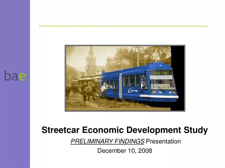
Streetcar Economic Development Study PRELIMINARY FINDINGS Presentation December 10, 2008. Portland Streetcar. Overview of Scope. Background Review, Corridor Tour Team: BAE; Warren & Associates; Integra Realty Resources Assess value premium for system financing

E N D
Streetcar Economic Development Study PRELIMINARY FINDINGS Presentation December 10, 2008
Portland Streetcar Overview of Scope • Background Review, Corridor Tour • Team: BAE; Warren & Associates; Integra Realty Resources • Assess value premium for system financing • Interview stakeholders (property owners, developers, CDCs, institutions) • Literature review • Limited literature on streetcars • Need to borrow from light rail studies • Case studies (both quantitative and qualitative) • Little Rock, AR • Seattle, WA • Memphis, TN • Portland, OR
Seattle Streetcar Overview of Scope • Estimate amount and location of new development in Charlotte along streetcar route • Four segments to reflect local markets • Improvement-to-land ratio (I/L) as first-cut to identify underutilized land • Identify development potential (current zoning) and prototype projects • Result - summary of location, type, and timing of development in 5 year increments, 2010 to 2035 • Estimate increased tax revenues • Estimate amount of system potentially paid through value capture • One-time capital costs • Assessment districts, Tax increment financing (TIF), etc. • Report
Overview of Streetcar Financing Tools • Federal Small Starts – strict cost rules have led to only 3 approvals. May be revised with SAFETEA-LU reauthorization • Proposals to consider economic development benefits when reviewing • Approved extension to date: Portland (after multiple tries) • Approved new systems to date: Fort Lauderdale, FL; Tucson, AZ • State and regional capital improvement programs funded through various sources • Most common are gasoline and sales taxes • Multiple local sources typical – taxes, parking, surcharges • General funds, sales taxes parking meters, parking garages, surcharges at served public arenas and venues (Portland, Ore: 8 sources) • Institutional or private donations because of benefits received • Ohio State contributing $12.5 million to Columbus streetcar. Cincinnati raising $30 million in donations; Grand Rapids $50 million
Value Capture: Literature Review • Numerous studies on property value increase close to transit • Most studies about light or heavy rail • Limited literature about streetcar value capture • Findings: • In US, value can increase 5 to 20% + for housing units within ¼ mile of transit station (light/heavy rail) • In US, office rents can increase 5% (confirm) • Depends on business cycle, noise and nuisance from trains • New Center for TOD study emphasizing tax increment over “TOD premium” • Financing based on value capture • Idea is that property values will go up, and property taxes will go up too • Value capture translates into higher property taxes to support Tax Increment Financing (TIF) • TIF captures increment (growth) in taxes above a baseline amount. Can be pledged for repayment of bonds • Has been used only on limited basis so far – Portland, Seattle
Overview of Streetcar Financing Tools • Local land-value based sources to capture transit’s enhancement to real estate value • Tax Increment financing (TIF) – capture increment (growth) in taxes above a baseline amount. Can be pledged for repayment of bonds • Assessment Districts, e.g., Local Improvement District (LID), Municipal Service District (MSD) etc. – direct tax assessment on area receiving “benefit”; bondable • Can be based on benefit by lineal foot of frontage, sq. ft. in walkable zone (LID); or as added rate onto property tax rate (MSD) • Development Impact Fee or Service District Charge – broadly used, typically require “nexus” study linking fee to benefit received • Charlotte has transportation impact fees. Equity issue for those who pay vs. those who don’t but still get benefits • Joint Development –publicly owned developed to benefit from increased land value. Streetcars typically have less land available for this • North Carolina law only provides for TIF, MSD, TAD, impact fees. Legislative approval likely needed for additional tools
Value Capture: Primary Research • Portland • Opened in 2001 • Extensive development along line (e.g., Pearl District) • More than 9,000 riders average (weekday) • Managed by unique non-profit on contract with City (Portland Streetcar Inc.) • Capital Funding:
Value Capture: Primary Research • Portland, cont’d • Extensive analysis of impact on amount and timing of development, not land value increases • 2005 report for Portland Streetcar, Inc. analyzed new development patterns as a result of downtown Westside streetcar • Most of the downtown area has FAR more than double long-term market potential • Between 1997 and 2004, density of new development was greatly increased – total of 4.6 million sq. ft. near streetcar • Density greatest within 1 block of streetcar – built to 90% of FAR post-1997; pre-1997 existing development only at 34% of FAR • Sites within 1-block had 19% of neighborhood development pre-1997; captured 55% of all new development in their neighborhoods post-1997 • Net result: less intensively developed area was built up to average density elsewhere in the downtown area
Value Capture: Primary Research • Seattle • 1.3 miles through South Lake Union (bio-tech corridor near downtown) • Part of larger initiative to develop South Lake Union neighborhood (substantial recent investment in Fred Kettering Cancer Research Center, lofts, retail, office, R & D) • Opened in Dec 2007 • Ridership has surpassed projections (~ 350,000 a year, need full year of operations to get to average) • Total cost $50.5 M • $25 M funded by Local Improvement District (LID) • Balance from public sources (local, state, federal) • Funding works well due to major property owners (U of W, Vulcan) • Value capture analysis not feasible due to recent opening (one year) • Appraiser study to calculate LID benefit effectively assumes transit value premium that is created is 1.3% of baseline assessed value
Value Capture: Primary Research • Memphis • Original line opened in 1993 along riverfront as part of riverfront redevelopment • Expanded in late 1990s, and again in 2003 (Madison Street line, runs perpendicular to river, through downtown). Refurbishes historic (“heritage”) trolley cars • Total system now 7+ route miles. Ridership – more than 3,200 per day • Frequent headways are key to high use (peak hour headways - 10-12 minutes) • Most recent extension serves growing medical/bio-tech corridor • $1 B development by 5 hospitals, U of TN research facilities, U of Memphis Law School • 450 new housing units nearby + more in area (related to strong real estate market as well) • Transit Authority believes streetcar established Class A amenity due to development pattern with bio-tech R & D at/near streetcar, creating vibrant urban environment • Multiple funding sources • BAE looked at 2002, 2008 tax appraisal data for Madison Street line. Land value for commercial land increased 70% in value • Residential properties increased 780% due to condo building boom (vs 24% City-wide; however, existing commercial buildings decreased in value (vs. City-wide 17% increase)
Value Capture: Primary Research • Little Rock • Opened in late 2004 • 2.5 miles, half is bridge across Arkansas River • Financing relied mostly on FTA Smart Starts • Limited ridership – primarily tourists, ~ 300 riders per day • Most new development along line is non-taxable (Clinton library, parks, baseball stadium) • Quantitative analysis of value capture not feasible due to timing of assessments (properties reassessed 9 months after opening, next reassessment in 2009)
Charlotte’s Light Rail Experience • Special analysis by Integra to study value increases along LYNX Blue Line • Approx. 9.5 mile route with 15 stations • Total of 65 land sales along corridor between 2002, 2008, including 11 paired land sales • Reflects land with, without TOD zoning • Annualized change (per year) ranged from 37% to 143%for parcels with TOD zoning • Annualized change ranged from 5% to 17% for parcels without TOD zoning
Charlotte Stakeholder Interviews • Local developers, property owners, brokers, community members on interest in streetcar, link to economic development • Blue Line has convinced people of transit benefits and value that accrues to land • Transit entitlements for greater density attractive to developers. However, developers caution transit is an amenity, not a demand generator • Amenities can enhance project success, developer returns • Streetcar seen as critical to east/west corridor economic development, so competes with NoDa and South End • Developers have acquired sites and paid prices that have a streetcar premium “built-in” – up to $50 per sq. ft. of land • Affects ability to do redevelopment, attract equity and debt investment • Support for both TIF and MSD; institutions opposed to LID • Expect Gold Rush line replacement by streetcar continues fare-free zone
Streetcar Corridor Overview • Most of the corridor is subject to an Area or other plan completed since 2000 • Downtown segment has same zoning controls as rest of downtown, allowing tall, dense development • PED zoning overlay applied to many parcels outside Downtown allows moderate density mixed-use development • More flexible on mix of uses, other requirements • Starts with 40’ base height, allows height increases at ration of 1’ height for each 10’ distance from adjacent residential • Maximum height limit of 100’ • Reduced parking requirements, flexibility in how can be met – a key factor for enhancing development feasibility
Infill Development Potential • Streetcar corridor is fully developed, so new projects are either redevelopment or infill development • These types of projects can face numerous challenges • Finding or assembling large enough parcels • New development can create enough additional value to justify risks, giving up existing income from property, etc. • Potential complex issues – infrastructure, environmental remediation • Challenges of neighbor and other public acceptance • A big plus is increasing premium by residents and businesses on convenient locations closer to downtown areas • Particularly older nearby areas with high quality or historic building stock, unique character, etc. • Increasing emphasis on quality of place and experience
Estimating Development Capacity • Evaluated entire corridor to identify underimproved properties most likely to redevelop or have infill development • Based on PED, other applicable zoning, calculated “development potential” for opportunity sites • Corridor sites with greatest potential in next 25 years could support 10,000 – 20,000 new dwelling units in all segments; 500,000 - 1 million sq. ft. commercial outside Downtown • Sites with longer-term potential (25+ years) could accommodate 5,000 – 10,000 new dwelling units, 200,000 – 400,00 sq. ft. commercial • New development – does not include renovation of existing buildings • Residential range affected by rate Charlotte supports future development at greater densities compared to lower density past, present
Market Support for Development • Infill site analysis answers question of how much development might fit in the streetcar corridor • Market analysis seeks to answer the question of how much development activity is likely to occur • Challenge in looking at market potential is, except Downtown, historical trends show modest development activity • Midtown area, esp. Elizabeth Avenue, now showing strong development interest, proposed projects. Initial phases being constructed • Can look to experience of other cities, including Charlotte, on how transit has helped accelerate development • While not market-based, can look to future regional growth projections to think about how to capture a larger share
Projecting Market Support • Work with Warren & Associates to consider alternatives • Started with Centralina COG projections for growth 2010 – 2035 for local areas around streetcar corridor segments • Used this to define a “baseline scenario” • Aside from Downtown, higher growth than historical and recent trends based on supportive policies, public investment, etc. • Assess portion of local area potential each segment captures • Further allocate residential by ownership vs. for-sale, product type • Office space based on employment growth, adjusted for proportion of office employment in various economic sectors • Retail based on household growth, spending patterns • Also created an “accelerated scenario” assuming corridor captures .5% more of growth in 9-County region • Rapid growth, multiple corridors limit share growth • Likely upper limit for region 1% - 2%; chose more modest figure to not overestimate TIF and MSD potential
Market Projections • Figures are preliminary, for 2010 – 2035, subject to revision based on staff and other technical review • For residential, based on growth in one household generates one new housing unit • Baseline scenario: Streetcar corridor captures 6% of all household growth in 9 county region • Accelerated scenario: Streetcar corridor captures 6.5% of all household growth in 9 county region • Retail calculated based on number of households, household expenditure patterns • Figures show more buildable capacity available than potential demand to absorb sites • i.e. development capacity is not constrained by current zoning
Market Projections • Share of development by segment for each product type (baseline, accelerated scenario is similar +/- 1% - 2%):
Funding Sources for Value Analysis • NC Constitution recently amended to allow “district-based” Tax Increment Finance (TIF), limited state-wide experience • Previously limited to “synthetic TIF” -- essentially repayment of developer-advanced funding for public improvements • Once district is ok’d, baseline assessed valuation is set, City collects its share, $.46/$100 on increases in valuation (excludes County share) • Does not provide funding for increased public service costs • Municipal Service District (MSD) • Collected as additional rate on property tax. For 4 existing Downtown MSD’s, rates vary from .017% to .056% (latter is South End) • For Downtown MSD’s in streetcar corridor, added MSD rate of approx..04% combined with existing MSD would match South End rate • No other sources modeled – not allowed / no policy direction • Critical Infrastructure Needs Assessment District legislation would include exempt properties
Scenarios for Modeling • Three scenarios created that combine multiple variables for development, TOD premium, appreciation, other investment • “Low” – baseline growth, low appreciation, no TOD premium • “Medium” – baseline growth, historic appreciation, modest residential reinvestment, 5% TOD premium • “High” – accelerated growth, historic appreciation, modest residential reinvestment, 10% TOD premium • Existing assessed value for corridor properties used to set assessed value • TIF is increment, next reassessment cycle expected before setting base value, so doesn’t affect calculation of increment • To identify MSD rate to calculate receipts, assumed three potential rates based on current Downtown MSD rates • Modeled .02%, .04%, .06% • Only .06% rate would set a new peak rate for Downtown MSD’s
Model • Created year-by-year cash flow model for 2010 – 2035 to calculate annual and cumulative increase in TIF, MSD • Model is linked to parcel database, assumptions to allow modeling of multiple scenarios • Assumes no TIF, MSD collected from tax-exempt properties (CPCC, Presbyterian, Johnson C. Smith University, Johnson & Wales, churches) • Incorporates market projections, current market values • Calculated in constant 2008 dollars • Answer provides input to consideration of potential bonding or other financing tools • Have not attempted to estimate potential bonding • Needs depend on project timing and cost. May require interim borrowing from other City accounts, or credit guarantees • Bonding costs, underwriting requirements will mean that total increment is not available for bonding, financing improvements
Modeling Results • Potential streetcar capital cost of up to $400 million. Potential 25-year receipts per preliminary model, for City share only: • Does not include existing synthetic TIF repayment agreements • Relative to other cities, this is a much higher potential proportion of funding – due to Charlotte’s higher growth rate • Changes in assumptions can significantly change findings • Development assumptions based on proactive public policy and supporting actions to stimulate revitalization
Next Steps • Submit draft report for review • Technical, policy, other review by City staff • Following submittal of consolidated comments, revise report and model runs as needed • Final report produced in January for consideration by Advisory Committee, City Council