Download
1 / 49
490 likes | 581 Views
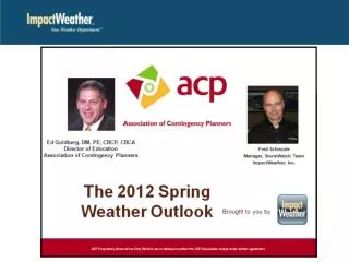
2012 Spring Weather Outlook May Update. Fred Schmude StormWatch Manager ImpactWeather, Inc. fschmude@impactweather.com

E N D
2012 Spring Weather Outlook May Update Fred SchmudeStormWatch ManagerImpactWeather, Inc. fschmude@impactweather.com Fred specializes in hurricane forecasting, severe thunderstorms, winter weather monitoring and forecasting and long-range monthly and seasonal forecasting. He holds a BS in Geology from Texas Tech and a BS in Meteorology from Texas A&M. Fred joined ImpactWeather’s parent company as a meteorologist in 1990.
ImpactWeather helps our clients worldwide operate safely, effectively and efficiently in all weather conditions.
2012 Spring Weather Outlook May Update Fred SchmudeStormWatch ManagerImpactWeather, Inc. fschmude@impactweather.com Fred specializes in hurricane forecasting, severe thunderstorms, winter weather monitoring and forecasting and long-range monthly and seasonal forecasting. He holds a BS in Geology from Texas Tech and a BS in Meteorology from Texas A&M. Fred joined ImpactWeather’s parent company as a meteorologist in 1990.
Spring Weather Outlook for 2012 • Worldwide water temperature trends (including El Niño risks and effects) • Review of spring tornado and high wind reports • Review of the April temperature & precipitation pattern • May weekly and monthly forecast (find the most vulnerable severe risk areas) May, June and July projected flow pattern & T/P forecast (identify most vulnerable severe risk areas) • Summer outlook, including a brief tropical outlook • Soil moisture and drought outlooks for the spring • Tropics Sneak Preview
Colder Water PDO Cold Phase Small Negative IOD Warming Water Developing El Niño?
~+1.3C...Moderate El Niño El Niño La Niña Current (-0.1C)
El Niño La Niña
Effects of Warming Water in Eastern Tropical Pacific Upper air outflow enhance upper-level wind shear Warmer Water Enhances Thunderstorm Development
Forecast ENSO Trends • Initiation of EL Niño by early summer • Likely to peak out in the early part of 2013 • Likely to be moderate in intensity at about (+1.0 to +1.4C)
REVIEW Tornadoes, Temperature, Rainfall and Flow Pattern from January thru May 1, 2012
Average Trend 2005-2011 Current # Average
Projected Precipitation Outlook for Apr-Jun, 2012 Elevated Severe Risk Area Mean Storm Track BEST CHANCE
Projection ~1500 2011 2008
Current Projection
MUCH ABOVE NORMAL! +8 to +16F
ABOVE NORMAL! +3 to +6F
North America April Temperature Anomalies WARMER WARMER
WET WET DRY DRY WET WET DRY WET WET
WET WET WET DRIER DRIER WET WET DRIER DRIER WET
April Mean Flow Pattern Higher Pressure Higher Pressure Lower Pressure Lower Pressure Higher Pressure
Weather Trends for May 8th-14th, 2012 Near Normal Mostly Dry Mostly Dry Near Normal +2 to +4F Near Normal UNSETTLED -2 to -4F Mostly Dry +4 to +8F UNSETTLED HEAVY RAIN & FLOODING RISK Mostly Dry +3 to +6F -3 to -6F UNSETTLED STORMY Near Normal -1 to -3F
Weather Trends for May 15th-21st, 2012 Near Normal Mostly Dry Mostly Dry Warmer Than Normal Warmer Than Normal Cooler Than Normal UNSETTLED Warmer Than Normal Mostly Dry STORMY Warmer Than Normal Near Normal Cooler Than Normal
Projected Flow Pattern For May-July, 2012 L H L H H WARMER COOLER Mean Storm Track H L WARMER L Enhanced Severe Weather Risk
Projected Precipitation Outlook for May-Jul, 2012 Enhanced Severe Weather Risk
Monitor for Home Grown Storm Gulf/ W Car. Tropics “Sneak Peek” For 2012 • Risk will be lower than normal for a TC strike • However, some very memorable TCs have occurred during +ENSO events • Preliminary estimates call for 10-5-2 Higher Westerly Wind Shear Likely “Negative Factor” COOLER WATER “Another Negative Factor” El Niño
Moderate Drought (tan) Abnormally Dry (yellow) Severe Drought (red) Exceptional Drought (dark red)
WET SOIL DROUGHT DROUGHT DROUGHT
Worldwide weather forecasting and notification 24/7 • Seasonal outlook forecasting • Severe terrestrial weather monitoring and automated notification • Offshore/marine forecasting year-round • Customized weather websites • Direct consultation with a meteorologist • Business Continuity, Employee Resiliency and Response Plan Consulting Webinar Questions: fschmude@impactweather.com More information(877) 792-3220 sales@impactweather.com