Download
1 / 23
230 likes | 334 Views
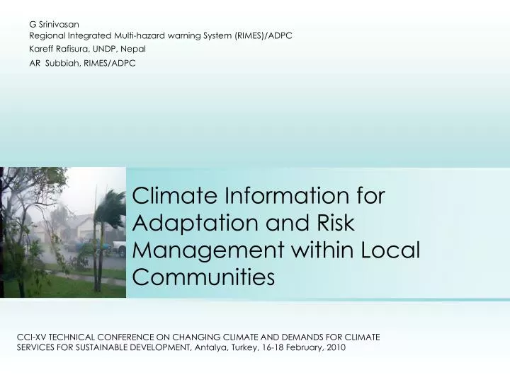
G Srinivasan Regional Integrated Multi-hazard warning System (RIMES)/ADPC Kareff Rafisura, UNDP, Nepal AR Subbiah, RIMES/ADPC. Climate Information for Adaptation and Risk Management within Local Communities.

E N D
G Srinivasan Regional Integrated Multi-hazard warning System (RIMES)/ADPC Kareff Rafisura, UNDP, Nepal AR Subbiah, RIMES/ADPC Climate Information for Adaptation and Risk Management within Local Communities CCl-XV TECHNICAL CONFERENCE ON CHANGING CLIMATE AND DEMANDS FOR CLIMATE SERVICES FOR SUSTAINABLE DEVELOPMENT, Antalya, Turkey, 16-18 February, 2010
Content • Adaptation and Management of climate risks • End-to-end Systems to connect to local communities • Assessment of user requirements – primacy of the user needs • Examples • Gaps
ClimateRisk manifestations – what are we worried about? i. Alteration of the mean state of climate ii. Increased frequency and intensity of extreme climate events iii. Combination of i. and ii. iv. Climate surprises (i.e. emergence of historically unexpected and sudden climate change-induced patterns)
Develop Capacities to Adapt to climate Change Develop Capacities to Better Manage Climate/Disaster Risks Develop Capacities to Manage Risks Associated with Climate Variability & Change TIME HORIZONS Current Climate Variability Future 2030s 2050s 2070s CLIMATE VARIABILITY Sectoral Impacts Vulnerabilities Future Impacts In the Context of CRM Future Vulnerabilities
Climate Information Services Assimilate the Best Knowledge Available Upgrade Operational Systems for Monitoring and Forecasting relevant/customized to local needs Create Appropriate Delivery Mechanism
Monitoring and Generation of Early Warning Met Service Monitoring Early Warning Systems Customization and dissemination protocols Customization and communication to sectoral agencies Sector agencies translate into disaster scenario How effectively forecasts are translated to disaster preparedness relevant information eg Flood Warnings Alert /warning messages issued to specific agencies in the field Involvement of grass root organizations in mobilization of community level response Provincial Governmental actions etc. Coordinated Community response to the alert or warning in terms of preparedness ConceptualSteps in the End-to-End System for Communities Overall vulnerability reduction through development interventions Poverty alleviation and sustainable development
Managing climate risks by connecting science, institutions, and society Global, Regional Model Products Regional Products Probabilistic location specific hydro-met & geo information Risk Thresholds Impact Outlooks Hazard Derivatives Risk Management tools RIMES/ADPC, Natl. DRR Agencies, Communities ECMWF, NCEP, CMA, UKMO
Climate Information Applications at Community Level The six‐step CFA methodology consists of: • Assessment of user needs and existing capacities of national institutions to meet these needs (need/capacity assessments) • Assessment of relevance of latest scientific information to meet these needs (assessment of available science/technology) • Developing partnerships and enhancing capacities of national institutions to generate climate information • Institutional development to communicate information to end users (institutionalization of end‐to‐end system: pilot demonstrations, replication) • Applying information to enable pro‐active decision making • Monitoring and evaluation of applicability of information
Climate Forecast Applications in Bangladesh (CFAB) • Evolved long lead forecast- up to 10 days forecast models in collaboration with Georgia Tech University, USA • Tested the models in 2004 • Operational on experimental basis since 2006 ADPC Project Support - USAID Partners - CARE, Bangladesh, Univ. of Colarado, Georgia Tech – Earth Atmospheric Sciences; BMD, Flood Forecasting and Warning Centre (FFWC) of Bangladesh Water Development Board (BWDB)
BrahmaputraDischarge Forecasts 20071-10 day flood forecasts using ECMWF precipitation forecasts
Institutional Collaboration For Sustainable End-to-end Generation and Application of Flood Forecasts
Institutionaland community responses on 2007 flood forecast Discussion of options with local communities, CBOs, local working group members, networks Incorporated into customized local model Communication to Disaster Emergency Group Flood forecast issued for two boundary locations Communication to project partners Information to relief agencies about the extent of flooding Communication to stakeholders and local DMC members 24 Jul 25 Jul 26 Jul 30 Jul 2 Aug 23 Jul 21 Jul 22 Jul Local institutions prepared response and relief plans Community in low lands reserved their food, drinking water, fodder requirements Local Disaster Management Committee and Volunteers prepared for rescue Relief distribution started in affected locations Aid agencies arranged logistics and begin dialogue with district administration Flood water exceeded danger level on 28th July Low lying areas are flooded on 29th July
Monsoon Forum objectives Ensure that forecast products, including their uncertainties and limitations, are understood by and communicated to users on a regular basis Provide a platform for inter-agency coordination of policies and programs for dealing with potential impacts of climate-related hazards on seasonal basis Encourage climate forecast applications for mitigating risks in various climate-sensitive sectors; Provide a platform for long-term process of understanding risks posed by/opportunities brought about by past, current, and future climate
Output • Preparedness plan for every season • Short and medium term recommendations on how to improve inter-agency coordination and collaboration towards greater uptake of climate information for various purposes (e.g. disaster risk reduction, planning, etc.) • Recommendations on how to better tailor climate information products to support decision making • Long-term policy recommendations on how to better manage climate risks and adapt to climate change
Provision of climate outlook BMKG (Met. Geophys. Agency) Translation of climate outlook into impact outlook Conversion of impact outlook into crop management strategies Indramayu Agriculture Office Dissemination of information to farmers and evaluation of farmers response Institutional mechanism: Indonesia example IPB (Bogor Agril. Univ.) Directorate of Plant Protection
Forumsfor climate information providers and Users • National: • Seasonal climate forum(national meteorological and hydrological service (NMHS), intermediate users - e.g. agriculture and water resources ministries) • Inter- (user) agency committees(NMHS, agriculture and water resources ministries, water regulatory board, dam operators, water concessionaires, hydropower agency) • Sub-national: Provincial working group(provincial meteorological and hydrological station, agriculture and irrigation departments, universities, local government units, NGOs) • Local: • Local climate forum(local meteorological and hydrological station, agriculture and irrigation departments, local government unit, local NGOs, farmers’ groups) • Field schools(provincial and local meteorological and hydrological station, agriculture extension, farmers)
Sample – typical example from farming sector Critical climate risks are as follows: • Wet season cropping (November/December‐March/April): Flooding in January/February is a major problem. The probability of flooding during this period is more than 50%. • Farmers at the tail‐end of the irrigation system receive water only in December, while planting has to start in November. Otherwise, the paddy will not be tall enough to survive flooding in February. • Dry season cropping (April/May‐August/September): Droughts in June to July is the major problem during this season. About 4,000 ha, or 60% of the total rice paddy area is vulnerable to drought. • Tools built around down-scaled seasonal predictions are very useful
Forecast Applications – Timor-Leste • Program focused on Maubara sub‐district in Liquica District, which is located on the north coast. • Climate Field Schools conducted
Climate Risk Management Project: Current variability and future change • Sparse networks and discontinuity in climate observations • Data rescue efforts required • Capacities for data analysis • Validation and careful interpretation of regional model results • User interfaces with sector agencies
Addressing Key Gaps Societal Risks GAPS 1 Forecast products Operational Forecast Institutions GAPS 2 Addressed through CFAB type technology Research output Flexible mechanisms and enabling mechanisms for customized solutions Building Institutional Partnerships & Capacities to evolve solutions Research Institutions, Universities