Download
1 / 14
140 likes | 275 Views
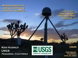
USGS Earthquake Hazards Program. Courtesy of JPL. Kenneth W. Hudnut U. S. Geological Survey Pasadena, California. USGS Coalition Meeting Washington, DC --- January 14, 2005. Statement of Problems. Must understand complex fault interactions to attain a system-level understanding

E N D
USGS Earthquake Hazards Program Courtesy of JPL Kenneth W. Hudnut U. S. Geological Survey Pasadena, California USGS Coalition Meeting Washington, DC --- January 14, 2005
Statement of Problems • Must understand complex fault interactions to attain a system-level understanding • Some questions: • How does the San Andreas fault interact with abutting and nearby structures? • How do these secondary and tertiary structures interact with the San Andreas (e.g., the Sierra Madre - Cucamonga fault along the north side of the metropolitan region)? • How is the Big Bend influencing the region? • How may ruptures propagate along these fault systems? • Fundamental goals: • Unique natural laboratory opportunity to capture large events and fault interaction • Hazards high due to proximity of faults to Los Angeles greater metro area • Devise large experiments & additional new instrumentation (and obtain funds)
San Andreas Fault • 35 mm/yr slip rate; • >70% of plate motion • 1685, 1812, 1857 eq’s • Big Bend compression • 1971 Sylmar (M 6.7) • 1994 Northridge (M 6.7) • SoCal is now heavily ‘wired’ - but need still more instruments • Catalog; SCEC CMM3 • ‘Natural laboratory’ • Likely source of most future ‘Big Ones’ • Southern SAF Interest Group
LA Contraction • Must integrate many types of information • Combine GPS with the deep fault geometry (from imaging and seismicity, etc.) and 3D structure • Employ novel modeling methods Complex Problem: Figure Courtesy of Don Argus, JPL new geodetic results for LA D. Argus, JPL
Summary for SoCal Eq. Program • We can understand the SoCal fault system in all of its complexity, it’s just not going to be easy • We must understand the fault interactions if we are to predict aspects of future behavior within the SoCal fault system • Much remains to be discovered about fault system dynamics
Sea floor deformation • Fault slip caused the sea floor to deform (4-5 meters up, and 10-11 meters to the west) • This pushed the water and formed the tsunami • Model by Dr. Chen Ji at Caltech, funded by USGS external research program
USGS large-scale data purchase - free for non-commercial uses
ftp://edcftp.cr.usgs.gov/pub/data/disaster http://gisdata.usgs.gov/website/Disaster_Response Inter-disciplinary work by USGS researchers in Geography and Geology divisions is allowing rapid evaluation of imagery data
BEFORE AFTER Courtesy of Space Imaging and USGS CRSSP
Tilly Smith, 10 years old, saved approx.100 people from the tsunami LONDON — A British schoolgirl who recognized the signs of a coming tsunami thanks to a recent geography lesson saved her family and some 100 other tourists at a Thai beach, a British newspaper reported.Tilly Smith, 10, realized they were in danger when she saw the tide suddenly rush out — an indication earthquake-driven tidal waves are only minutes away — and told her mother. She explained that she had studied tsunamis only two weeks before at her school in Oxshott, just south of London. Her parents, Penny and Colin Smith, warned nearby vacationers and staff at their hotel in Phuket, and the hotel swiftly evacuated Maikhao beach, minutes before the devastating waves struck.The beach was one of only a few in Phuket where no one was killed or seriously hurt. "I was on the beach and the water started to go funny," Tilly said. "There were bubbles and the tide went out all of a sudden. I recognized what was happening and had a feeling there was going to be a tsunami. I told mummy."
What can Before & After images tell us? • Derive damage assessment maps: • Indicate areas most severely affected by shaking & inundation • Provide rapid and comprehensive information needed in support of decisions on prioritization for resource deployment • Help with vital logistical aspects of relief efforts (e.g., Can ports be used for shipping? Are bridges knocked out? Where are survivors?) • Validate & verify rapidly estimated finite-fault slip models (e.g., predicted vs. observed coastal uplift & submergence) • provide important input data to refine fault source models • Tsunami inundation map data as input to tsunami propagation models • Flood data to assess saline infiltration and damage to irrigable lands and water supplies; is flooding permanent or transient? • Commercial and other imagery and analysis tools have reached a new level of utility with recent disaster responses • still require calibration, ground-truthing, validation, and algorithm & software development • promising for future rapid assessment & quantification
Summary for Earthquake & Tsunami Research • USGS Earthquake Program uses Global Seismic Network data to analyze for magnitude and location, and also slip on the fault in large earthquakes globally • Fault slip models allow sea floor displacement to be calculated rapidly, so that tsunami models are much more accurate in near real-time • Coordination with NOAA on new system presents a great challenge and opportunity that will improve future disaster mitigation
Contact Information Kenneth W. Hudnut, Ph.D. - Geophysicist Chief, Southern California Earthquake Hazards Assessment Project Geodetic Coordinator, USGS Earthquake Hazards Program Council Department of the Interior, United States Geological Survey 525 S. Wilson Ave., Pasadena, California 91106 (626)583-7232 hudnut@usgs.gov