Download
1 / 17
180 likes | 309 Views
Pathway Committee. 2009. Mission Statement. To develop a plan for an integrated network of pathways for recreational use within the Town of Norwell. Goal and Objective. Provide methods of access to community locations not dependent on automobiles.

E N D
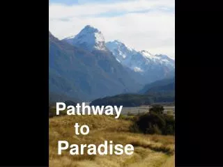
Pathway Committee 2009
Mission Statement • To develop a plan for an integrated network of pathways for recreational use within the Town of Norwell
Goal and Objective • Provide methods of access to community locations not dependent on automobiles. • Enhance access to public lands using existing pathways and develop new pathways (In conjunction w/Con Com)
Pathway Committee • Appointed Jointly by Board of Selectman and Planning Board – February 2008 • Residents at Large • Representatives from • Planning Board, Conservation Commission, Recreation Committee, and Water Commissioners • Town Planner Assistance
Norwell Today • Most Norwell roads developed from cart-paths are not suitable for safe Bicycle or Pedestrian Access • Safe Access to many community locations is dependent on Motor Vehicles
Pathway History - Resources • Norwell Bikeway Plan – 1996 • Open Space & Recreation Plans 2005–10 w/attachments • Master Plan with map attachments • Jacobs Pond Conservation Area Management PL • Conservation Commission Trail Maps • Updated Community Surveys • Connect Neighborhoods, Schools, Norwell Center, Playing Fields, …
Pathway Committee Process • Review Pathway/Bikeway/Sidewalk Plans • Survey needs, Meet with residents • Walk Existing Trails and Connection Points • Master Trail and Greenway Overview • Grant Reviews • 1996 Bikeway Development • Land Acquisition • Easement Creation • Approvals • Bicycle Rack Reviews
Priorities • Develop 1996 Bike/Pathway - Cole School to Middle School • Segments • Cole School to Route 53 and Hall, Washington Park Drives • Route 53 to Cliff Prentiss Bridge • Cliff Prentiss Bridge to Jacobs Farm House • Jacobs Farm House to High School Grounds • High School to Town Land off Cushing Hill Road • Cushing Hill Road to Middle School • Obstacles • Ownership, Easements, Wetlands Crossings, Approvals
Other Pathway Priorities • Middle School to Donovan Farms • Donovan Farm to Stetson Meadows • Middle School to Norwell Center • Norwell Center to Scituate • Main Street Sidewalk/Pathway • Jacobs Pond to Grove Street
Basic Pathway Development Approach • Define Connection Points/Routes • Evaluate Options • Safety, Environment, Community Support, Approvals • Establish Ownerships, Easements, Approvals • Select Segments for Actions • Clear Simple Trail for Walking • Design Improvements for Individual Segments • Details, Width, Surface, Signage (RFP) • Construct Specific Improvements (RFP) • Funding Dependent, Donations, Grants
Pathway Guidance Documents • Standard Easement Language • Pathway Use Guidelines • Pathway Design Standards • Construction Standards • Controlled Access Barriers Designs • Signage and Marking Standards • Maintenance Program • Community Support
Approvals / Interface Agencies • Planning Board • Board of Selectman • Community Preservation Committee • Conservation Commission • Historic New England - (Formerly SPNEA) • Historical Commission • Police & Fire Departments • Highway Department • School Department • Water Department
Reference Plans / Maps • 1996 Bikeway Plan • Master Plan W/attachments • Conservation Commission Trail Maps • Updated Bikeway/Pathway by segment • Obstacles • Easement Liability Limitation Law • Main Street (Route 123) Reconstruction Plans • Town Center to Scituate Town Line
Landowner Easement Liability LimitationMass General Law Chapter 21 • 17C Private landowner cannot be sued if the public is allowed to use its land free of charge • Any suit brought against that property owner for something like an injury would immediately be thrown out of courts.
This is Really Just the Beginning!~Norwell Pathway Committee 2009