Download
1 / 14
140 likes | 395 Views
Thematic Mapping for the Internet. Bruce Muller Geog 8670 20 February 2013. Overview. Background Review – Common Types of Thematic Maps Brief History (~last 5 years) of Thematic Mapping on the Web Current Methods & Web Page Demos. Background.

E N D
Thematic Mappingfor the Internet Bruce Muller Geog 8670 20 February 2013
Overview Background Review – Common Types of Thematic Maps Brief History (~last 5 years) of Thematic Mapping on the Web Current Methods & Web Page Demos
Background Originally started looking for ‘Thematic Mapping APIs’ as my topic, surprisingly little material current material Most web mapping has been general reference maps or satellite imagery (e.g. Google Maps) Rapidly changing environment…always a work in progress (e.g. Google Maps fusion tables)
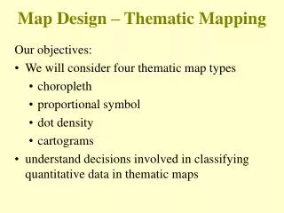
Thematic Maps • CHOROPLETH MAPS • Depicts qualitative or quantitative about a region • Uses an enumeration unit like a state or county for classification • Examples shown: 2012 Election Results by State or Median Income by State
Thematic Maps • PROPORTIONAL SYMBOLS • Uses graduated sizes of a particular symbol (point size or line width) to indicate relative values
Thematic Maps • ISARITHMIC / ISOPLETH MAPS • Contour Maps, lines are drawn to connect lines of equal value across a continuous domain • Examples are: Elevation/Topographic and Meteorological Maps
Thematic Maps • DOT DISTRIBUTION/DENSITY MAPS • Uses a concentration of points to indicate quantities of a particular feature in an area • Example: Density of Tabacco Farms (2002)
Thematic Maps • DASYRITHMIC MAPS • Use classification system similar to unclassedchoropleth maps, however contours are used to identify regions of common properties instead of quantifiable values • Examples: Soil types, plant hardiness zones, soil moisture regimes
Web Tools – Recent Attempts • ArcGIS is highly capable of making any of these maps, but is not conducive to production for the web • Thematicmapping.org • 2008-2009: Bjorn Sandvick created a javascript library for thematic mapping…the API / sample code is downloadable and allows you to make maps from your own data • Also created Thematic Mapping Engine (TME), creates .kmz files suitable for viewing in Google Earth
Web Tools – Recent Attempts • Thematicmapping.org (continued) • Note: Still in beta since 2009? Unsure what current efforts are to update/maintain this API but blog entries continue through late 2012 (blog.thematicmapping.org) • For example, he uses Quantum GIS, SQLLite Database Browser, and TileMill to create this population density map of New Zealand
Web Tools – Recent Attempts • Google Maps Flash API • Released in 2008, but deprecated in 2011, with instructions for developers to migrate to Google Maps JavaScript API v3 • Will be discontinued in 2014 due to decline of Flash • Cartographerjs • Thematic Mapping Library for Google Maps – last updated in 2010 • See examples of choropleth, pie chart and proportional symbols maps
The World of Google • Google Maps API • We are already familiar with this! (See examples on Earthquakes – proportional symbols and heatmaps – beyond basic map pins) • Google Fusion Table Mapping • Examples: Chicago Crime and Median Household Income • Google Gallery • Google Maps Engine “Scalable and secure mapping platform powered by the Google cloud” – fee for service (not free)
Other New Tools • TileMill: Open source project by MapBox • Software downloads available in Windows/Mac/Ubuntu • Creates interactive maps suitable to Webpages • Example: Poverty Change in America Map • Indiemapper: A free service of Axis Maps • Makes static thematic maps through a web based application—nothing to download except the finished product • Downloads in .png, .jpg or layered SVG • Geocommons: ESRI community site for sharing data and visualizations