Download
1 / 12
130 likes | 312 Views
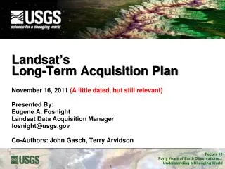
Landsat Long-Term Acquisition Plan. Jim Lacasse USGS Landsat Mission Management Officer January 9, 2007. Agenda. Background What is the LTAP? Why is there a need for an LTAP? How does the LTAP work? What are the results of having the LTAP?. Background.

E N D
Landsat Long-Term Acquisition Plan Jim Lacasse USGS Landsat Mission Management Officer January 9, 2007
Agenda • Background • What is the LTAP? • Why is there a need for an LTAP? • How does the LTAP work? • What are the results of having the LTAP?
Background • In the past, most Landsat efforts to define image acquisition approaches were ad hoc: • NASA: 1972-1978 • NOAA: 1979-1985 • EOSAT: 1985-2003 • USGS: 2003-present • Times where NASA Landsat program managers of large-area missions had significant impact in defining mission acquisitions • Innovation of an automated long-term acquistion plan originated in ad hoc Landsat science team discussions • Current LTAP implementation taken up by Landsat Project Science Office in 1995 to support Landsat 7 operations
Agenda • Background • What is the LTAP? • Why is there a need for an LTAP? • How does the LTAP work? • What are the results of having the LTAP?
What is the LTAP? The LTAP is a method to ensure a seasonally refreshed US-held archive, with substantially cloud-free observations for all land areas of the Earth . . . with maximum radiometric fidelity • Primary Tasks • Defines land by WRS • Defines Seasons (NDVI, Niches) • Attempts to avoid clouds (ISSCP, NCEP, ACCA) • Optimizes radiometry (gains and thresholds)
Agenda • Background • What is the LTAP? • Why is there a need for an LTAP? • How does the LTAP work? • What are the results of having the LTAP?
Why is there a need for an LTAP? • No Landsat to-date has collected data continuously while in orbit; if it did… • Large data volumes • Expensive • Value of additional data to users • Maximize science value • Consider system constraints and spacecraft management • All this is implemented through MOC scheduler
Agenda • Background • What is the LTAP? • Why is there a need for an LTAP? • How does the LTAP work? • What are the results of having the LTAP?
LTAP Scheduler Architecture Calibration acquisition requests Special acquisition requests Fig. 6 from the paper: Arvidson, T., Gasch, J., & Goward, S.N. (2001). Landsat 7's Long Term Acquisition Plan - an innovative approach to building a global archive, Special Issue on Landsat 7. Remote Sensing of Environment, 78, 13-26.
Agenda • Background • What is the LTAP? • Why is there a need for an LTAP? • How does the LTAP work? • What are the results of having the LTAP?
What are the results of having the LTAP? • Improved seasonality coverage • Good global cloud-free coverage obtained quarterly • Cloud Avoidance • Reduced cloud contamination in archived imagery • Radiometry • Multiple gain change approach • Changed solar zenith threshold to 75° from 85° • Recommended that future missions include requirements such that gain changes will be unnecessary
LTAP Enhancements • Implemented • Reduced desert and winter acquisitions • Focused Boreal and tropical forest acquisitions • Converted niches to campaigns • Potential • Continuous Variable Seasonality (NDVI) • Better use of LTAP decision making capability • Include Land Mask for ACCA Assessment • Low-Gain-Only Operations • Gain changes are more of a problem than a solution Reference for Presentation: PE&RS Landsat Special Edition, October 2006, Volume 72, Number 10