Download
1 / 32
340 likes | 531 Views
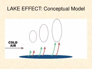
VIC Model Status Blowing Snow and Lake Algorithms. Princeton Meeting December 4, 2006. Blowing Snow. Günter Eisenhardt 3.31.2002, Iceland. Snow accumulation. SWE > 0?. Blowing snow sublimation. Snow mass and energy balance. Yes. No.

E N D
VIC Model StatusBlowing Snow and Lake Algorithms Princeton Meeting December 4, 2006
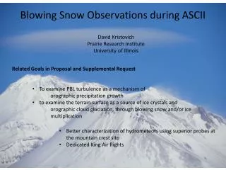
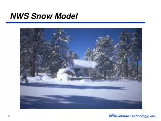
Blowing Snow Günter Eisenhardt 3.31.2002, Iceland
Snow accumulation SWE > 0? Blowing snow sublimation Snow mass and energy balance Yes No Predictive model of the sublimation from blowing snow • Derived from existing small-scale blowing snow models (Pomeroy et al. 1993 and Liston and Sturm 1998). • Mass concentration of suspended transport based on power law relationship (Kind 1992). • Particle sublimation rate proportional to the undersaturation of water vapor. = VIC snow model
Distribution of terrain slopes Trail Valley Creek, NWT Imnavait Creek, Alaska
transport = 0 transport = Qt(x= f) average fetch, f Non-equilibrium Transport snow
Simulated annual sublimation from blowing snowSensitivity to fetch
Soil node temperatures solved via heat diffusion equation (Cherkauer and Lettenmaier 1999) • Constant flux or constant temperature options • Imposed temperature distribution at each node allows spatial variation of infiltration capacity and active layer depth across the grid cell (Cherkauer et al. 2001)
On-going work at UW • Confirmed functionality of constant flux solution • Revise distribution of soil thermal nodes to improve stability • Introduce ground ice parameterization
Lakes and wetlands Source: San Diego State University Global Change Research Group
Predicting the effects of lakes and wetlands • Lake energy balance based on: • Hostetler and Bartlein (1990) • Hostetler (1991) • Lake ice cover (Patterson and Hamblein) • Assumptions: • One “effective” lake for each grid cell; • Laterally-averaged temperatures.
Mean daily values, June-August 2000 Lake surface energy balance Mean diurnal values, June-August 2000 ‘Lake 1’, Arctic Coastal Plain, Alaska
Mean temperature profile (1993-1997)Toolik Lake, Alaska ObservedSimulated
soil saturated land surface runoff & baseflow enters lake evaporation depletes soil moisture lake recharges soil moisture Wetland Algorithm
History • Original model - documented (briefly) in Cherkauer et al. (2003) • Subsequent revisions (incorporated into VIC 4.1.0 r3 and documented in Bowling et al. manuscript): • Lakes can disappear/reappear • Lake profile description and thermal solution nodes separated • Lake runoff rate more physically described
Water Table Previously VIC did not calculate the water table depth Average depth to water table calculated for each vegetation type Summation of depth of saturated layers and depth of excess soil moisture for unsaturated layer
Wetland fraction (const) Upland fraction (variable) Lake fraction (variable) lake h
Wetland fraction (const) Upland fraction (variable) Lake fraction (variable) lake h
Observations show rain pulse penetrating to water table quickly Issue of moisture transfer to depth? or Lateral inflow from flooded ditch? VIC Simulations Observations VIC top layer moisture VIC 2nd layer moisture VIC water table
Lateral Exchange Previously the lake could not recharge the local groundwater Equilibrium soil moisture is calculated to determine flow direction Baseflow can go either into or out of the lake in a given time step Baseflow out of lake is at maximum rate
Equilibrium Soil Moisture Soil Moisture State lake lake h
Lake Extent • Previously, maximum water extent fixed by inputs • elevation curve supplied for this wetland fraction only • emerging land had static characteristics • never worked with snow bands • Wetland now considered a subset of each vegetation type • Same elevation curve applies to all vegetation classes? • Lake area can be calculated separately for each veg class, or collapsed back to one effective lake • Could be a nightmare to calibrate
Three scenarios defined: Variable extent/defined maximum, e.g. as defined by Bowling et al. (2002) Constant extent, as used by Su et al. (2005) Variable extent/unlimited growth Maximum depth adjusted such that scenarios 1 and 2 have equal volume Lake extent scenarios Fractional Depth Grid Cell Fractional Area
Scenario 1 Scenario 2 Scenario 3 Change in open water extent
Sub-Lake Energy Exchange • Previously, heat fluxes in the soil below the lake were not resolved • Normal VIC implementation for exposed wetland soil (these are values output) • Appropriate soil heat flux algorithm called for sub-lake soil • Assumes that soil layers are preserved under the lake • When lake reaches a threshold depth, energy balance must be solved for combined water/soil layer for stability
What else? • Photosynthesis – based ET scheme? • Groundwater parameterization • Permafrost runoff scheme