Download
1 / 20
250 likes | 495 Views
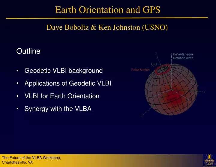
Earth Orientation and GPS. Dave Boboltz & Ken Johnston (USNO). Outline Geodetic VLBI background Applications of Geodetic VLBI VLBI for Earth Orientation Synergy with the VLBA. VLBI Part of a Global Geodetic Observing System. Integrated Earth observing system Space Geodetic Techniques

E N D
Earth Orientation and GPS Dave Boboltz & Ken Johnston (USNO) Outline • Geodetic VLBI background • Applications of Geodetic VLBI • VLBI for Earth Orientation • Synergy with the VLBA
VLBI Part of a Global Geodetic Observing System • Integrated Earth observing system • Space Geodetic Techniques • VLBI, GPS, LLR, SLR, DORIS • Global network of ground stations • Dedicated space missions • Gravity Field, Altimetry, SAR, InSAR, Magnetic Field
Geodetic VLBI and the IVS • Geodetic VLBI is coordinated through the International VLBI Service for Geodesy and Astrometry (IVS). • http://ivscc.gsfc.nasa.gov/
Geodetic VLBI Data Path • Observations • 24-hr sessions 2+ times per week • 1-hr “intensive” sessions daily • Data transmission • Mark5 modules shipped • Electronic transmission (e-VLBI) • Correlation • Mark 4 geodetic VLBI correlators • DiFX software correlators • Post-processing • Calibration, Fringe-fitting • Experiment analysis
Applications: Celestial Reference Frame • ICRF: quasi-inertial reference frame defined by VLBI estimates of the coordinates of 295 extragalactic radio sources • Realization of International Celestial Reference System (ICRS) • ICRF2 Adopted by the IAU January 1, 2010 • The ICRF enables narrow-angle astrometry and precise spacecraft navigation 295 ICRF2 Defining Sources
Applications: Terrestrial Reference Frame • ITRF: reference frame defined by estimates of the coordinates and velocities of a network of stations (VLBI, GPS, LLR, SLR, DORIS) on the surface of the Earth • Enables a wide range of geophysical science • Structure and deformations of Earth’s crust, mantel & core • Sea level change, earthquakes
Applications: Earth Orientation Nutation Polar Motion Rotation Rate (UT1-UTC) • Earth Orientation Parameters (EOP) describe the orientation of the space axes of the Earth and provide the transformation between the CRF and the TRF • Include: • Polar Motion (X-pole, Y-pole) • Nutation (longitude Dy, obliquity De) • Rotation rate (UT1-UTC) • Enable a variety of applications • Transportation, geo-location, communications, navigation
Earth Orientation at USNO • Analyzed VLBI results are distributed through the IVS • VLBI results combined with results from other techniques (i.e. GPS, SLR, LLR, DORIS) • Combined data then used to predict EOP into the future • Combination predictions are distributed through the IERS Rapid Service/Prediction Center for EOP at USNO • IERS Bulletin A (finals.daily) • EOP results fed back to GPS • Update GPS satellite orbit predictions • Accurate EOP predictions critical to various Govt. Agencies • Future support for GPS III
Combination of Space Geodetic Techniques • VLBI is only technique to uniquely determine • The Celestial Reference Frame (ICRF) • UT1 (Earth rotation angle relative to origin of ICRS)
How Can UT1 Predictions be Improved? • Reducing data latency from 2.25 days to 6 hours results in: • Factor of 5 reduction in UT1-UTC prediction uncertainty • 40% reduction UT1-UTC prediction errors 7 days out • Answer:e-VLBI
Current e-VLBI Measurements of UT1 • Daily 1-hr Intensive experiments coordinated through the IVS • Int1 series Kokee Park, HI – Wettzell, Germany (Mon. – Fri.) • Int2 series Tsukuba, Japan – Wettzell, Germany (Sat., Sun.) • Data transferred via e-VLBI to reduce latency • Correlated in Washington, Japan, or Bonn
Synergy with the VLBA • USNO requirement to provide EOP to various Govt. Agencies • Want US-controlled assets • Plan for Continuity of Operations (COOP) • USNO and NASA-GSFC already collaborating with NRAO to maintain and improve the ICRF • RDV experiments important part of ICRF2 • High-frequency (K/Q-band) reference frame observations • Could the VLBA provide a complimentary series of Intensive measurements for UT1?
UT1 Testing With the VLBA • With in conjunction with NRAO, USNO began a series of “Pseudo-intensive” experimentsto measure UT1 • TC015 • 5 stations (HN, LA, MK, PT, SC) • 13 experiments • Optimized for MK-SC baseline • TB014 • 3 stations (MK, LA, PT) • 5 experiments • Optimized for MK-PT baseline
Results from Pseudo-Intensive Experiments • Shown are differences between VLBA UT1 measurements and IERS C04 combination solution as a function of baseline length • Longer baselines more tightly distributed • At the altitude of GPS constellation: 5ms ~ 1 cm • Despite shorter baselines, VLBA measurements meet present and future requirements for UT1
So Why Choose MK-PT Baseline? • Mauna Kea • provides long east-west baseline necessary for UT1 • Infrastructure mostly there except for last mile • Redundancy with Kokee Park geodetic VLBI station • Pie Town • All fiber infrastructure already in place • Cost sharing for some legs • Proximity to NRAO-AOC
USNO-NSF-NRAO MOU • USNO to make a significant contribution to VLBA operating costs beginning in 2012 • In return USNO will receive: • Access to MK - PT baseline for ~1.5 hr/day • Single VLBA intensive experiment 7 days/week • Back-up antenna (without e-VLBI) if needed • Data to be streamed back to USNO via high-speed links • Continued VLBA participation in the RDV experiments • Six 24-hr experiments per year • Vital to the CRF and TRF
Current Status of the VLBA Intensive Program • Contracts in place to connect the Pie Town and Mauna Kea VLBA stations to high-speed networks in 2011 • Contract with AUI/NRAO • 1 Gbps link from VLA to PT (Western NM Telecom) • Access to shared 1 Gbps connections from the VLA to UNM • Access to 10 Gbps NLR pop at UNM • Equipment for both MK and PT • Contract with Univ. of Hawaii • 1 Gbps link from the MKOCN to the VLBA site • Access to 10 Gbps Internet2 pop on Oahu back to mainland • Subcontracted to Hawaiian Telecom • Expect in-service: March 2011
Summary • Geodetic VLBI is part of an integrated Earth observing system • Applications of Geodetic VLBI include: CRF, TRF, EOP • Earth Orientation vital to U.S. interests • VLBI is the only space geodetic technique that can provide CRF and UT1 • VLBA is a useful asset for geodesy and increased interaction with the geodetic community (i.e. IVS, VLBI2010) is highly desirable • Geodetic VLBI is beneficial to astronomy: • Correlator model inputs (TRF and EOP) • Reference sources (CRF) for narrow-angle astrometry • Observing techniques (DELZN troposphere)