Download
1 / 29
290 likes | 436 Views
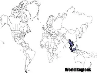
Major World Urban Regions. Worlds Largest Cities. Anglo America In the U.S Eastern constriction (older cities, hearth region) U.S western expansion (new, faster growing region) U.S urban problems: drug abuse, crime, inner cities

E N D
Worlds Largest Cities Anglo America • In the U.S Eastern constriction (older cities, hearth region) U.S western expansion (new, faster growing region) • U.S urban problems: drug abuse, crime, inner cities • In Canada cities are more compact with higher population and building densities (more space- saving and better mass transportation) • Canadian cities have higher densities of foreign born residents (i.e. Vancouver with large Asian population, Toronto and Montreal)
Western Europe Cities have been affected by: • Ancient Greeks/ Romans • Medieval Society • The renaissance • warfare • Communism (in Eastern Europe; “socialist” city) • European cities are central cities and slums are in the outskirts • Effects of colonialism on cities in Europe today?
The Soviet City • Bolshevik revolution of 1917 (nationalization of all resources) • More “equitable” land use • Central planning system The skyline of many cities became dominated by standardized apartment blocks
Cities in the Developing World • Most large Asian and African cities were developed by European colonist (i.e.: Calcutta, Mumbai, Havare, Dakar, Saigon, Jakarta, Shanghai) • Traditional south Asian cities are based on a bazaar • Latin America South America has the most rapid and large-scale urbanization process of any region in the world • 1900 < 10% urban • 1950 < approximately 25% urban • 2000 < approximately 75% urban
Fes, Morocco • The old city has narrow, winding streets and dense population
Latin American Model • Commercial/ industrial areas • Elite residential sector • Zone of maturity gradually improved, upgraded • Zone of accretion • Zone of peripheral • CBDs of Latin American cities are vibrant and specialized • Wealthy residents closest to CBD (near major boulevard) • Ongoing construction for the rural poor on the outskirts
Caracas, Venezuela • 90% urban dwellers • About 70% live in squatter settlements http://www.nytimes.com/2011/03/01/world/americas/01venezuela.html?pagewanted=all&_r=0
The City in Space and Time: Urban Systems and Urban Structures Introduction to the city • Urbanization in the last 200 years strengthen links between culture, society and the city • “urban explosion” has gone hand in hand with the industrial revolution • The world urban population more than doubled since 1950 • Urban population doubled again by 2000 • Over 50% of Earth’s population live in cities
Urban Hierarchy • World cities • Major Cities • Large Cities • Small Cities • Villages • “Layers within layers” in the urban system • A scale from regional to global
The First Cities Two elements were crucial to the social change that led to urbanization • 1. generation of agricultural surplus- prerequisite for supporting non-farming • 2. a stratified social system (upper and lower classes)
Urban Hierarchy • City: a multifunctional nucleated settlement with a central business district (CBD) and both residential and non residential land use • Town: a nucleated settlement that contains a CBD but that is smaller and less functionally complex than a city • Suburb: a subsidiary area of large urban complex • Central city: main urban boundaries • Urbanized Area: a continuously build up landscape • Metropolitan Area: a large scale, functional entity containing several urbanized areas
Positives • Economic activities • Proximity and Access to good and services • Government • Education • Healthcare • Safe and Shelter • Entertainment • Socializing
Negatives • Social and ethnic problems • Crime • Land use problems- loss of agricultural land • Congestion • Solid waste • Pollution; air, water, soil, land • Noise
Understanding the City as a System: Settlement Patterns and World Cities • Nucleated, Linear and Dispersed settlement Pattern • Nucleated settlements are town where buildings are close together, often clustered around a central point. Factors: defense, close to water or transportation route. • A linear patter (a settlement along a line) usually develops due to the growth of the town being geographically restricted dispersed settlement by mountains, hills, valleys or rivers. Linear settlements are also found along roads • Dispersed settlement are found in areas where a lot of land is required such as farming regions. Houses are far apart from one another and the hamlet and villages are small
Functional Structure of Cities • There are three basic functional structures of cities: • 1. Central Places: functioning primarily as service centers for local hinterlands • 2. Transportation Centers: performs break-of-bulk functions for larger regions • 3. Specialized- Function cities: dominated by one activity such as mining, manufacturing or recreation.
How urbanized is the world today? • Africa 38% • Asia 38% • Latin America 75% • North America 77% • Europe 75% • Oceania 70% • 1. the developing of Africa and Asia have a more rural population • 2. Regions that industrialized earlier have more medium-sized town (Europe) • 3. Most urbanized region Europe- Belgium, Netherlands, UK > 90% urbanized • Many rural residents commute daily to work in the city while their families enjoy rural life
World Cities World cities play a key role in organizing global space and the global economy- most are big but not all (i.e. Milan is a center of world fashion, Geneva has several key UN agencies) London, New York and Tokyo are considered the 3 key world cities. Most world cities have over 5 million in population Over half of the world’s 20 largest cities today are in the developing world
Central Place Theory • In 1930’s a German geographer, Walter Christaller develops a theory of central places. It states that there is a hierarchy of central places • From cities to town to villages to hamlets • Central places provides services retail, medical churches, gas stations, hairdressing • Big cities provide high level services (i.e.: universities; finance), while small hamlets provide low level services (i.e.: general store and gas stations) • A city may have 4 to 6 satellite towns, a town 4-6 satellite villages; a village 46 satellite hamlets • Range- the farthest a customer ill travel to buy a good • Threshold- the minimum number of customers needed to stay in business
Christallers Assumptions • 1. Transport costs are proportional to distance and there is only one type of transport • 2. population is evenly distributed over the plain • 3. central places (settlements) are located on he plain to provide goods, services and administrative functions to their hinterland • 4. consumers minimize the distance to be traveled • 5. assumes all consumer have the same income and the same demands for goods and services
The countryside has emptied- hamlets and villages are mostly gone • Industrial town are not central place and not organized in hierarchies • There is massive primacy and centrality in only a few huge agglomerations • The internet and new transportation
Urban Influence Zones • Influence zones refer to market areas • Examples of the way cities influence serve or impact their surroundings areas • Banking (how many branches in our area?) • Newspapers
Classic Urban Land Use Models Social areas of cities • Three key factors of residential segregation: • Income status • Family status • Ethnicity • Homogeneous unit principle • Originated by Ernest Burguess in the 1920s the concentric zone model depicts the use of urban land as a set of concentric rings with each ring devoted to a different land use (studied the city of Chicago)
Zone 1: central business district (CBD); where most of the tertiary jobs employment is located and where the urban transport infrastructure is converging making this zone most accessible • Zone 2: Adjacent to the CBD a zone of transition, where many industrial activities locate to take advantage of nearby labor and markets. Most transport terminals, namely port sites and rail yards, are located adjacent to the central area • Zone 3: the zone independent workers is used by expanding manufacturing/industrial activities contains the poorest segment of the urban population (inner cities and ethnic enclaves) • Zone4: zone of better residences is dominated by the working class and those who were able to move away from the previous zone (often second generation immigrants) near major employments area • Zone5: commuter suburbs
Concentric Zone Weaknesses • Too simple • Developed only for American cities • Developed when American cities were growing very fast • Motorized transportation uncommon • Reliance on public transportation • Highway have enabled urban development to take place directly in the suburbs • Lots of spatial differences in terms of ethnic, social and occupational patterns
A study of residential areas done in 1939 by Hoyt entitled “one hundred years of land values in Chicago” concluded that the land use pattern was not a random distribution nor, sharply defined rectangular area or concentric circles but rather sectors • Communication routes, such as rail lines and major roads • 1. central business district • 2. transportation and industry • 3. Low-class
Multiple Nuclei Model • The Harris and Ullman multiple nucleic model (1945) look at a city as being multi nucleated with a downtown center and satellite center on periphery