Download
1 / 21
210 likes | 332 Views
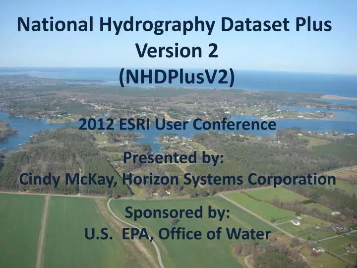
National Hydrography Dataset Plus Version 2 (NHDPlusV2). 2012 ESRI User Conference Presented by: Cindy McKay, Horizon Systems Corporation Sponsored by: U.S. EPA, Office of Water. NHDPlus Availability. NHDPlus Version 1 – 2006 Available from Archive 6/1/2012 NHDPlus Version 2 – 2012

E N D
National Hydrography Dataset Plus Version 2 (NHDPlusV2) 2012 ESRI User Conference Presented by: Cindy McKay, Horizon Systems Corporation Sponsored by: U.S. EPA, Office of Water
NHDPlus Availability • NHDPlus Version 1 – 2006 • Available from Archive 6/1/2012 • NHDPlus Version 2 – 2012 • Full Continental U.S. ETA – 8/31/2012
NHDPlus Access ftp://ftp.horizon-systems.com/NHDPlus/NHDPlusV21
NHDPlus Concepts: Integration of NHD, WBD, and NED National Hydrography Dataset (NHD) Watershed Boundary Dataset (WBD) National Elevation Dataset (NED)
NHDPlus Concepts: Integration of NHD, WBD, and NED WBD Boundaries “walled” Into Elevation NHD Streams and Waterbodies “burned” Into Elevation
NHDPlus Concepts: Link between the Landscape the Mapped Stream Network
NHDPlus Concepts: Link the Landscape to the Mapped Stream Network Catchment: Land Surface that Drains to Each Stream Segment
NHDPlus Concepts: Watershed Delineation From any Network Point
NHDPlus Concepts: Watershed Delineation From any Network Point
NHDPlus Concepts: Rapid Navigation of the Linear Surface Water Network Susquehanna River Drainage Basin Susquehanna River Main Stem
NHDPlus Concepts: Accumulated Characteristics using the Stream Network Cumulative Drainage Area Stream Flow
NHDPlusV2 – NED 2011-12 (ned.usgs.gov) • 30m • re-sampled from • 10m
NHDPlusV1 – WBD 2005 Only Eleven States
NHDPlusV2 – WBD 2011-12 (nrcs.usda.gov)
NHD: Data Improvements for NHDPlus V2 NHDPlusV2 • More names, corrected placement • More lakes • Lakes split by quad lines merged • Disconnected networks connected • Real sinks (non-contributing areas and networks that drain into the ground) identified • Duplicate geometry removed • Micro and small network gaps closed • Great Lakes drainage connected • Reachcodes migrated to the February 2012 WBD
Improved Process NHDPlusV2 • Build/Refresh Tools • Built-in QAQC • More Consistent Processing Across the U.S. • More Frequent Refreshes • Scalable to Higher Resolution NHDPlus • Inclusion of International Stream and Elevation Data • Improved Hydro-Enforcement • Enhanced Unit Run-off Flow Estimation
NHDPlusV2 Core Structure Elev_cm Fdr & Fac FdrNull PlusFlowlineVAA CatSeed FilledAreas Hydrodem CumulativeArea FeatureIDGridCode Cat DivFracMP Catchment MegaDiv NHDFlowline NHDWaterbody ElevSlope Sink PlusFlow Burn Components PlusARPointEvent PlusFlowAR WBD_Subwatershed
NHDPlusV2 Extended Structure EROMExtension Catchment & Cumulative Temp NHDFlowline Catchment & Cumulative Precip Catchment Runoff VOGELExtension
NHDPlusV2 Tools • Interactive Desktop Network Navigators • Batch Desktop Basin Delineator • Interactive Desktop Basin Delineator • Web Service Basin Delineator • Catchment Attribute Allocation and Accumulation • Network/Catchment/Attribute Generalization
NHDPlusV2 Access http://www.epa.gov/waters/ NHDPlus.com Google “NHDPlus” User Support: NHDPlus@hscnet.com Put yourself on the user email list. Questions? LDM@Horizon-Systems.com