Download
1 / 63
680 likes | 895 Views
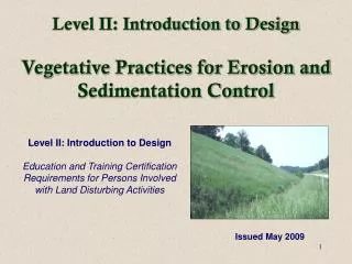
Erosion and sediment control: Handbook introduction. Clayton Gillies RPF, RPBio Senior Researcher Forest Road Engineering. One vision Global competitiveness. Handbook overview: beginning to end. Funding contribution. Background.

E N D
Erosion and sediment control: Handbook introduction Clayton Gillies RPF, RPBioSenior ResearcherForest Road Engineering One vision Global competitiveness
Background • Through an Advisory Committee process, members and partners identified erosion and sediment control as an area of high importance. • Initial cooperators and strong support originated in Alberta. • Soon took on a national focus.
Field days to gather input and determine needs • Weyerhaeuser Company Limited, Nordegg, AB • Millar Western Forest products Ltd, Whitecourt, AB • Canadian Forest Products Ltd., Grande Prairie, AB • Daishowa-Marubeni International Ltd., Peace River, AB • Alberta-Pacific Forest Industries Inc., Lac La Biche, AB • Tolko Industries Ltd., Lumby. B.C. • Field days provided an excellent opportunity for participants to interact • Participants represented the resource industries, Provincial government, and Federal government (DFO)
Steering committee (blue) & National reviewers • Juri Agapow, Diashowa-Marubeni International Ltd., AB • Roy Crawford, Alberta-Pacific Forest Industries Inc., AB • Tony Gaboury, Alberta-Pacific Forest Industries Inc., AB • Aaron Highmoor, Millar Western Forest Products Ltd., AB • Brian Martell, Canadian Forest Products Ltd., AB • Tom Plouffe, Millar Western Forest Products Ltd., AB • Don Sarin, Weyerhaeuser Company Limited, AB • Andre Savaria, Alberta Sustainable Resource Development, AB • Christopher Spytz, West Fraser Mills Ltd., AB • Robert Thomson, Diashowa-Marubeni International Ltd., AB • Kathryn Collet, Department of Natural Resources, NB • Mike Kelly, Stora Enso Port Hawkesbury Ltd, NS • Mark Partington, FPInnovations, Feric Division, QC • Gary Wearne, Domtar Pulp and Paper Products Inc., ON • Eric Young, Department of Natural Resources, NL
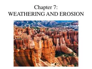
Introduction to the types of erosion • Wind erosion and mass wasting not covered
Know your soils • Coarse fragments:- are easily identified- not many erosion issues • Fine earth portion:- harder to identify- has higher erosion potential • § 1 - Introduction
Know your erosion hazard Table 5 shows: • By soil type • By slope Layout and field notes: • Terrain or field indicators - i.e. long continuous slopes vs. benches and breaks
Planning • Control vs. repair: it is less costly to plan ahead and identify techniques to control erosion than conduct repairs. • Communication: discus plans with regulatory agencies and the field crews early in the process. • Phasing: plan the various phases of construction to occur closely to reduce the erosion potential of exposed soil. • Erosion and sediment control plan: from basic to complex depending on size of activity and known hazards. • § 1 - Planning
Planning: phasing example • Initial surfacing applied soon after road built • Additional surfacing • Hydroseeding • § 1 - Planning
Planning: phasing example • Felled ROW still gives cover to soil • Felled and hauled ROW leaves soil exposed
Riparian areas • Last natural line of defense against sediment entering a watercourse • Protect water quality by maintaining stream bank and channel stability • Offer a filtering function for sediment-laden water arriving from upland areas • § 1 – Riparian areas
Riparian areas • Narrow width of ROW felling when approaching a stream • Establish buffers • Do not build roads adjacent to a stream • Older roads may need to be armored, upgraded or relocated
§ 2 - Preventing erosion: ground preparation & cover Key strategies for preventing erosion include: • Keep the amount of exposed soil to a minimum • Maintain existing ground cover • Cover exposed soils soon after exposure • Machine operating techniques should be considered • Keep surface rough as compared to smooth
Minimize exposed soil: by amount and time • § 2 - Preventing erosion: ground preparation and cover
Maintain existing vegetation • Bridge was constructed while maintaining riparian attributes below structure • Use of barriers or obstacles in the field can clearly mark disturbance limits • § 2 - Preventing erosion: ground preparation and cover
Provide cover for exposed soils: Live • § 2 - Preventing erosion: ground preparation and cover
Provide cover for exposed soils: Inert • § 2 - Preventing erosion: ground preparation and cover
Machine operating techniques • Machine tracking can result in 10% less erosion • § 2 - Preventing erosion: ground preparation and cover
Rough and irregular surface • § 2 - Preventing erosion: ground preparation and cover
§ 2: Containing and collecting sediment Time for suspended sediment to fall 1 cm in water • Slow the flow or movement • Increase roughness • Use of a flocculent Strategies to promote deposition: • § 2 – Containing and collecting sediment
Slowing flow or movement Silt fence Check structure • All will require maintenance and removal of deposited material • § 2 – Containing and collecting sediment
Sediment pond / basin • Will require periodic maintenance • Meandering flow path promotes longer detention time • § 2 – Containing and collecting sediment
§ 2: Diverting flows & seepage: upland water mgt. • Upland water can cause severe rills and gullies on exposed slopes. • Important to identify source areas and incorporate actions in an E&S control plan.
Ditch armouring • Permanent versus temporary armouring • Consider shape of ditch and vegetation establishment • § 3 – Ditches
Check structures • § 3 – Ditches
Check structure spacing • § 3 – Ditches
Ditch turnouts • Disperse ditch flow into the forest • Spacing will vary by terrain and hazard • § 3 – Ditches
Ditch bypass and double ditching • Neither are all that common • Very site specific • § 3 – Ditches
Cross ditch and cross-drain culvert • Not suitable for main haul roads. • Spacing correlated to slope, soil type, and terrain. • Locate to allow water to maintain natural flow path. • § 3 – Ditches
Road surfaces • Rolling grade • Waterbar • Open-top surface drains • Deflectors • Outslope, inslope and crowned • Roadside berms
Rolling grades • § 3 – Road surfaces
Waterbars • § 3 – Road surfaces
Deflectors and open-top surface drains • § 3 – Road surfaces
Outsloped, insloped and crowned surfaces • Shape of a road can promote positive water flow off the road. • Goal is to prevent water from accumulating, weakening or eroding a road. • § 3 – Road surfaces
Roadside berms • Can purposefully contain water to protect a resource. • Berm eventually breached away from fish-stream • Grader berms can pond water, weaken subgrade and should be avoided. • § 3 – Road surfaces
Cutslopes and fillslopes • Contain and direct water:by use of a slope drain, downdrain, or open-top flume • Terracing and increased roughness will promote deposition • Establish a cover:by seeding, mulching, use of fibrous mats, or bioengineering • § 3 – Cutslopes and fillslopes
Culverts • Armouring • Alternatives to aggregate armouring • Ditch considerations at stream crossings • Vertical alignment of road • Dewatering (during construction) • Stockpile management (during construction) • Protection against beaver damming