Download
1 / 30
300 likes | 429 Views
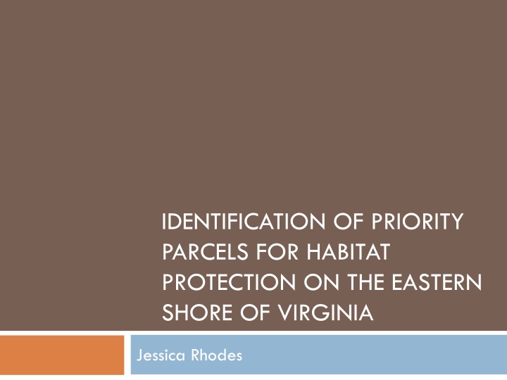
Identification of Priority Parcels for Habitat Protection on the Eastern Shore of Virginia. Jessica Rhodes. Outline. Importance of analysis Summary of existing conservation plans Goals and objectives Study area Methods Deliverables Timeline. Importance of Analysis.

E N D
Identification of Priority Parcels for Habitat Protection on the Eastern Shore of Virginia Jessica Rhodes
Outline • Importance of analysis • Summary of existing conservation plans • Goals and objectives • Study area • Methods • Deliverables • Timeline
Importance of Analysis • Eastern Shore of Virginia is a critical migration corridor • Numerous migratory bird species populations in decline • Numerous threats facing migratory birds • Recommendation made to acquire and protect land in a series of conservation corridors
Existing Plans • Identified focus areas based on broad taxonomic groups • Coarser scale than my study area • Focused on planning versus implementation
BCR 30 Implementation Plan • Designated focus areas for shorebirds, landbirds, and waterbirds within BCR 30 • Discussed waterfowl focus areas developed by NAWMP • Criterion includes: • Regional importance • Developed at landscape level • Discrete and continuous habitat • Size
North American Waterfowl Management Plan • Developed focus area for waterfowl only • Three tiered approach • Planning area • Focus area • Sub-focus areas • Used similar approach as BCR 30
U.S. Shorebird Conservation Plan • Eleven regional groups • Eastern Shore is within North Atlantic Planning Region • Identified goal to protect and manage sufficient areas of high priority habitats to support current populations of breeding, migrating, and wintering shorebirds • Areas in Virginia include: coastal marshes and mudflats, barrier islands, Craney Island, mainland coastal areas, and uplands on the Delmarva Peninsula
NAWCA Priority Areas for Waterbirds • Developed as an interim tool • Developed criteria for breeding colonial waterbirds • NAWMP and Shorebird Plan priority areas were selected for non-colonial waterbirds and wintering waterbirds • Eastern Shore is part of Atlantic Coast Region and Florida priority area
Goals • Identify and prioritize parcels for habitat protection based on importance to migratory birds • Develop an interactive web mapping application which will incorporate existing data layers with the prioritized parcels identified in my analysis
Analysis Objectives • Develop potential habitat distribution layer for each response guild • Identify non-protected parcels within the study area • Determine acres of currently protected lands for each guild and compare it to management goals • Calculate cost associated with habitat protection • Identify parcels vulnerable to sea level rise • Create a habitat protection prioritization strategy for non-protected parcels
Web Mapping Application Objectives • Create an interactive web map which will allow users to: • View the prioritized parcels alongside the existing data layers • Perform queries to display only the data of interest • Create printable maps • Export data layers • Compare currently protected habitat acres to acres identified in the analysis and determine if protection goals can be achieved
Study Area • 425,505 acres • Agricultural and aquacultural community • Historically hardwood dominated forest with interspersed marshes and wetlands • International Biosphere Reserve • Western Hemisphere Shorebird Network Site • Globally important migration corridor Insert study area map
Protected Lands on the Eastern Shore • 124,144 acres (29%) currently protected • 21,158 acres permanently protected with ecological disturbance events allowed • 26,209 acres permanently protected, ecological disturbance events suppressed • 71,151 acres protected but subject to extractive uses • 5,625 acres protected through easements
Ownership of Protected Lands • Three National Wildlife Refuges • Seaside barrier islands and seaside farms owned/managed by TNC • Four Wildlife Management Areas • One state park • Two natural areas • Barrier Island owned by Department of Conservation and Recreation
Methods - Guild Development • Develop a species list for response guilds based on habitat requirements during foraging and breeding • Use land cover types as a base • Whole guild approach vs. guild indicator species • Birds may be placed in multiple guilds • Sensitivity to habitat fragmentation • Based on Eastern Shore habitat, not range-wide • Bird list a subset of priority species
Methods - Analysis • Create a layer of all non-protected real estate parcels • Merge all existing focus areas into one data layer • Determine distance from non-protected parcels to other areas of suitable habitat which are protected • Identify areas of contiguous habitat • Determine minimum patch size for guild groups • Identify concentrated stopover areas
Methods - Analysis (ctd.) • Identify parcels vulnerable to sea level rise • Determine cost of habitat protection activities • Assign weights to input data layers to prioritize non-protected lands using a weighted overlay analysis • High • Medium • Low • Non-priority
Methods – Web Mapping Application • ArcGIS Online through USFWS account • Incorporate analysis data and input data layers • Basic web map features will be included • Additional features will include: • Creation of printable maps • Ability to export data • Ability to query data • Dashboard tool display
Deliverables • Map for each guild depicting priority parcels • Final report explaining the analysis • Web mapping application • Presentation at ESRI Mid-Atlantic user conference and Southern Tip Ecological Partnership meeting
Timeline • August • Gather existing data layers • Create any needed data layers • Finalize guild assignments • Conduct preliminary data analysis • September • Submit abstract • Preliminary design of web mapping application • Create weighting system for data input layers
Timeline (ctd.) • October • Complete analysis • Develop results section of final report • Finalize web mapping application design • November • Prepare final presentation • Publish web mapping application • December • Present at ESRI Mid-Atlantic User Conference (December 10-11) in Baltimore, MD • Submit final project report
Acknowledgements • Dr. Joseph A. Bishop- Penn State Advisor • Cindy Schulz, Project Leader – USFWS • Bridgett Costanzo, Supervisor – USFWS • Herb Bergquist, Region 5 GIS Coordinator - USFWS
References • Atlantic Coast Joint Venture (ACJV). 2005. Atlantic Coast Joint Venture waterfowl implementation plan revision. North American Waterfowl Management Plan. Hadley, Massachusetts. • Atlantic Coast Joint Venture (ACJV). 2008. New England/Mid-Atlantic Coast Bird Conservation Region (BCR 30) Implementation Plan. Laurel, Maryland. • Atlantic Coast Joint Venture (ACJV). 2009. Atlantic Coast Joint Venture strategic plan. North American Waterfowl Management Plan. Hadley, Massachusetts. • Brown, S., C. Hickey, B. Harrington, and R. Gill (ed.) 2001. The U.S. Shorebird Conservation Plan, 2nd ed. Manomet Center for Conservation Sciences, Manomet, Massachusetts. • Clark, K.E., and L. Niles. 2000. U.S. Shorebird Conservation Plan: Northern Atlantic Regional Shorebird Plan, Version 1, U.S. Fish and Wildlife Service, Woodbine, New Jersey. • Devenish, C., D.F. Diaz Fernandez, R.P. Clay, I. Davidson, and I. YepezZabala (ed.) 2009. Important bird areas - Americas priority sites for biodiversity conservation (BirdLife Conservation Series, No. 16). BirdLife International, Quito, Ecuador.
References • Fraser, J., J. Cohen, J. Berkson, E. Hallerman., and D. Hata. 2006. Factors limiting the migratory shorebird community in Delaware Bay and Coastal Virginia: Implications for the management of bird populations and the horseshoe crab fishery, 2004-present [Internet]. Blacksburg, Virginia [accessed July 21, 2013]. Available from: http://fishwild.vt.edu/faculty/karpanty/shorebirds.html. • Glick, P., A. Staudt, and B. Nunley. 2008. Sea-level rise and coastal habitats of the Chesapeake Bay: A summary. The National Wildlife Federation, Reston, Virginia. • Graaf, R.M, N.G. Tilghman, and S.H. Anderson. 2013. Foraging guilds of North American birds. Environmental Management 9(6): 493-536.0 • National Audubon Society. 2013. Global and continental important bird areas [Internet]. New York, New York [accessed May 24, 2013]. Available from: http://web4.audubon.org/bird/iba/prioritizedibas.htm . • North American Bird Conservation Initiative (NABCI), U.S. Committee. 2009. The State of the Birds, United States of America, 2009. U.S. Department of Interior: Washington, D.C. • North American Bird Conservation Initiative, U.S. Committee, 2009. The State of the Birds, United States of America, 2009. U.S. Department of Interior: Washington, DC. 36 pages.
References • O’Connell, T.J., L.E. Jackson, and R.P. Brooks. 2000. Bird guilds as indicators of ecological condition in the central Appalachians. Ecological Applications 10(6): 1706-1721. • Pashley, D.N., C.J. Beardmore, J.A. Fitzgerald, R.P. Ford, W.C. Hunter, M.S. Morrison, and Rosenberg, K.V. 2000. Partners in Flight: Conservation of the Land Birds of the United States. American Bird Conservancy, The Plains, Virginia. • Robbins, C.S., D.K. Dawson, and B.A. Dowell. 1989. Habitat area requirements of breeding forest birds of the Middle Atlantic States. Wildlife Monographs 103: 3-34 • U.S. Fish and Wildlife Service (Service). 2008. Birds of Conservation Concern 2008. United States Department of Interior, Fish and Wildlife Service, Division of Migratory Bird Management, Arlington, Virginia. • Verner, J. 1984. The guild concept applied to management of bird populations. Environmental Management 8 (1): 1-14. • Watts, B.D. 1999. Partners in Flight: Mid-Atlantic Coastal Plain bird conservation plan (Physiographic Region #44). Center for Conservation Biology, College of William and Mary, Williamsburg, Virginia.
Questions? Jessica Rhodes U.S. Fish and Wildlife Service 6669 Short Lane Gloucester, VA 23061 Jessica_Rhodes@fws.gov