Download
1 / 26
270 likes | 449 Views
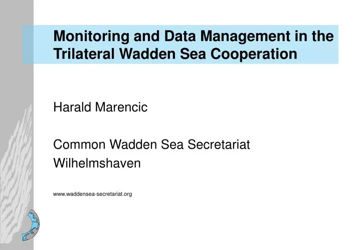
Monitoring and Data Management in the Trilateral Wadden Sea Cooperation. Harald Marencic Common Wadden Sea Secretariat Wilhelmshaven www.waddensea-secretariat.org. Denmark. Trilateral Wadden Sea Cooperation.

E N D
Monitoring and Data Management in the Trilateral Wadden Sea Cooperation Harald Marencic Common Wadden Sea Secretariat Wilhelmshaven www.waddensea-secretariat.org
Denmark Trilateral Wadden Sea Cooperation Since 1978, the Netherlands, Germany and Denmark have been cooperating to conserve and protect the Wadden Sea as a an ecological entity. Schleswig- Holstein Guiding principle “to achieve, as far as possible, a natural and sustainable ecosystem in which natural processes proceed in an undisturbed way”. Hamburg Lower Saxony Germany The Netherlands
Trilateral Cooperation Area Wadden Sea Area • Conservation Area • Nature Reserve (DK) • National Parks (FRG) • Niedersachsen • Hamburg • Schleswig-Holstein • PKB-Area (NL)
Trilateral Wadden Sea Cooperation Protection of the Wadden Sea as an ecological entity Wadden Sea Plan • Common Management Framework • Trilateral Targets • Common Policy • Trilateral Projects and Actions
Trilateral Wadden Sea Plan Targets: • Landscape and Culture • Water and Sediment • Salt Marshes • Tidal Area (tidal flats and subtidal gullies) • Beaches and Dunes • Estuaries • Offshore Zone • Birds • Marine Mammals Regulations on : • Agriculture • Fishery • Hunting • Dredging and dumping • Sand and clay extraction • Tourism • Shipping • Energy (wind, gas, oil) • others
Trilateral Monitoring Program Trilateral Monitoring and Assessment Program (TMAP) Aim of the TMAP • To provide a scientific assessment of the status of the ecosystem • To assess the status of implementation of the trilateral „Targets“ of the Wadden Sea Plan
Concomitant Research • Cause of changes • Specific hypotheses • Optimizing the monitoring • Data Handling • Compilation, long-term storage, re-use, exchange • Reporting • Quality Status Reports and „Target“ Assessments • Recommendations for Monitoring and Management • Policy Assessment • Trilateral Ministerial Conferences (every 3- 4 years) TMAP Structure • Monitoring • Observation of changes in pre-defined spatial-temporal scales.
TMAP Implementation • 1991 Cooperation in Research and Monitoring • (Ministerial Conference Esbjerg 1991) • 1993 TMAP Concept • 1994 Agreement to install the TMAP • (Ministerial Conference Leeuwarden 1994) • 1995 – 1997 TMAP Manual and Data Management System • (EU Life Project DEMOWAD) • 1997 Agreement to implement the TMAP „Common Package of TMAP Parameters“ • (Ministerial Conference Stade 1997)
„Common Package“ TMAP Parameter The Concept The Implementation: Deduction of parameters from 5 „Issues of Concern“ Setting Priorities • Criteria: • „Trilateral Targets“ • Availability (methods, existing programs), • Cost - Benefit Analysis • Climate Change • Input of substances (nutrients, pollutants) , • Fishery, • Tourism, • Agriculture
TMAP Parameter Common Package of TMAP Parameters Chemical Parameters • Nutrients • Metals in sediment • TBT in sediment • Contaminants in blue mussels, flounders and bird eggs Biological Parameters • Phytoplankton • Macroalgae • Eelgrass • Macrozoobenthos • Breeding birds • Migratory birds • Beached Bird Surveys • Common seals Human Use Parameters • Mussel/cockle/shrimp fishery • Recreational activities • Agricultural utilization • Coastal Protection measures General Parameters • Geomorphology • Flooding • Land use • Weather conditions Habitat Parameters • Blue mussel beds • Salt marshes • Beaches and Dunes
TMAP Chemical Parameter • Nutrients • Metals in sediment • TBT in sediment • Contamininats in blue mussels, flounders and bird eggs Nutrient concentrations (1985 – 1996, winter values) Decrecase of phospate No trend for nitrate (QSR 1999)
TMAP Chemical Parameter • Nutrients • Metals in sediment • TBT in sediment • Contamininats in blue mussels, flounders and bird eggs Contaminants in Bird Eggs (yearly, 13 stations, in TMAP since 1998), Common Tern, Oystercatcher, Hg, HCHs, DDTs, PCBs, HCB, Chlordan TMAP report in 2001
TMAP Habitat Parameter Blue Mussel Beds • Whole intertidal area • Yearly (spring – autumn) • Aerial photographs – ground truth • Mussel bed size, biomass, coverage • Trilateral harmonized GIS data
Pioneer salt marsh • Low salt marsh • High salt marsh • Green beach, sandy pioneer • Brackish marsh • Fresh (anthropogenic) grassland TMAP Habitat Parameter Salt Marshes • Whole area • 5 – 7 years • Aerial photographs – ground truth • Vegetation types, grazing, drainage • Trilateral harmonized GIS data
Macrozoobenthos communities • Species abundance, biomass, • 2 times per year, • Specific sites in each country Figure: Mean annual bivalve biomass at tidal flats (QSR 1999) TMAP Biological Parameter Phytoplankton • Number main species, chlorophyll (biomass), bloom events • Every week to 4 weeks (depends on season and location), • Existing sampling sites (status 1997), additional sites Macroalgae • Location, area, coverage, biomass, • Yearly / 4-6 surveys per year, • All intertidal flats, selected areas for ground truth Eelgrass • Location, area, coverage, biomass, • Yearly, • All intertidal flats, selected areas for ground truth
TMAP Biological Parameters • Breeding Birds: • Yearly Counts in selected Census Areas. • Yearly Counts in selected species (since 1990). • Complete Counts every five years (1991, 1996, 2001). • Migratory Birds: • a. Bird Counts in the whole area • Mid-winter counts in January (since 1980), • Synchronous counts in an additional month, • b. Synchronous counts of selected geese species during their maximum, • c. Spring-tide counts in selected areas. • Beached Bird Survey • Number of beached birds, oiled birds, • Yearly • Representative stretches (4-10 sub-regions per country)
TMAP Marine Mammals Common Seals • Whole area • Yearly • Aerial surveys • (3-5 flights in summer)
TMAP Data Management „TMAP Data Units“ • De-central • Identical database structureand integrated data catalogue • Data transfer via Internet • www.waddensea-secretariat.org • Data catalogue (public) • Data donwload (registered user)
TMAP Data Unit The User Interface • Interactive surface for data search • Downloading files compressed form • Import into user’s programs
TMAP Data Unit Three Tier Model • Client Level: Java applet • Application Server: JDBC • Database Server
TMAP Data Units Overview of data sets accessible via the TMAP data units (download in TMAP format via Internet) (status October 2004) * Chemical data compiled in TMAP format by CWSS for QSR. ** GIS data is compiled and harmonized by the CWSS and available for QSR update in TMAP format (to be transferred to data units)
TMAP Revision (§ 81 ED, 2001) Proposals for optimization of the TMAP based on the results of the QSR Update 2004 and with regard to international monitoring obligations, like EU Directives (Habitat, Birds, Water Framework) and OSPAR to the next Trilateral Governmental Conference in November 2005. Table 1 : Coverage of Wadden Sea Plan Targets and EU Directives Overall Aim: Coherent approach for the Wadden Sea Area
TMAP Revision Work Strategy 2004 – 2006 (adopted by TWG, November 2004) • Definition of common monitoring objectives for the entire Wadden Sea by combining the requirements of the TrilateralTargets and the EU Directives • TMAG / TWG, May 2005 • Development of a common program (parameters, methods, frequencies, stations) • Expert workshops, TMAG, June 2005 – June 2006 • Streamlining assessment and reporting • Long term tuning of reportinc activities (national, trilateral, international level by end of 2006 (by TMAG/TWG)
TMAP Cooperating Institutes Denmark: Skov- og Naturstyrelsen, Danmarks Miljøundersøgelser, Danmarks Fiskeriundersøgelser, Danmarks Miljøstyrelsen, Ribe Amt, Sønderjyllands Amt, Danmarks Hydrografisk Institut, Kystinspektoratet, Fiskeri-og Søfartsmuseet Esbjerg, Dansk Ornitologisk Forening. Germany: Bundesministerium für Umwelt, Naturschutz und Reaktorsicherheit, Umweltbundesamt, Bundesamt für Naturschutz, Bundesamt für Gewässerkunde, Bundesamt für Seeschifffahrt und Hydrographie, Wasser- und Schiffahrtsdirektion, Deutscher Wetterdienst, Bundesforschungsanstalt für Fischerei, Umweltprobenbank, Alfred-Wegener Institut für Polar- und Meeresforschung. Schleswig-Holstein: Landesamt für den Nationalpark Schleswig-Holsteinisches Wattenmeer, Landesamt für Natur- und Umweltschutz, Amt für ländliche Räume, Staatliches Umweltamt, Uni Kiel – FTZ Büsum, GKSS Geesthacht. Hamburg: Behörde für Umwelt und Gesundheit, Nationalparkamt, ARGE ELBE - Wassergütestelle Elbe Niedersachsen: Nationalparkverwaltung Niedersächsisches Wattenmeer, Bezirksregierung Weser-Ems, Niedersächsisches Landesamt für Ökologie, Forschungsstelle Küste, Niedersächsischer Landesbetrieb für Wasserhaushalt und Küstenschutz, ARGE Weser, Uni Oldenburg, Niedersächsisches Landesamt für Verbraucherschutz und Lebensmittelsicherheit, Staatliches Veterinäruntersuchungsamt f. Fische u. Fischwaren, Staatliches Amt für Fischerei, Institut für Vogelforschung. The Netherlands: Rijksinstituut voor Kust en Zee, Rijkswaterstaat Directie Noord, Rijkswaterstaat Meetkundige Dienst, Expertisecentrum LNV, Alterra, NIOZ, Rijksinistuut voor Visserij Onderzoek, Staatsbosbeheer, Koninklijk Nederlands Meteorologisch Instituut, Stuurgroep Waddenprovincies, Vogelbescherming Nederland, SOVON Vogelonderzoek Nederland, Rijksuniversiteit Groningen. NGOs: Verein Jordsand, Schutzstation Wattenmeer, Worldwide Fund for Nature, Waddenvereniging, other NGOs.
TMAP Future Work • Optimization and harmonization of running programs • Data management (data flow) and assessment tools • Tuning with EU requirements (Birds and Habitats Directive, Water Framework Directive) • Filling of monitoring gaps: • Offshore area and subtidal, • Fish populations, • Sediment processes, • Marine mammals: Harbour porpoise and Grey seal, • Bird monitoring: food availability, breeding success.
TMAP – Assessment Work • Quality Status Report (QSR) - Update 2004 • Update of major topics of the QSR 1999, • Data compilation and assessment by spring 2004, • Preparation of final draft by mid 2004, • Policy Assessment by end of 2004 in preparation of the Ministerial Conference in 2005.