Download
1 / 12
120 likes | 212 Views
Explore hydroclimatic linkages, precipitation and streamflow analyses, modeling activities, and regionalization in NAME region. Develop downscaled climate forecasts, enable seasonal hydrological predictions, and implement flood mapping and river forecasting systems. Utilize satellite-based precipitation estimates and soil moisture predictability methods.

E N D
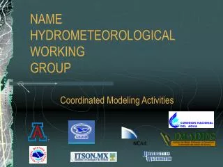
NAMEHYDROMETEOROLOGICALWORKINGGROUP Coordinated Modeling Activities
Hydroclimatic Linkages in NAME ( Shuttleworth, Gochis and Nijssen ) Precipitation Analyses Streamflow Analyses • Regionalization • Temporal disaggregation • Merged radar products • Statistically consistent • downscaled climate • forecasts ( and distributed • precipitation products) • Regionalization • Assess hydrologic • response to precipitation • characteristics • Physically-based • hydrological model • development Enable downscaled seasonal hydrological forecasts
Hydroclimatic Linkages in NAME ( Shuttleworth, Gochis and Nijssen )
Exploratory Work on Teleconnections between SST and Soil Moisture ( Lettenmaier, Cavazos and Zhu ) Sea surface temperature:Extended Reconstruction of Global Sea Surface Temperature data set based on COADS data. (1847-1997) developed by T.M. Smith and R.W. Reynolds, NCDC. The original data resolution is 2º longitude, 2 º latitude. It was interpolated into 0.5 ºresolution (The ocean domain is chosen according to the Bin Yu and J.M. Wallace’s paper, 2000, J. Climate, 13, 2794-2800) Soil Moisture:VIC retrospective land surface dataset (1950-1997). The original data with 1/8 degree resolution is aggregated into 0.5 º resolution.
Soil Moisture Predictability by Persistence and SST PCs The highest variance explained is more than 90%. For June, over 40% of the variance is explained over most of the study domain, including Mexico. ( Lettenmaier, Cavazos and Zhu )
SST and Persistence Persistence Soil Moisture Predictions: SST & Persistence vs. Persistence Only Introducing SST PCs benefits long-time lead predictability (of June soil moisture), but no significant benefits for less than 6-month lead time predictability. ( Lettenmaier, Cavazos and Zhu )
Hydrological Operations in NAME ( CNA, NWS ) Implementation of River Forecast Systems
Hydrological Operations in NAME ( CNA, NWS ) Flood Inundation Mapping
Satellite-Based Precipitation Estimation ( CNA, NWS ) • Satellite Precipitation Estimates Available From Two Sources and in Two Formats • Auto-Estimator (U.S.) • EpprepMex (Mexico) • Animated Hourly Precipitation Est. (Meteor.) • Gridded Precipitation Data (Hydrologists) • Technique Developed for Bias Correction for Mexico
Ongoing and EOP 2004 Activities ( various participants ) • Ingest and archive available streamflow data into the NAME data archive • Continue development of land-surface and hydrographic datasets • Perform additional service and download of the NAME event network during the field campaign • Project Office: Coordinate “non-standard”, gage-based precipitation analyses in core region