Download
1 / 15
1.09k likes | 2.72k Views
Types of Clouds. What’s the Weather?. Cirrus, Cirrocumulus and Cirrostratus (high 5000-16,000 m). thin and often wispy composed of ice crystals that originate from the freezing of supercooled water droplets.

E N D
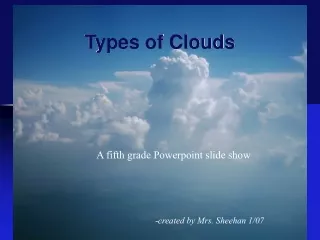
Types of Clouds What’s the Weather?
Cirrus, Cirrocumulus and Cirrostratus(high 5000-16,000 m) • thin and often wispy • composed of ice crystals that originate from the freezing of supercooled water droplets. • Generally occur in fair weather and point in the direction of air movement at their elevation.
Cirrus • They are made of ice crystals and have long, thin, wispy streamers. • Cirrus clouds are usually white and predict fair weather.
Cirrocumulus • They are small rounded puffs that usually appear in long rows. • Cirrocumulus are usually white, but sometimes appear gray. • Cirrocumulus are usually seen in the winter time and mean that there will be fair, but cold weather.
Cirrostratus • Sheetlike thin clouds that usually cover the entire sky. • Cirrostratus clouds usually come 12-24 hours before a rain or snow storm.
Altocumulus and Altostratus(middle 2,000 to 7, 000 m) • Middle clouds are made of ice crystals and water droplets. • The base of a middle cloud above the surface can be anywhere from 2000-8000m in the tropics to 2000-4000m in the polar regions. An
Altocumulus • They are grayish-white with one part of the cloud darker than the other. • Usually form in groups. • If you see altocumulus clouds on a warm sticky morning, then expect thunderstorms by late afternoon.
Altostratus • An altostratus cloud usually covers the whole sky. • The cloud looks gray or blue-gray. • Usually forms ahead of storms that have a lot of rain or snow. Sometimes, rain will fall from an altostratus cloud. • If the rain hits the ground, then the cloud is called a nimbostratus cloud.
Stratus, Nimbostratus and Stratocumulus(low surface to 2000 m) • Low clouds are made up of water droplets. The base of a low cloud is from the ground to 2000m.
Stratus • They are gray and can cover most or all of the sky (like a big blanket). • Stratus clouds sometimes produce light mist or drizzle.
Stratocumulus • Low, lumpy, and gray. • Only light precipitation, usually drizzle, occurs with stratocumulus clouds.
Nimbostratus • They are dark gray with a ragged base. • Produce rain or snow. • Sometimes they cover the whole sky and you can't see the edges of the cloud.
Clouds with Vertical DevelopmentCumulus and Cumulonimbus(surface to 13,000 m) • The clouds develop by warm air rising from the surface. Cumulus and Cumulonimbus clouds provide the most interesting and severe weather to our planet.
Cumulus • Puffy white or light gray clouds that look like floating cotton balls. • Cumulus clouds have sharp outlines and a flat base. • Seeing cumulus clouds in the sky can mean the weather will be good or bad.
Cumulonimbus • Known as thunderstorm clouds. • Can grow up to 10km high. • High winds make the top of the cloud flat. • Cumulonimbus clouds can produce heavy rain, hail, lightning, and tornadoes.