Download
1 / 22
220 likes | 325 Views
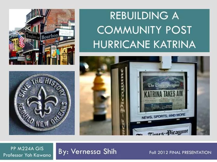
Rebuilding a community Post hurricane Katrina. By: Vernessa Shih Fall 2012 FINAL PRESENTATION. PP M224A GIS Professor Yoh Kawano. What happened? What were rebuilding goals? What were parish priorities? What areas saw the most success in rebuilding ?

E N D
Rebuilding a community Post hurricane Katrina By: Vernessa Shih Fall 2012 FINAL PRESENTATION PP M224A GIS Professor YohKawano
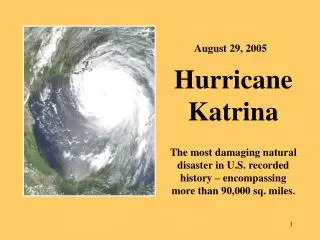
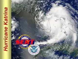
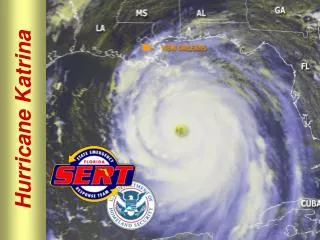
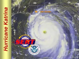
What happened? • What were rebuilding goals? • What were parish priorities? • What areas saw the most success in rebuilding? • What areas need the most attention now? Hurricane Katrina Aug 23,2005 – Aug 31, 2005
Hurricane Katrina Route –Through Plaquemines, St. Bernard & St. Tammany Parish
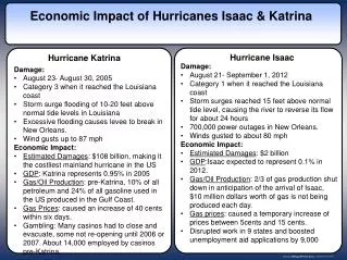
Let’s get factual . . . • 217,000 Homes Damaged • 1.4 million people displaced, 15 million people affected • estimated 75-110 billion dollar cost • (referred to as the costliest natural disaster in history) • extreme coastal erosion • Over 1,800 deaths
WHAT IS MOST IMPORTANT TO YOU? (PICK THREE) Build better levees and other hurricane protection (58%) Encourage development of new housing (34%) Restore coastal areas (27%) Improve schools (26%) Attracting new businesses to the area (26%) Making reconstruction jobs available to residents (25%) Providing better community/social service (21%) Making street/highway improvements (13%) Reducing crime (13%) Devising a workable evacuation plan (13%)
Jefferson Parish Build better levees and other hurricane protection Restore coastal areas Attract new businesses to the area Improve the school *107,000 damaged homes Orleans Parish Build better levees and other hurricane protection Encourage development of new housing Improve schools Make reconstruction jobs more available *largest number of displaced residents *90% evacuated Plaquemines Parish Build better levees and other hurricane protection Restore coastal areas Attract new businesses to the area Improve schools *over 50% buildings destroyed St. Tammany Parish Build better levees and other hurricane protection Restore coastal areas Attract new businesses to the area Make highway and street improvements *38,900 damage claims St. Bernard Parish Build better levees and other hurricane protection Restore coastal areas Buy out flood-prone properties Encourage development of new housing *29,000 destroyed homes
Highlighting areas within and outside of a 5 mile service area to FEMA evacuation routes
* Many FEMA applicants not included in this data were living in temporary FEMA trailers
Hospitals and Schools in Louisiana and the 5 Parish Study Area
*Highlighting areas of high African American population Indicators for Improvement: Calculating the decrease in students dropouts for 7-12th graders, comparing 2000 to 2010(from schools statistics tracked by Louisiana Department of Education
Living below Poverty Line # of Vacant Housing Units Map Algebra to create a Priority NEED Index for Louisiana # of Unemployed Workers High School Dropout Rates
Hurricane Katrina completely changed the way our country reacts to disasters
Caveats and Addendums • Clearly it would have been beneficial to have access to additional data regarding the Hurricane, but when Katrina hit and then Rita, gathering data is most likely not at all a priority • Regardless of missing attributes, this is still an important area of study • Groundbreaking in terms of being able to see new applications of GIS for other disasters, using Google Earth/Twitter/Social Networking to track disasters, Hurricane Sandy Shapefiles are already available • Problems: • Many clearinghouses, databases, including FEMA have been closedor have severely limited access only allowed to organizations associated with rebuilding or giving grants • Disaster data is by nature very unreliable, due to the constant changes in population, displaced citizens addresses etc
Sources ESRI/Social Explorer NASA CENSUS.gov/American Fact Finder National Oceanic and Atmospheric Administration FEMA GOOGLE EARTH US Geological Survey Greater New Orleans Community Data Center Regional Planning Commission for New Orleans City of New Orleans Mysealevel.org Regional Planning Commission for Great Metro New Orleans LSU AGU Center LSU Atlas Database SimplyMap Louisiana Dept of Education Crisis Commons Louisiana Site Selection.Com Louisiana Map.Com State of Louisiana.gov
Skills Used • Point/line graduated symbol • Geoprocessing – Clipping • Geoprocessing – Joining • Geocoding KMZ/KML files • Custom Shape files • Original Data (built new shapefiles from addresses) • Aggregating attribute fields • Boundary sub-sets selections • Images • Model Building/Rasters • Pie Charts • HotSpot Analysis • Buffering/concentric buffers • Creating Need Index • Distance Analysis • Spatial Analysis
Model Builder – Feature to Raster *Reclassified individual rastersusing ToolBox