Download
1 / 15
150 likes | 272 Views
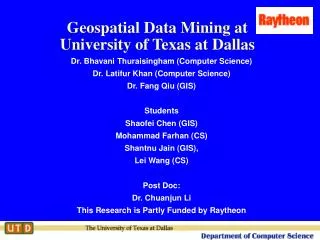
Geospatial Information Management Research at the University of Texas at Dallas. Dr. Bhavani Thuraisingham (Computer Science) Dr. Latifur Khan (Computer Science) Dr. Fang Qiu (Geography) The University of Texas at Dallas April 24, 2006. Outline.

E N D
Geospatial Information Management Research at the University of Texas at Dallas Dr. Bhavani Thuraisingham (Computer Science) Dr. Latifur Khan (Computer Science) Dr. Fang Qiu (Geography) The University of Texas at Dallas April 24, 2006
Outline • Introduction to the Research (CS Perspective) • Bhavani Thuraisingham • Geospatial Data Mining • Latifur Khan • Geospatial data research in the Department of Geosciences • Fang Qiu • Working toward producing a UTD-wide presentation involving CS, Geosciences, Geology departments in 3 schools (Engineering, Social Sciences, Natural Sciences)
Introduction to the Research • Vision for Assured Information Sharing • Our ultimate goal involving structured, semi structured and unstructured data • Vision for Geospatial Data Management • Geospatial Data Mining: Early Research • Approaches to Geospatial Data Integration • Geospatial Semantic Web • Geospatial Data Security • Education (CS) • Technical Accomplishments (CS) • Future Plans
Vision 1: Assured Information Sharing Data/Policy for Coalition Publish Publish Data/Policy Data/Policy Publish Data/Policy Component Component Data/Policy for Data/Policy for Agency A Agency C • Friendly partners • Semi-honest partners • Untrustworthy partners Component Data/Policy for Agency B
Vision 2: Geospatial Data Management * Semantic Metadata Extraction * Decision Centric Fusion * Geospatial data interoperability through web services * Geospatial data mining * Geospatial semantic web Data Source A Tools for Analysts Data Source B SECURITY/ QUALITY Data Source C
Vision 3: Surveillance and Privacy Raw video surveillance data Face Detection and Face Derecognizing system Suspicious people found Faces of trusted people derecognized to preserve privacy Suspicious events found Comprehensive security report listing suspicious events and people detected Suspicious Event Detection System Manual Inspection of video data Report of security personnel
Early Research in Geospatial Data Mining:Change Detection • Trained Neural Network to predict “new” pixel from “old” pixel • Neural Networks good for multidimensional continuous data • Multiple nets gives range of “expected values” • Identified pixels where actual value substantially outside range of expected values • Anomaly if three or more bands (of seven) out of range • Identified groups of anomalous pixels
Geospatial Data Integration - I • On-site chemical spill management teams face a number of challenges • Multiple sources of data at a variety of security levels • Overlapping areas of authority • Time-critical objectives • We have recently completed a project to integrate UTD’s E-Plan system with CH2M Hill’s iCIT solution • Knowledge aggregator that connects E-Plan’s secure chemical reference web interface with iCIT’s collaboration environment • Information is only made available to authorized individuals
Framework for Geospatial Data Security (Joint with UCDavis and Purdue U.)
Semantic Web: GRDF • The strength of RDF lies in the ease of composition with which RDF based formalisms can be integrated with other similar languages. • On the Semantic Web, the goal is to minimize human intervention and to make way for machines to perform rule based automated reasoning. • We are developing GRDF for geospatial data representation • Why not use GML?
GRDF Feature Topology Temporal & Dynamic Elements CRS Coverage Spatial Non-Spatial Geometry GRDF Model Geographic phenomena involve change. For example, Flood water rise and recede Electoral boundaries are defined and reshaped Vehicles move around Canals built or filled up
Education in CS Department • Some Relevant Courses • Database management • Data Mining • Visualization • Multimedia Information Management • Geospatial data management • Data and Applications Security • Future Courses • Geospatial semantic web • Geospatial data mining • Geospatial data security • Joint Graduate Program in GIS • CS, Geosciences, Geography • Oracle Center for Excellence in Geospatial Data
Technical and Professional Accomplishments • Publications of research in top journals and conferences, books • IEEE Transactions on Knowledge and Data Engineering, IEEE Transaction on Software Engineering, IEEE Computer, IEEE Transactions on Systems, Man and Cybernetics, IEEE Transactions on Parallel and Distributed Systems, VLDB Journal, 7 books published and 2 books in preparation including one on UTD research (Data Mining Applications, Awad, Khan and Thuraisingham) • Member of Editorial Boards/Editor in Chief • Journal of Computer Security, ACM Transactions on Information and Systems Security, IEEE Transactions on Dependable and Secure Computing, IEEE Transactions on Knowledge Engineering, Computer Standards and Interfaces - - - • Advisory Boards / Memberships • Purdue University CS Department, - - - • Awards and Fellowships • IEEE Fellow, AAAS Fellow, BCS Fellow, IEEE Technical Achievement Award, IEEE Senior Member, - - -
Some Plans • Raytheon funded research on Geospatial semantic web and Geospatial data mining • Research on Geospatial Data Security - submitted to NSF • Representation based on GML • Algebraic Geometry based techniques for geospatial data mining- to be submitted to NGA under NURI • UTD funded research on developing GRDF (Geospatial Resource Description Framework) • Geospatial Data Surveillance based on UTD funded research on Video Surveillance • Integrate research into current project funded by AFOSR on Assured Information Sharing and second project on Data Provenance • Work with OGC, Oracle and Raytheon to accomplish the goals in the agenda (April 24, 2006 meeting)