Download
1 / 22
220 likes | 400 Views
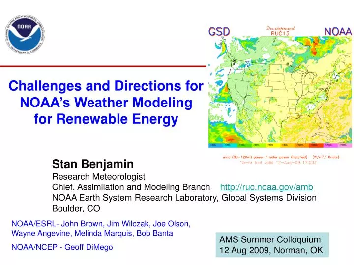
Challenges and Directions for NOAA’s Weather Modeling for Renewable Energy. Stan Benjamin Research Meteorologist Chief, Assimilation and Modeling Branch http://ruc.noaa.gov/amb NOAA Earth System Research Laboratory, Global Systems Division Boulder, CO.

E N D
Challenges and Directions for NOAA’s Weather Modeling for Renewable Energy Stan Benjamin Research Meteorologist Chief, Assimilation and Modeling Branch http://ruc.noaa.gov/amb NOAA Earth System Research Laboratory, Global Systems Division Boulder, CO NOAA/ESRL- John Brown, Jim Wilczak, Joe Olson, Wayne Angevine, Melinda Marquis, Bob Banta NOAA/NCEP - Geoff DiMego AMS Summer Colloquium 12 Aug 2009, Norman, OK
NOAA plans for improving renewable energy forecasts • More accurate weather forecasts (esp. wind and solar) will allow more accurate forecasts of transmission and storage needs, carbon-based power, “load”, “ramps”, etc. • Costly inaccuracy exists currently in forecasts of all scales (1h to 15 days) for energy. • What’s needed: • Better models, especially in treatment of 10-200m winds, clouds, addition of chemistry/aerosols, including hourly updating models (RUC, RR, HRRR) • Better global models for 1h-15d+ forecasts (and climate). • Better observations above surface to initialize models - winds, moisture, temperature, clouds. • Higher-resolution models, ensemble forecasts/uncertainty • Much improved data assimilation - model initialization • Interaction between NOAA, DOE, NREL, other govt, energy industry, other private sectors • Common users: Energy, aviation, severe weather, fire wx, AQ, hydrology
Hourly Updated NOAA NWP Models 13km Rapid Refresh domain • RUC – current oper model - 13km • Rapid Refresh (RR) – replace RUC at NCEP in 2010 - WRF, GSI w/ RUC-based enhancements • HRRR - Hi-Res Rapid Refresh • Experimental 3km • 12-h fcst updated every hour Current RUC CONUS domain 2009 3km HRRR domain
Hourly Updated NOAA NWP Models Experimental 13km Rapid Refresh domain • 13km RUC • 13km Rapid Refresh • 3km Hi-Res Rapid Refresh (HRRR) • Storm-resolving • (3-km) model init from radar-enhanced RUC or RR • For aviation, severe weather, energy, fire weather, emergency situations, etc. Current RUC-13 CONUS domain Exp 3km HRRR domain – Feb2010
Initial Playbook at 1100 UTC Playbook: revised at 1300 UTC National Airspace Planning in Presence of Convective Weather 13Z CCFP Forecast Fcst valid : 15 – 21 UTC : 02 Aug 08 Air traffic management analogy to regional/national power management - both need accurate hourly updated accurate, weather information
GSI 3dvar GSI 3dvar Obs Obs Rapid Refresh Hourly Assimilation Cycle Cycle hydrometeor, soil temp/moisture/snow plus atmosphere state variables Hourly obs Data Type ~Number Rawinsonde (12h) 150 NOAA profilers 35 VAD winds 120-140 PBL – prof/RASS ~25 Aircraft (V,temp) 3500-10000 TAMDAR (V,T,RH) 200-3000 Surface/METAR 2000-2500 Buoy/ship 200-400 GOES cloud winds 4000-8000 GOES cloud-top pres 10 km res GPS precip water ~300 Mesonet (temp, dpt) ~8000 Mesonet (wind) ~4000 METAR-cloud-vis-wx ~1800 AMSU-A/B/GOES radiances Radar reflectivity/ lightning 1km 1-hr fcst 1-hr fcst 1-hr fcst Background Fields Analysis Fields Time (UTC) 11 12 13
00z+6h HRRR No radar 00z+6h HRRR RUC radar NSSL verification Effective radar refl assimilation (via 13-km RUC) critical HRRR 3-km forecast 06z 16 Aug 2007
18-h fcst 18-h fcst 18-h fcst 18-h fcst 18-h fcst 18-h fcst 3DVAR 3DVAR 3DVAR 3DVAR 3DVAR Obs Obs Obs Obs Obs RUC Hourly Assimilation Cycle - fall 2009 Background Fields Analysis Fields Time (UTC) 11 12 13 14 15 16
Obs impact for 3-12h forecasts for near-sfc winds - • “Relative short-range forecast impact from aircraft, profiler, • radiosonde, VAD, GPS-PW, METAR and mesonet obs • within hourly assimilation in the RUC” • Benj et al., 2010, • Mon. Wea. Rev., accepted for publication
Sat, METAR, radar Example: 11 Aug 09 http://Ruc.noaa.gov RUC fcst – 80-120m wind power potential RUC anx - cld RUC fcst - cld RUC fcst – Solar rad
RUC 3h forecast of 1000’ ceiling (IFR flight conditions)-probability of detection – verification against METAR observations over US every 3 h 2004 2005 2006 2007 2008 2009 Improvements in GOES-cloud and METAR assimilation in Nov 2008 and March 2009 have led to major improvement in NCEP RUC cloud forecasts
Two main points on improved weather models for RE: • 1. Atmospheric forecasts from weather models for bothwind energy and solar energy are outputs from the same model. • Improved model and assimilation for better cloud/sun forecasts also improve near-surface wind forecasts, and conversely, • Improve for better near-surface wind forecasts will increase accuracy for forecasts of clouds, precipitation, and even winds above the PBL. • Consistent forecasts for both wind energy and solar energy generation potential are from the same physical atmospheric system. • 2. Equally complicated problems: Development of a. Weather model and b. Data assimilation (to initialize model) Both are important for 1h to 15-day forecasts
Two main points on improved weather models for RE • 1. Atmospheric forecasts from weather models for bothwind energy and solar energy are outputs from the same model. • Improved model and assimilation for better cloud/sun forecasts also improve near-surface wind forecasts, and conversely, • Improve for better near-surface wind forecasts will increase accuracy for forecasts of clouds, precipitation, and even winds above the PBL. • Consistent forecasts for both wind energy and solar energy generation potential are from the same physical atmospheric system. • 2. Equally complicated problems: Development of a. Weather model and b. Data assimilation (to initialize model) Both are important for 1h to 15-day forecasts
PBL research – NOAA Winds and TKE - WRF Aircraft Observations of TKE (m2 s-2) MYJ PBL MYNN PBL Upcoming PBL tests verifying w/ Industry tall tower 60m data Olson, Brown, Angevine – NOAA-ESRL
Forecast NOAA’s NWS Model Production Suite Oceans HYCOM WaveWatch III Climate CFS Coupled Hurricane GFDL HWRF MOM3 ~2B Obs/Day Mostly Satellite +Radar Dispersion ARL’s HYSPLIT North American Mesoscale WRF NMM Global Forecast System Global Data Assimilation Severe Weather WRF NMM WRF ARW Short-Range Ensemble Forecast North American Ensemble Forecast System WRF: NMM+ARW ETA, RSM Air Quality GFS, Canadian Global Model NAM+CMAQ Rapid Update for Aviation, Severe Weather, Energy NOAH Land Surface Model
Very Short-Range Ensemble Forecasts - VSREF - Updated hourly w/ available members valid at same time • RR – hourly • time-lagged (TL) ensemble members • 2010 - 3km CONUS HRRR at ESRL • (incl. TL ensemble) • 2012 - ensemble RR – 6 members • 2012 - proposed HRRR at NCEP • future HRRR ensemble from RR-ens • NAM / NAM ensemble • GFS / GFS ensemble • SREF (updated every 6h) VSREF – Hourly Updated Probabilistic Forecasts = TL+ ensemble VSREF members VSREF to include subhourly - merged RCPF/extrap - similar for icing, turb, etc. The vision for high-frequency weather models in NextGen
VISION: Toward estimating and reducing forecast uncertainty for aviation applications using high-frequency data assimilation VSREF mems output - stat corrected VSREF mems output for each AIV variable For turb For turb HRRR VSREF-Model Ensemble Members - hourly (1h) updated Unified Post-processing Algorithms (modularized!!) for following: (multiple where appropriate), built on current WRFpost from NCEP Stat correction post- processing using recent obs + blending Stat correction post- processing using recent obs Turb (e.g., GTG) Icing (e.g., FIP) Ceiling Visibility Convection ATM route options Wake vortex Terminal forecast Object diagnosis (line convection, clusters, embedded) Others… VSREF members - HRRR, RR, NAM, SREF, GFS, etc. Optimal weighting Explicit met variables from each VSREF member - V,T,qv,q* (hydrometeors),p/z, land-surface, chem, etc. Most-likely-estimate singlevalue Potentially multiple variables under each Avx-Impact-Var (AIV) area SAS Probability/PDF output 4D-datacube
Subset of full domain • NOAA/ESRL FIM global model • 10km, 15km - horizontal resolution • (highest yet resolution real-time global model runs in NOAA) • New global model design • icosahedral soccer-ball-like grid • isentropic-sigma vertical coordinate • 3-5km global model now in design - FIM extension - “NIM” • 10km FIM global model runs out to 7 days daily • NSF Texas supercomputer since Aug 2008 • - NOAA experimental Hurricane Forecast Improvement Project (HFIP) • http://fim.noaa.gov NOAA is increasing effort to improve global model skill vs. ECMWF
Actual wind energy potential - strong regional and temporal variations Outstanding RUC 1h fcst 80-120m wind energy Valid 23z Wed 12 Nov 08
Wind energy - V3 - 80-120m wind / Solar energy (shaded) 6h RUC forecast - initialized 16z Wed 12 Aug 2009 http://ruc.noaa.gov/pig.cgi?13km_D2 13km development RUC
NOAA plans for improving renewable energy forecasts • More accurate weather forecasts (esp. wind and solar) will allow more accurate forecasts of transmission and storage needs, carbon-based power, “load”, “ramps”, etc. • Costly inaccuracy exists currently in forecasts of all scales (1h to 15 days) for energy. • What’s needed: • Better models, especially in treatment of 10-200m winds, clouds, addition of chemistry/aerosols, including hourly updating models (RUC, RR, HRRR) • Better global models for 1h-15d+ forecasts (and climate). • Better observations above surface to initialize models - winds, moisture, temperature, clouds. • Higher-resolution models, ensemble forecasts/uncertainty • Much improved data assimilation - model initialization • Interaction between NOAA, DOE, NREL, other govt, energy industry, other private sectors • Common users: Energy, aviation, severe weather, fire wx, AQ, hydrology