Download
1 / 45
500 likes | 779 Views
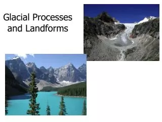
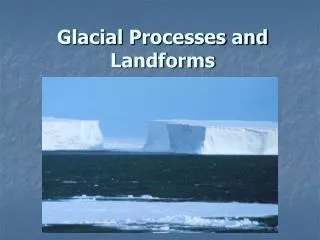
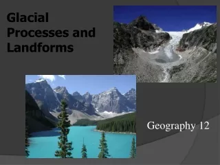
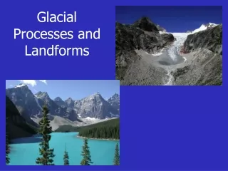
Glacial Landforms and the Ice Age. Glaciers Alpine Glaciers Ice Sheets of the Present Sea Ice and Icebergs The Ice Age Landforms Made by Ice Sheets Investigating the Ice Age in the PNW. Glaciers. when snow accumulates to a great thickness, it can turn into flowing glacial ice

E N D
Glacial Landforms and the Ice Age • Glaciers • Alpine Glaciers • Ice Sheets of the Present • Sea Ice and Icebergs • The Ice Age • Landforms Made by Ice Sheets • Investigating the Ice Age in the PNW
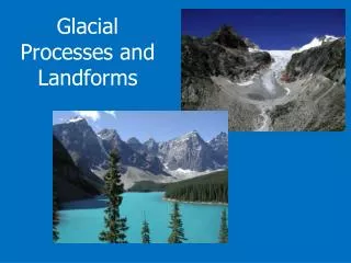
Glaciers when snow accumulates to a great thickness, it can turn into flowing glacial ice alpine glaciers form in high mountains, while ice sheets form on continental interiors at high latitudes Alpine glaciers can flow into ice sheets and add to overall ice flow
Glaciers glacial ice accumulates when the average snowfall of the winter exceeds the amount of snow that is lost in summer by ablation the term ablationmeans the loss of snow and ice by evaporation and melting when winter snowfall exceeds summer ablation, a layer of snow is added each year to what has already accumulated as the snow compacts by surface melting and refreezing, it turns into a granular ice and is then compressed by overlying layers into hard crystalline ice when the ice mass is so thick that the lower layers become plastic, outward (ice sheet) or downhill (alpine glacier) flow starts, and the ice mass is now an active glacier
Glacial Ice Formation • Recent snow exposed to freezing and thawing, plus metamorphosis • Granular ice neve’ forms • Neve’ buried, pressure of snow and ice above changes it to firn • Under pressure firn changes to into glacial ice http://en.wikipedia.org/wiki/Image:Glacial_ice_formation_LMB.png
Alpine Glaciers snow collects at the upper end in a bowl-shaped depression, the cirque the upper end lies in a zone of accumulation layers of snow in the process of compaction and recrystallization are called firn the smooth firn field is slightly bowl-shaped in profile flowage in the glacial ice beneath the firn carries the ice down-valley out of the cirque Strahler and Strahler, Figure 19.3, p. 632
Alpine Glaciers motion of glacial ice moves most rapidly on the glacier’s surface at its midline - movement is slowest near the bed, where the ice contacts bedrock or sediment Strahler and Strahler Figure 19.4, p. 633
(a) Alpine Glaciers landforms produced by alpine glaciers (a) before glaciation sets in, the region has smoothly rounded divides and narrow, V-shaped stream valleys (b) after glaciation has been in progress for thousands of years, new erosional forms are developed (c) with the disappearance of the ice, a system of glacial troughs (U-shaped valleys) is exposed (b) (c) Strahler and Strahler Figure 19.5, p. 634
Alpine Glaciers (a) during glaciation, the U-shaped trough is filled by ice to the level of the small tributaries (b) after glaciation, the trough floor may be occupied by a stream and lakes (c) if the main stream is heavily loaded, it may fill the trough with alluvium (d) should the glacial trough have been deepened below sea level, it will be occupied by a fiord (a) (b) (c) (d) Strahler and Strahler Figure 19.7, p. 635
Ice Sheets of the Present the Greenland Ice Sheet has an area of 1.7 million km2 (about 670,000 mi2) and occupies about seven-eights of the entire island of Greenland Strahler and Strahler Figure 19.9, p. 638
http://upload.wikimedia.org/wikipedia/commons/4/4f/Greenland_ice-sheet_hg.jpghttp://upload.wikimedia.org/wikipedia/commons/4/4f/Greenland_ice-sheet_hg.jpg
Ice Sheets of the Present the Antarctic Ice Sheet covers 13 million km2 (about 5 million mi2) Strahler and Strahler Figure 19.10, p. 639
http://upload.wikimedia.org/wikipedia/commons/f/f2/Antarctic_profile_hg.pnghttp://upload.wikimedia.org/wikipedia/commons/f/f2/Antarctic_profile_hg.png
Sea Ice and Ice Bergs two types - sea ice and icebergs sea ice is formed by direct freezing of ocean water (< 5m thick) - pack iceis sea ice that completely covers the sea surface icebergs are bodies of land ice that have broken free from glaciers that terminate in the ocean (may be hundreds of meters thick) Strahler and Strahler Figure 19.11, p. 639
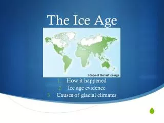
The Ice Age an ice age includes cycles of glaciation, deglaciation, and interglaciation at present, we are within an interglaciation of the Late- Cenozoic Ice Age, following a deglaciation that set in quite rapidly about 15,000 years ago in the preceding glaciation, called the Wisconsin Glaciation, ice sheets covered much of North America and Europe, as well as parts of northern Asia and southern South America the maximum ice advance of the Wisconsin Glaciation was reached about 18,000 years ago
The Ice Age the maximum extent to which North America and Europe were covered during the last advance of the ice Strahler and Strahler Figure 19.13, p. 641 Strahler and Strahler Figure 19.14, p. 641
Why Ice Age Cycles? • Positive and Negative Feedback • Atmospheric Composition • Milankovitch Cycles • Tectonic Plate Movement • Supervolcanoes
Positive Feedback • Positive Feedback • Albedo • Fewer forests (>Albedo) • Ice-free Arctic Ocean? • Ice no evap. or sublimation drier earth less snow in other areas • Open more evap more precip more snow higher albedo
Negative Feedback • Glacial erosion reduces land surface area • Lower sea level reduces reflective area (< albedo) • Glaciers tie up moisture, less precipitation for snow accumulation
Atmospheric Composition • Carbon dioxide, methane, sulfur, sulfur dioxide and particulates affect greenhouse effect • Variations over time in concentrations affect amount of heat as radiation retained from earth • Greater retention warmer • Less retention colder • Snowball earth
Snowball Earth • 850 – 630 mya • Cryogenian period • Equatorial Continent distribution high weathering of rocks • Absorbs CO2 and earth cools • Not a generally accepted Theory (or theory) http://en.wikipedia.org/wiki/Image:SnowballSimulations.jpg
Milankovitch Cycles • Variation in Earth’s Orbit • Sometimes cycle reinforce variation, other times negate • Cycles don’t match up well to times of ice ages
Milankovitch Variables Eccentricity Precession (wobble) Axial Tilt (Obliquity)
Variation in Solar Output • Solar output varies with time • Astronomers believe output increases 10%/billion years • Shorter term variations would affect glaciation/ice ages • Sunspots and sunspot cycles
Continental Movement • Location and distribution of continents affects sea and atmospheric circulation • Heat transfer on earth is affected or controlled by sea and atmospheric circulation • Mountain building, orographic effect also affects precipitation patterns and related atmospheric effects
Volcanoes • Additional particulates might initiate global cooling • However, unlikely particulates would stay suspended long enough to initiate on their own • Undersea volcanoes could release enough methane and methane clathrates (methane molecules trapped in sedimentary rocks/molecules)
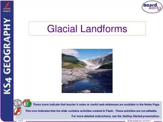
Landforms Made by Ice Sheets ice sheets are highly effective eroding agents the slowly moving ice scraped and ground away much solid bedrock, leaving behind smoothly rounded rock masses these bear countless abrasions trending in the general direction of ice movement Strahler and Strahler Figure 19.15, p. 642
Landforms Made by Ice Sheets the term glacial drift describes all types of rock debris deposited in close association with glaciers stratified drift includes sediment laid by water, while till is deposited directly by ice Strahler and Strahler Figure 19.17, p. 643
Landforms Made by Ice Sheets moraines are built of rock debris deposited at the edges of a melting glacier or ice sheet terminal moraines mark the limits of glaciation Strahler and Strahler Figure 19.17, p. 643
Landforms Made by Ice Sheets an outwash plain is formed of stratified drift left by braided streams issuing from the ice the plain is built of layer upon layer of sands and gravels Strahler and Strahler Figure 19.17, p. 643
Landforms Made by Ice Sheets after the ice has gone, the position of a former ice tunnel is marked by a long, sinuous ridge of sediment known as an esker (stream-bed deposit remains, forming a ridge) Strahler and Strahler Figure 19.17, p. 643
Landforms Made by Ice Sheets a drumlin is a smoothly rounded, oval hill resembling the bowl of an inverted teaspoon (consists of till) - lie in a zone behind the terminal moraine (commonly occur in groups) Strahler and Strahler Figure 19.17, p. 643
Landforms Made by Ice Sheets the long axis of each drumlin parallels the direction of ice movement drumlins are typically steeper at the broad end, which faces oncoming ice Strahler and Strahler Figure 19.20c, p. 647
Landforms Made by Ice Sheets between moraines, the surface overridden by the ice is covered by glacial till where thick and smoothly spread, the layer forms a level till plain Strahler and Strahler Figure 19.17, p. 643
Landforms Made by Ice Sheets marginal glacial lakes formed along the ice front streams of meltwater from the ice built glacial deltas into these marginal lakes when the ice withered away, the lakes drained, leaving a flat floor exposed
Landforms Made by Ice Sheets former glacial deltas become isolated, flat-topped landforms known as delta kames, composed of well-washed and well-sorted sands and gravels
Investigating The Ice Age several theories have been proposed for the cause of the Ice Age: change in the position of the continents, increased volcanism, decrease in the Sun’s output of energy the timing of glaciations and interglaciations is determined by variations in insolation produced by minor cycles in the Earth’s orbit and the Earth’s axial rotation (the Milankovitch mechanism) Milankovitch curve Strahler and Strahler Figure 19.22, p. 649
Investigating The Ice Age in the PNW The elapsed time span of about 10,000 years since the Wisconsin Glaciation ended is called the Holocene Epoch Glaciers in the PNW were a mix of Continental and Alpine (of vast extent) Alpine glaciers predominated in High Cascades and Olympics Alpine Glaciers in BC contributed to continental ice sheet, the Cordilleran Ice Sheet, to flow into Puget Lowlands East of Continental Divide was the Laurentide IceSheet
http://en.wikipedia.org/wiki/Image:Rainiersourdoughridge.jpg
http://upload.wikimedia.org/wikipedia/en/d/d7/Mount_Olympus_Washington.jpghttp://upload.wikimedia.org/wikipedia/en/d/d7/Mount_Olympus_Washington.jpg
http://www.nps.gov/archive/olym/glacier.htm http://www.extremeicesurvey.org/