Download
1 / 21
210 likes | 220 Views
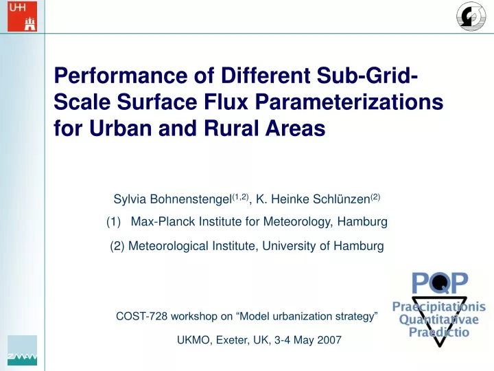
Performance of Different Sub-Grid-Scale Surface Flux Parameterizations for Urban and Rural Areas. Sylvia Bohnenstengel (1,2) , K. Heinke Schlünzen (2) Max-Planck Institute for Meteorology, Hamburg (2) Meteorological Institute, University of Hamburg

E N D
Performance of Different Sub-Grid-Scale Surface Flux Parameterizations for Urban and Rural Areas • Sylvia Bohnenstengel(1,2), K. Heinke Schlünzen(2) • Max-Planck Institute for Meteorology, Hamburg • (2) Meteorological Institute, University of Hamburg • COST-728 workshop on “Model urbanization strategy” UKMO, Exeter, UK, 3-4 May 2007
Evaporation Sub-grid-scale land-use within one grid box Parameterization of sub-grid-scale land-use • urban areas vs. rural areas: • Distinct heterogeneity (gardens next to buildings) • Sealed surfaces • Reduced evaporation • Lower wind speeds • ? Which parameterization? • ? Modify rural ones for urban areas? Land-use Northern Germany, 1km resolution
Parameter averaging Main flow Latent heat flux Grid cell
( ) = H H , H , H water sand forest flux aggregation with blending height • Model performance • parameterization • heterogeneity • resolution • meteorological situations Main flow Latent heat flux Grid cell
Sub-grid-scale land-use scheme (latent heat flux) Parameter Averaging: Flux Averaging:
Problems Problem Heterogeneity can not be resolved: non-linear effects, which contribute to box-averaged fluxes, are not captured. Evaluation showed Performance of parameterization depends on resolution and meteorological situation. Open Question? Which is the best parameterization for which meteorological situation? Is there a suitable parameterization to account for urban effects?
short timescales: very fast & efficient processes. Index with diffusion impact T = lt I lt T diff = T 6 hours lt resulting path L ( ) = = z T , with s max u ,w Figure: characteristic timescales fast process diff * * * s * slow process 94 % of episodes & ~50 % of amount Index with humidity impact = probability I I *rh rh lt Classification of meteorological situations Situations are classified with respect to their „locality“ • Index: • Indicator for local impact of surface characteristics on boundary layer processes. parameterization more important for locally driven situations • Indicator for precipitation probability.
Model area Berlin • Model area • 400 km x 400 km • Different meteorological • Situations • Parameterization scheme: • Parameter averaging • Flux aggregation with blending height • Horizontal resolution: • 16 km (control) • 8 km • 4 km
Simulated cases increasing local impact
ILT20 7 6 5 4 T-TD [°C] 3 2 1 0 0 6 12 18 -1 time [UTC] ILT10 16 14 12 10 8 T-TD [°C] 6 4 2 0 -2 0 6 12 18 time [UTC] Performance urban vs. rural areasDifference: temperature - dew point ILT40 30 25 20 T-TD [°C] 15 10 5 0 0 6 12 18 time [UTC] ILT30 20 18 16 14 12 T-TD [°C] 10 8 6 4 2 0 0 6 12 18 time [UTC] (pa04) rural (OBS) rural (fl04) rural (fl04) Berlin (pa04) Berlin (OBS) Berlin
Calculating Hitrates Variable Temperature Dew point Wind speed Wind direction Pressure - 1 (°C) temperature (m s ) (hPa) (°C) ± ± ± ± ± Accuracy A 2 2 1 30° 1.7 desired Threshold 0 to 45 - 10 to 45 1 to 8 0° to 360°, 990 to 1 100 values: wind speed - 1 minimum to above 1 m s maximum
Whole model area 40 30 20 10 0 30 20 10 0 40 30 20 10 0 40 40 30 20 10 0 bc_16km bc_08km bc_04km pa_08km pa_04km 60 50 40 30 20 [%] 10 0 dd ff te td -10 -20 -30 Changes in hitrates: compared to pa_16km „theoretically worst case“
Berlin area bc_16km bc_08km bc_04km pa_08km pa_04km 60 40 30 20 10 40 30 20 10 40 30 20 10 40 30 20 10 50 40 30 20 [%] 10 0 -10 -20 dd ff te td -30 Changes in hitrates: compared to pa_16km „theoretically worst case“
Differences in hitrates: Berlin – rural areas bc_16km bc_08km bc_04km pa_08km pa_04km 50 40 30 20 10 40 30 20 10 40 30 20 10 40 30 20 10 40 30 20 10 0 -10 -20 -30 -40 -50 dd ff te td
Differences for urban and rural areas • Wind speed rural area performs better than urban area. • Temperature rural area performs better than urban area. • Dew point • high Ilt: rural area performs better than urban. • low Ilt: urban area performs better than rural. • Wind direction • high Ilt: rural area performs better than urban. • very low Ilt: urban area performs better than rural.
Conclusions urban vs. rural areas • Humidity differences between urban and rural areas • In general METRAS more humid than measurements except wet situation Ilt 20 initialisation of soil moisture needs to be checked • Observation: pronounced offset (urban area mostly less moist than rural) • METRAS: smaller differences between urban/rural areas • BC has a more pronounced daily cycle than PA • Urban (heat) dryness island? • Observation: • urban area dryer in most cases • dryness maximum later in the afternoon in urban than rural area. • METRAS: • difference urban/rural much smaller than observation too few sealed surfaces? • dryness maximum as in rural area re-check land use data for the urban.
Conclusions for whole model area • In general: • per resolution: results with blending height concept are better than with parameter averaging. • Increasing resolution: does not necessarily improve model results. • Wind: • less sensitive than temperature (& dew point) to parameterization and resolution. • parameterization and resolution more relevant for higher than for lower Ilt values. • Temperature (& dew point): • general relation on meteorological situation (Ilt) not found. • performance depends on parameterization and resolution for meteorological situations with low RH other classification parameter needed!
Final conclusions & Outlook • Flux aggregration is superior in most cases. • Nesting in ECMWF-Analysis data. • Check of land-use data. • Improvement of soil water initialisation (dependent on previous dryness/wetness period).
Acknowledgements • Many thanks to Frank Beyrich (DWD) for preparing and providing data and helpful discussions. • Data were kindly provided by the „Deutscher Wetterdienst“ (DWD) and „BADC“. • This project is partly funded by SPP 1167.