Download
1 / 39
390 likes | 525 Views
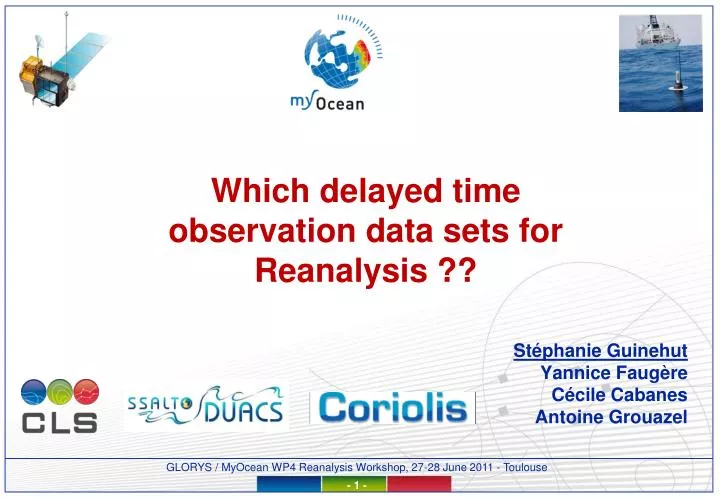
Which delayed time observation data sets for Reanalysis ??. Stéphanie Guinehut Yannice Faugère Cécile Cabanes Antoine Grouazel. Introduction. Observations are essential components of reanalysis project for assimilation : for validation :

E N D
Which delayed time observation data sets for Reanalysis ?? Stéphanie Guinehut Yannice Faugère Cécile Cabanes Antoine Grouazel
Introduction • Observations are essential components of reanalysis project • for assimilation : • for validation : • - climatologies (T/S, U/V, MLD), current meters, ADCP, transport estimates, surface drifters, tide gauges, OC, Sea Ice (drift, concentration) … • Sea level anomalies from satellite altimeter : • - 3 sources of data: Fr, EU space agencies + Navy • - main challenges = processing : to extract a SLA from the altimeter instrumental measurement + consistency during all the life time of one mission & between the different missions / MDT • In-situ T/S profiles : CORA3.2 data set • - many sources of data : many data centers, many projects, many types of instrument • - main challenge : to qualify all these individual profiles • - !! Need to detect / correct for systematic errors, instrument failures • SST from satellites • Many products exist : summary of a comparison study performed as part of MyOcean WP4 activities
Sea level anomalies from satellite altimeterMyOcean SL TAC – SSALTO/DUACS system and productsFocus on the REProcessed data for assimilation Yannice Faugère
Level 2 products from all agencies Overview of the DUACS system • DUACS stands for Developing Use of Altimetry for Climate Studies • It is an operational production system (since 1998), and the name of a family of Level 2P to Level 4 altimeter products • Originally a EU project, it’s now part of the CNES SSALTOground segment and used in the MyOcean project • 2 components: • Near Real Time (NRT): objective is to provide operational applications with homogeneous and directly usable high quality altimeter data from all missions in operations • Delayed Time (DT), objective is to maintain a consistent altimeter climate data record using the state-of-the-art recommendations from the altimetry community • DT data set has been entirely reprocessed (REP) last year Multimission Level 2P/3/4 products
The DUACS REP dataset – Input data • GDR data from all altimeter missions • 7 missions have been used for last REP • The total time series corresponds to ~60 years of cumulated data
The DUACS REP dataset – Input data preprocessing • 7 missions with almost 7 sets of standards (except on recent products) • Homogeneity is a strong requirement for the users: between the missions, over time • Necessary to complement L2 dataset : • Updates instrumental correction, orbit solution, reference surfaces, … 30 types! • Use of the most recent standards Mean (left) and stdev (right) of New (GSFC) orbit - GDR Orbit on TP whole mission -2 cm 2 cm 0 2 cm Centimetric systematic and/or variable errors in the TP GDR product that would be partly assimilated without updates of the latest orbit available
Standards of the SSH components for the 2010 reprocessing Fully documented in the User Manual
The DUACS REP dataset – Input data Calibration/Validation • Validation activities of altimetric measurements are essential to estimate the performance of altimetric missions, consolidate the reliability of altimeter missions, quantify the evolution and improvements of altimeter • These activities are crucial to obtain high quality REP products • These validation activities consists in • Global internal analyses: Ensure the internal consistency of altimetry data and sea-level estimation from validation diagnostics derived from one mission • Global multi-mission comparisons: Measure mainly the sea-level consistency between different altimetry missions as global and geographical biases or drift for instance. • Global altimetry and In-situ data comparison : Measure the sea-level consistency between different altimetry missions and in-situ data which are independant : tide gauge networks, ARGO profiles. Estimation of the GMSL from all the altimetry missions from 1993 to 2010
The DUACS REP dataset – Processing • Editing process: to detect and remove the erroneous measurements • Mono satellite orbit error reduction • Multisatellite orbit error reduction based on dual crossover minimization of all the satellite on a reference mission (now Jason-2) • Estimation and correction of residual Long wave length error • Along track filtering and sampling RMS of SL variability for ERS-1 (from Le Traon and Ogor, 1998) Before OER After OER
The DUACS REP dataset – The REP products • 3 families of DUACS product : • The Reduced GDR or CorSSH (L2P): possibility to choose a specific corrections • Along track SLA products (L3): along track product, various resolution, and various processing • Multimission maps (L4): Merges the information of all the satellites • - Reference series (constant 2-satellites since 1993) • Update: uses all sensors available • Several kind of frequency: weekly, monthly, + daily test dataset available • Frequency of the updates : • Time series updated every ~6 months • The whole reprocessing is performed every ~2 years • The L3/4 products available for the Global Ocean and for Regional Seas with specific tuning: Mediterranean Sea and Black Sea. New regions will be available next year (Arctic, North West Shelves) « intermediate »
The DUACS REP dataset – Final product validation MSL trend differences between new and old DT data set (mm/year) • Internal consistency of the DUACS DT series which allows us to measure the intrinsic performances of altimeter system at different spatial and temporal scales (SSH at crossovers, along-track statistics, global and local MSL trends…) • External altimetry data and diagnostics are generated. In this case, the tools are based on comparisons between altimeter and in-situ measurements in order to detect drift in altimeter SSH with external and independent data MSL L4 DT – MSL Tide Gauge For more details see : http://www.aviso.oceanobs.com/fileadmin/documents/OSTST/2010/Pujol_DUACS.pdf
The DUACS REP dataset – Summary • The use of reprocessed data is crucial for model reanalysis: • A 60 years – data set • Recent altimetric standards, correction, calibration, intermission biases • Homogeneity of the standard for all the missions • Temporal homogeneity • The Validation and Calibration activities are crucial to : • Reduce the unavoidable errors of the input (GDR) data (biases, drift, …) • Select the best correction • Allows to have the accuracy needed for the climate applications • The DUACS reprocessing exercise is a complex and heavy process. All the DUACS processing steps have to be applied again • nominal frequency every two years • Any feedback from the users welcome !!!!
The ocean Mean Dynamic Topography Marie-Hélène Rio • Very important referenced surface needed for SLA assimilation • May be computed from OGCM runs, climatological fields, inverse modeling, combination of altimetry and gravity (GRACE, GOCE… but only at large scales (>100km with GOCE)) • The use of an observation-based MDT has proved to improve both the analysis and the forecasts of OGCM assimilating SLA • Do this group needs/wants to use the same MDT ???
The ocean Mean Dynamic Topography • Latest « observed » solution computed at CLS (as part of the SLOOP project) = the CNES-CLS09 ¼° MDT from altimetry, GRACE geoid model, and in situ measurements (drifters/ARGO) for the 1993-2008 time period The CNES-CLS09 MDT (Rio et al, 2011) cm • Further improvements are expected with the use of the new GOCE geoid models, improved altimetric Mean Sea Surface (CNES-CLS11, DTU10) and updated in-situ dataset of Argo and drifters
T/S profiles from in-situ observationsThe CORA3.2 data set MyOcean INS TAC – Coriolis data center Cécile Cabanes Antoine Grouazel
Description of the CORA data set • Temperature and salinity profiles at observed levels • Global data set for the 1990-2010 periods (CORA3.2) • Corresponds to an extraction of all in situ T and S profiles from the Coriolis database at a given time • Updated on a yearly basis with several processing steps : • Distributed as part of MyOcean (next week!) • Addition of new profiles – duplicate check • Update of existing profiles (raw adjusted parameters) • Quality control • Specific processing: XBT fall rate correction
Data types and sources • 7 data types : • PF files : Argo profiles (RT&DM) • XB files : high res. XBT profiles from research vessels and GTSPP • CT files : CTD high res. profiles from research vessels + sea gliders data + marine mammals data received from MNHN • OC files : high resolution CTD profiles from WOD09 • MO files : TAO, TRITON PIRATA data received in real time • BA and TE files : low resolution profiles received from GTS
Data types and sources temperature salinity CORA3.1 • High frequency coastal moorings large number of stations in ‘TE’ files • XBT stations from GTSPP have been added in this new version of CORA • WOD05 WOD09 for high resolution CTD • A large number of Argo profiles have been processed in DM between the two releases
Quality Controls : two steps 1. TESTS CLS • 2. CHECKS of the WHOLE database • follow platforms with recurrent alerts • analyses of AO residuals
Plateforme : 3900062 θ S TEMP PSAL Quality Controls • 1. Automatic tests (CLS) : • values outside regional limits, values=0, constant along a profile • comparison to climatology ( > 10 σ) (WOA09) + systematic bias compared to climatology • Large salinity gradient at the surface • All suspicious profiles are visually checked and QC flags are modified if necessary • 2. Checks of the whole database : • Anomaly Method test : Bias > 7 sigma over at least half of the profile values • Objective Analysis test : statistical test involving an objective analysis method and based on residual analysis (Gaillard et al., 2009) • Argo platform control : Argo floats with recurrent alerts as well as Argo floats pointed out by the altimetry test (Guinehut et al., 2009) are visually checked over all their life period Check of the Argo platform over all its life period
CORA 3.1 flag =1 flag= 3 clim +/- 5 STD Quality controls: feedback from GLORYS2V1 (N. Ferry) • Suspicious profile detected by comparison with the model solution : • ~ 50 % of the 1993-2007 alerts confirmed after visual check and corrected in CORA3.2 • This kind of feedback can help to improve previous tests • Your feedbacks are important and really welcome !!!!
Update of existing profiles : temperature, salinity, pressure corrected from a drift or an offset etc… CORA database not only contains the raw parameters but also the adjusted parameters if it exists • Argofloats : the adjusted parameter is mainly the salinity corrected in delayed mode by the PI of the float (Owens and Wong method) – but also the pressure About 75% of Argo Data is processed in delayed mode in CORA3.2 Up-to-date compared to the GDAC Argo data sets
After correction Median bias before correction Depth 0 Specific processing: correction of XBT fall rate • Many corrections available – choice of the home made one: empirical correction developed by M. Hamon : • “M. Hamon, P. Y. Le Traon, and G. Reverdin: Empirical correction of XBT fall rate and its impact on heat content analysis, Ocean Sci. Discuss., 8, 291-320, 2011.” • Collocation method between XBT and ARGO or CTD profiles from CORA • Statistical corrections computed for each year and different classes of probes: • Correction of a thermal bias : Txbt = Txbt-Toff (due to possible errors on the calibration of the probe and obtained with selected profiles with a weak T gradient in the upper layer) • Correction of the deph bias : Ztrue= Zobs( 1-A-B*Zobs)-Zoff (due to too simple approximation of the XBT fall rate) Median temperature bias between XBT and collocated CTD or Argo Total number of XBT Number of collocated pairs (1° lat, 2° lon, 15 days) -0.02
CORA3.2 – Summary • CORA3.2 = more than 5 million profiles • First challenge : to gathered all the individual profiles ! • Second challenge : to qualify them ! • Third challenge : to be up-to-date with common corrections/adjustments • In-situ data sets: alive datasets : new validation tools, detection of a failure on a sensor, on a datasets … delayed time processing needed to correct drift, offset … • Any feedback from the users welcome !!!!
SST from satellite Comparison study performed as part of MyOcean WP4 activities Stéphanie Guinehut
8 SST products to be compared • Over the year 2008
Differences between 2 analysis • Spatial scales resolved :
Differences with Ostia • Differences with Ostia – mean over the year 2008:
Differences with Argo • Annual zonal mean of the differences Argo-SST
Differences with Argo • Annual zonal rms of the differences Argo-SST • Ostia* • Reynolds AVHRR-AMSR • Odyssea • RTG • * more resolution requested
Global mean averaged values • No mask / without OdysseaOdyssea mask From Balmaseda & al.
Which delayed time observation data sets for Reanalysis ?? • Long time series : reprocessing are always complex and heavy processes – real need to be up-to-date with the last standards - up-to-date with commons correction/adjustments • Still uncertainties on certain data sets (XBT fall rate, Argo floats, new sensors …) – it is important to know exactly which data sets are used! • When several datasets available: which one to choose ?? Preliminary studies needed • With the improvement of the reanalysis outputs – they can be used as new tools for validation / intercomparison Any feedback from the users welcome !!!!
… • …
The ocean Mean Dynamic Topography • Very important surface reference needed for SLA assimilation. • May be computed from OGCM runs, climatological fields, inverse modeling, combination of altimetry and gravity (GRACE, GOCE… but only at large scales (>100km with GOCE)) • The use of an observation-based MDT has proved to improve both the analysis and the forecasts of OGCM assimilating SLA. • For years, CLS has been working on computing « observed » MDT (combination of gravity, altimetry and in-situ measurements (ARGO, drifters…)
Latest « observed » solution computed at CLS: the CNES-CLS09 ¼° MDT from altimetry, GRACE geoid model, and in situ measurements (drifters/ARGO) for the 1993-2008 time period The CNES-CLS09 MDT (Rio et al, 2011) cm • Further improvements are expected with the use of the new GOCE geoid models, improved altimetric Mean Sea Surface (CNES-CLS11, DTU10) and updated in-situ dataset of ARGO and drifters
The ocean Mean Dynamic Topography MSS CNES-CLS10 – ITG-GRACE2010s, 100km low-pass filtered cm
The ocean Mean Dynamic Topography MSS CNES-CLS10 – GOCE, 100km low-pass filtered cm
Impact of removing or not Ekman currents from drifter velocities on the final CNES-CLS09 MDT estimate cm
Ekman model used in the CNES-CLS09 MDT computation (Rio et al, 2011) to extract the SVP geostrophic velocities