Download
1 / 19
710 likes | 1.25k Views
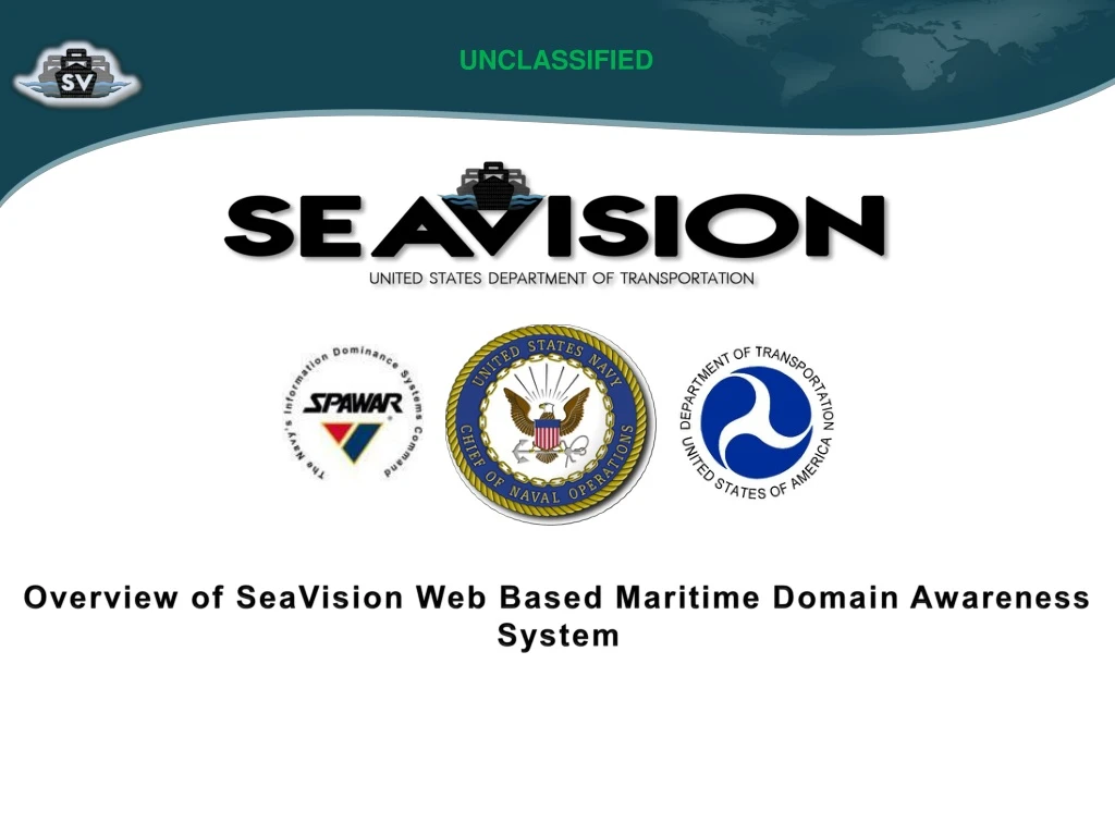
UNCLASSIFIED. Overview of SeaVision Web Based Maritime Domain Awareness System. Introduction. SeaVision is an unclassified web-based Maritime Domain Awareness tool which allows users to: Visualize vessel positions and tracks on a map.

E N D
UNCLASSIFIED Overview of SeaVision Web Based Maritime Domain Awareness System
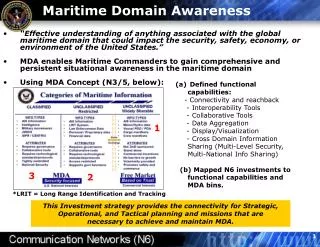
Introduction • SeaVision is an unclassified web-based Maritime Domain Awareness tool which allows users to: • Visualize vessel positions and tracks on a map. • Sources include terrestrial AIS, satellite AIS, coastal RADAR, and satellite imagery based positions. • View vessel details (i.e. owner, operator, port visit history). • Filter vessel based on wide range of parameters. • Perform and view the results of automated analysis including: • Complex searches with multiple criteria. • Automated real time alerts. • User define rules to quickly identify high priority vessels. • Vessel risk scores • Automated correlation of multiple data sources.
SeaVision Map • The SeaVision Map provides users with the ability to view & track information about vessels in both near real-time & historical contexts, with advanced filtering & search capabilities.
SeaVision Dashboard • The SeaVision Dashboard enables users to create user-defined rules, user defined alerts, and to view vessel Warnings Score details.
SeaVision Filters • SeaVision provides the ability to filter data based on: • Vessel Type. • Risk level/score. • Alert status (view vessels which match user defined alerts). • User defined rule status (view vessels which match user defined rules). • Custom vessel (filter/view vessels on custom.
Viewing Vessel History Trails • SeaVision allows visualization of history trails up to 90 days long. • Can view multiple history trails simultaneously. • Can export history trails for additional analysis. • Individual position reports in history trail are shown as red triangles. • Each one has date/time stamp.
Viewing Vessel Information • Data bubbles (baseball cards) display AIS information, USCG warning scores, and a picture, and have links to CVISR data (details), port and EEZ history, warning details, and links to enable/disable the history trail for the vessel and to add/remove it from the users custom vessel list.
Viewing Vessel Details • Clicking on “Vessel Details” will pull up an additional view with details including: • Owner, operator, builder. • Registration and P&I club. • Ship crew nationality. • Port State control. inspection and detention data. • Casualty history. • Changes in information (i.e. owner, operator, etc).
SeaVision Search • SeaVision provides ability to conduct complex searches with multiple criteria. • Search results can be exported or displayed on the map.
SeaVision Automated Alerts • SeaVision provides the ability to set up automated real time alerts. • Can add as many AIS constraints as desired. • Can receive automated email alerts when vessels match conditions.
SeaVision Automated Alerts • Results can be displayed in tabular form and on the map. • Alert results and definitions can be exported/imported.
SeaVision Automated Alerts • SeaVision Alerts results displayed on the map.
Automated USCG Port State Control Targeting Prioritization/Score Calculation • Priority scores calculated automatically based on data from following sources and targeting matrix. • IHS World Registry of Ships. • Port calls derived from AIS. • Calculated for all ships with an IMO. • Roughly 70k vessels. • Scores updated twice daily. • Ships defined as Priority I, Priority II, or Not a Priority Vessel. • Score details presented to user and score calculation is configurable.
SeaVision Warning Scores • Port State Control targeting matrix for Priority Color coded for simple visualization. • Red: Priority I • Yellow: Priority II • Green: Not A Priority • Warnings Overview link provides detailed break down of warning scores.
SeaVision Warning Score Details • Vessel warning score details break down.
SeaVision User Define Rules • Each rule has weight/score defined by user which represents it’s importance. • Allows user to define rules which are run automatically every 12 hours.
SeaVision User Define Rules • Results provide a prioritized list and score for vessel matching user rules. • Vessels with highest scores matched the most rules. • Results can be exported and viewed on the map.
SeaVision Automated Correlation • SeaVision automatically correlates coastal RADAR and AIS and satellite imagery based vessel contacts and AIS. • Allows the user to quickly identify uncorrelated targets. Correlated Satellite SAR imagery contact Uncorrelated Satellite SAR imagery contact
Questions Ms. Tate Radlinski SeaVision Program Manager Office of the DoD EA for MDA Tate.Radlinski@navy.mil