Download
1 / 12
120 likes | 284 Views
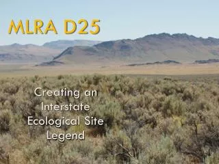
Core Geospatial Data Layers for Soil Survey Management Areas. MLRA Region 13. Core Geospatial Data Layers. October, 2007 distribution to all MOs Data sets delivered on a 1 Tb hard disk. Original distribution included NED, SSURGO, NHD, and miscellaneous (TeleAtlas) features

E N D
Core Geospatial Data Layers for Soil Survey Management Areas MLRA Region 13
Core Geospatial Data Layers • October, 2007 distribution to all MOs • Data sets delivered on a 1 Tb hard disk. • Original distribution included NED, SSURGO, NHD, and miscellaneous (TeleAtlas) features • Distribution in file geodatabase format • SSURGO was current as of August, 2007 • Elevation derivatives generated • Data were extracted for SSO areas
V’ger Learn all that is learnable. Transmit that information back to the Creator.
ArcCatalog ArcCatalog Windows Windows
Data contents • Disk partitioned for National data sets and MO-wide data sets • National Datasets • NED == 60.2 Gb • SSURGO == 79.1 Gb (33,678,443 polygons) • NHD == 8.8 Gb (16,859,511 vector records) • MO-13 Datasets • NED == 7.1 Gb • SSURGO == 32.8 Gb (3,562,729 polygons) • NHD == 0.5 Gb (1,064,894 vector records)
Data provided to SSOsClipped to 50 km buffer of MMA • USGS National Elevation Dataset (NED) • 30 meter DEM • Slope • Hillshade • USGS National Hydrologic Dataset (NHD) • Streams • Water bodies
Data provided to SSOs • Soils • SSURGO download from Soil Data Mart in August, 2007 • STATSGO • Soil Survey Area boundaries • National SSURGO Template tables imported to file geodatabase format
Data provided to SSOs • TeleAtlas data • Roads, streets, highways, railroads • Places • Postal boundaries • Census districts • Retail locations
Stuff you can and should do with data layers • Explore relationships in the database • Use them for developing work plans • Analyze landscape and landform patterns
Stuff you shouldn’t do with core geospatial layers • Edit line work • Worry about topology • Perform joins between survey areas