Download
1 / 1
10 likes | 103 Views
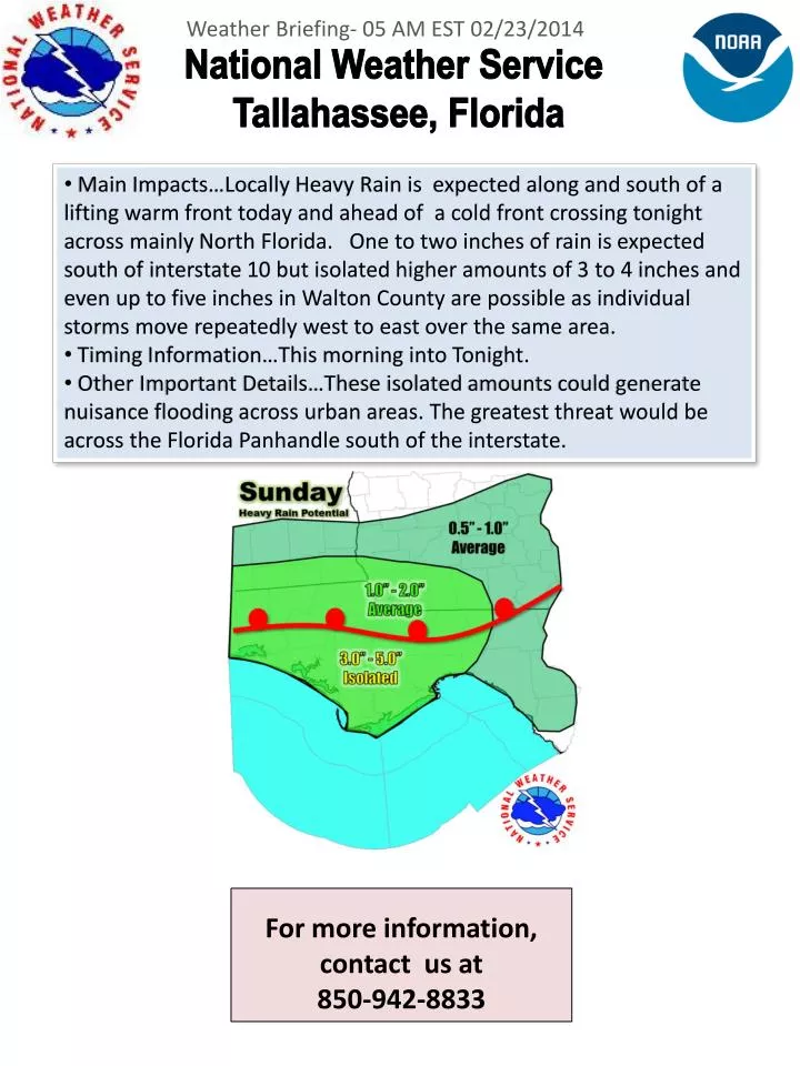
Weather Briefing- 05 AM EST 02/23/2014. National Weather Service T allahassee, Florida.

E N D
Weather Briefing- 05 AM EST 02/23/2014 National Weather Service Tallahassee, Florida • Main Impacts…Locally Heavy Rain is expected along and south of a lifting warm front today and ahead of a cold front crossing tonight across mainly North Florida. One to two inches of rain is expected south of interstate 10 but isolated higher amounts of 3 to 4 inches and even up to five inches in Walton County are possible as individual storms move repeatedly west to east over the same area. • Timing Information…This morning into Tonight. • Other Important Details…These isolated amounts could generate nuisance flooding across urban areas. The greatest threat would be across the Florida Panhandle south of the interstate. For more information, contact us at 850-942-8833


![For more information contact [insert name]: ext. 9999](https://cdn0.slideserve.com/757821/slide1-dt.jpg)
![For more information contact [insert name]: ext. 9999](https://cdn0.slideserve.com/762208/slide1-dt.jpg)


![For more information contact [insert name]: ext. 9999](https://cdn1.slideserve.com/3003648/slide1-dt.jpg)