Download
1 / 12
120 likes | 208 Views
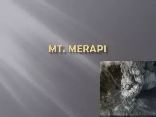
Determination of mechanical discontinuities at Merapi summit from kinematic GPS. F. Beauducel 1 , M. Agung Nandaka 2 , G. Florsch 1,3 , J. Ammann 1 , P. Mourot 2 , F.-H. Cornet 1 , M. Diament 1 1 Institut de Physique du Globe, Paris 2 Volcanological Survey of Indonesia, Yogyakarta

E N D
Determination of mechanical discontinuities at Merapi summit from kinematic GPS F. Beauducel1, M. Agung Nandaka 2, G. Florsch 1,3, J. Ammann 1, P. Mourot 2, F.-H. Cornet 1, M. Diament 1 1 Institut de Physique du Globe, Paris 2 Volcanological Survey of Indonesia, Yogyakarta 3 École Nationale Supérieure des Arts et Industries, Strasbourg
Plan • Introduction • Deformations modeling • Methodology: rapid static + kinematic • First results: Dec. 1999 - March 2000 • Conclusions & perspectives
Eruption: Magnitude? Direction? Rock slope problem: Localization? Volume? Type of source: Magmatic? Phreatic? Introduction Prediction = monitoring + interpretative model
Fluid transport (magma, gas, water) Numerical models need boundary conditions: Internal substructure geometry Source parameters Deformation modeling (1) Why does a volcano deform?
3-D mixed boundary elements method: quasi-static elastic discontinuities Merapi since 1993: evidence for fractures involvement local not elastic behavior Deformation modeling (2) [Beauducel et al., JGR, 2000]
Methodology (1) • Needs for rock slopes monitoring: • dense geodetic network • brief field campaigns at summit • Proposed solution: • GPS dual-frequency small receivers • Very short baselines (< 500 m) • Kinematic / rapid static processing • Automatic routines for interpretation
Kinematic GPS ~ 50 benchmarks 2-min. measur. n < 5 cm precision Rapid Static GPS 7 benchmarks 15-min. measur. < 1 cm precision Both 1-s sample rate Methodology (2) Ref.
Trajectories: Marks detection Positions extraction (3 components + STD) Automatic naming for new points Methodology (3)
Combination: Rapid static baselines Differential kinematic baselines (from point to point) Adjustment: Geocentric referential Least square linear system solving Methodology (4) AX = B + E X = (ATV-1AT)-1ATV-1B A = partial derivatives B = observations V = covariance matrix X = unknowns
Conclusion & perspectives • Residues after adjustment < 1.5 cm for the entire network and 3 components • No significant displacement from Dec. 1999 to March 2000 • Field strategy: • 2 trajectories + 3 static baselines • Campaigns every 1-2 month (VSI)