Download
1 / 24
240 likes | 663 Views
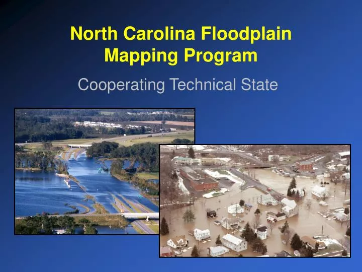
North Carolina Floodplain Mapping Program. Cooperating Technical State. State Response / Strategies.

E N D
North Carolina Floodplain Mapping Program Cooperating Technical State
State Response / Strategies • Strategy 1-Establishment of a statewide program to acquire, process and disseminate current, accurate, and detailed elevation data, flood hazard studies, reports, and maps (hard copy and digital). • Strategy 2-Establishment of North Carolina as a Cooperating Technical State (CTS) through the FEMA Cooperating Technical Partners Program. This designation would establish North Carolina as the custodian of the Flood Insurance Rate Maps.
Program Objectives and Deliverables • New / up-to-date / improved Flood Insurance Rate Maps: • Study on a Basin by Basin • Issued on a Countywide Basis • New DFIRMs (new H&H studies) for all North Carolina by FY 2007-08 • New detailed, accurate elevation data • Reduction of time needed for post-preliminary review and appeals process for new FIRM maps (6 months) • Better notification and dissemination of information about new and revised maps
Program Objectives and Deliverables - continued • On-going program for updating and maintaining FIRMs • Better equipped and informed post-event mitigation activities as a result of updated flood risk maps • Cost-effective data sharing through the implementation and operation of an inter-operable Geographic Information System • Internet web application providing cost-effective upload, download, management, and dissemination of digital data and maps (24 x 7 / free access) • Implement a real-time flood inundation and forecast mapping system (flood warning)
Floodplain Mapping - Phases Phase I—blue (December 2003) Phase II—gold (December 2004) Phase III—green (December 2006)
Key Components of the New Maps - Production + + Topography Flood Hazard Data Base Data Digital FIRM =
Programmatic / Operations - Priniciples • Leverage efficient and effective technology for more efficient digital / map modernization for new maps / future updates (GIS, LIDAR, etc.) • Collect complete elevation data coverage in North Carolina • Study as many miles of stream as need and possible (1 sq. mile basin threshold / efficient limited-detail approach) • Requirement for hard copy (snapshot) and digital (living) version – different purposes, valued products for each • Emphasize / Establish digital data sharing with counties / municipalities • Leverage program deliverables to defray the overall cost and further implement other (e.g. flood warning) • Strong, upfront community involvement and buy-in • Documentation is Required (Business Rules and Procedures) • No new wheels – Share everything / Co-opetition
Data Acquisition – Public vs. Private • Assessment / scoping of map needs (State of NC / NC Communities) • Digital base maps (State of NC / NC Communities) • Acquisition of elevation data (RFQ) • Engineering studies (RFQ) • Digital flood insurance rate maps (RFQ) • Quality assurance/quality control (Geodetic Survey / 3rd Party) • Information technology architectural design and implementation (RFQ) • Real Time Flood Forecasting and Inundation Mapping (State of NC / FEMA / USGS / NWS)
Current Program / Operations - Structure • NCFPMP has established a distributed program structure utilizing multiple agencies as leads: • NCFPMP – Overall program/policy developmentand management, contractual management, operations management, H&H analysis, scoping, outreach, post-preliminary • NCGS – (lead partner) Elevation acquisition, elevation quality control (3rd party, independent surveyors • NC CGIA – (lead partner) Base map acquisition / review, DFIRM review, IT design and implementation • FEMA – Overall CTP partner, concurrence on policy and maps, post-preliminary (regulatory responsibilities), financial support • Dewberry – H&H concurrence review, DFIRM and DFIRM database concurrence review, community mapping needs / scoping support, program and policy support • CTS Committee – policy / program direction (advisory), program / product feedback, inter-agency coordination and collaboration
Current Program / Operations – QA / QC • NCFPMP has established a distributed QA / QC program structure utilizing multiple agencies as leads: • QA / QC for elevation data –NCFPMP / NCGS / 3rd party surveyors / FEMA-Dewberry • QA / QC for DFIRM panels, database, reports –NCFPMP, CGIA, FEMA-Dewberry • QA / QC for Hydraulic & Hydrologic studies -NCFPMP, FEMA, and Dewberry • QA / QC for Information Technology Infrastructure –NCFPMP, CGIA, IRMC, FEMA
CTS Program Steps / Milestones • August 15, 2000, North Carolina General Assembly reallocates $23.2 million from Hurricane Floyd Reserve to Floodplain Mapping – Phase I • September 15, 2000, State of North Carolina and FEMA signed MOA transferring primary responsibility for NC FIRMs to North Carolina • October 2000, North Carolina holds first CTS Committee Meeting • November 2000, qualified two prime firms (WSC and G&O) to do the elevation acquisition, engineering and surveying, DFIRM generation, IT design and implementation • January 2001, issued first delivery orders to both firms for elevation acquisition for Phase I area
CTS Program Steps / Milestones • September 2001, General Assembly transferred NCFPMP from OSBPM to CCPS, sending NC CGIA and NCGS to DENR • November 2001, North Carolina General Assembly reallocates (through legislation) $ 9.0 million from Hurricane Floyd Reserve to Hurricane Floyd Reserve – Phase I and II • January 2002, OSBM puts hold on all state funds due to budget shortfall • January 15, 2002, Onslow County maps are submitted to community (post-preliminary process) • April 30, 2002, North Carolina Floodplain Mapping Information System (NCFMIS) is certified by IRMC and goes live on the web • September 2002, National Weather Service Flood Warning Grant approved
CTS Program Steps / Milestones • October 2002, North Carolina General Assembly reallocates (through Appropriation Bill) $ 9.0 million from Hurricane Floyd Reserve to Hurricane Floyd Reserve – “To be used to leverage / maximize federal and state funds to continue the Floodplain Mapping Program” • November 2002, Issue Delivery Order for Scoping Tool / Application to be used in Phase II • March 2003, Qualified two additional Prime Engineering Firms (AMEC and Arcadis) • December 2003, Submitted Draft State Map Modernization Business Plan (2004-09)
Map Modernization Plan FY 2004-09
Phase II – Scope of Work • Elevation Acquisition – 16,372 square miles (25 cm vertical accuracy to bare earth) • Hydrologic and Hydraulic Modeling – 13,100 linear miles (detail, limited-detail, redelineation) • DFIRM Panel Production – ~3,645 panels (1:500 and/or 1:1,000 scale) • DFIRM Database / FIS Reports – 45 counties (whole or partial) / GIS and non-GIS interoperability • Information Technology (FMIS) – • Transition from FMIS to AHMIS (e.g. Flood Warning, Spill Modeling, Technological hazards, HAZUS integration) • Multi-Hazard Mapping Portal – Local and Federal WM services data • Engineering and Inventory Data upload and download • LOMCs submittal, processing, mapping application • Real Time Flood Forecasting and Inundation Mapping – Phase II (Cape Fear, Roanoke, Yadkin, etc)
Future Delegation of FEMA Work to NC • Delegation of LOMCs receipt, processing and mapping • Post-Preliminary Processing - Mapping Resolution • Printing and Mailing of Preliminary and Effective Maps
RFQ Highlights / Contractual Approach • NC FPMP intends to award one IDIQs to a private sector engineering firm • Selection based on demonstrated competence and qualifications (G.S. 143-64.31) • 2 year contract with three / 1 year renewal options • No joint ventures allowed / Prime Firms • Letter of qualifications due by April 13, 2004 • An evaluation of the submitted letters will be conducted • A short list of firms will be determined with subsequent interviews be held between May 2004 • All firms submitting Letters must be equipped with manager(s) licensed as a Professional Engineer with the NC Board • Contractor must have primary contract office within 25 miles of the State Government Complex in downtown Raleigh, N.C. within three months of contract signing.
RFQ Highlights / Contractual Approach • Firms are required to identify project team members and their specific proposed roles on the project. • Regarding the evaluation of qualifications, note the emphasis placed on project management, quality control, and capacity (experience and manpower) for doing the work. • All work must meet FEMA requirements and meet or exceed North Carolina defined requirements (IT / Database) • Vertical Management Approach • Bi-weekly joint contractors meeting • CTS Committee Meeting
Visit the State’s Web Site: www.ncfloodmaps.com Thank You.