Download
1 / 13
130 likes | 213 Views
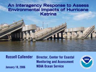
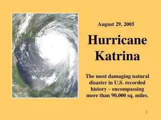
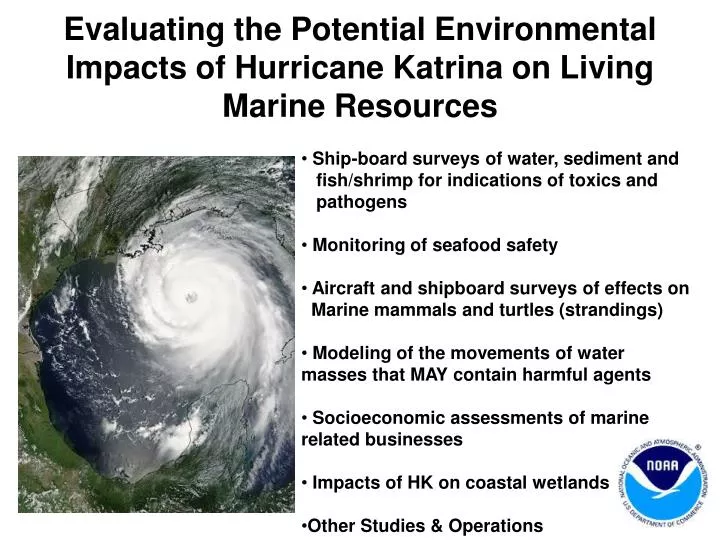
Evaluating the Potential Environmental Impacts of Hurricane Katrina on Living Marine Resources. Ship-board surveys of water, sediment and fish/shrimp for indications of toxics and pathogens Monitoring of seafood safety Aircraft and shipboard surveys of effects on

E N D
Evaluating the Potential Environmental Impacts of Hurricane Katrina on Living Marine Resources • Ship-board surveys of water, sediment and • fish/shrimp for indications of toxics and • pathogens • Monitoring of seafood safety • Aircraft and shipboard surveys of effects on • Marine mammals and turtles (strandings) • Modeling of the movements of water masses that MAY contain harmful agents • Socioeconomic assessments of marine related businesses • Impacts of HK on coastal wetlands • Other Studies & Operations
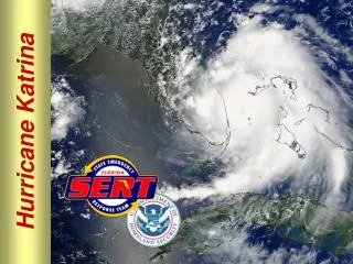
Looking for Evidence of Potential Movement of Toxics & Pathogens NOAA MODiS Coastwatch Imagery – TUESDAY 13 September
Gear: CTD Rosette Sampler Bottom Grabs Fish/Shrimp Trawls Phytoplankton CCMA-NOS NOAA Ship NANCY FOSTER Cruise 9/13-9/16 2005 Sample: Water Sediments Fish/Shrimp/Crabs For: Toxic Contaminants Metals Hydrocarbons Pesticides Etc. Pathogens Bacteria Viruses Science Personnel from Miami (OAR), Seattle (NMFS), and Pascagoula (NMFS)
Ship Operations NANCY FOSTER 9/12-9/16 2005
Proposed Ship Track – Water, Sediments and fish flesh sampling Fishing Vessel Patricia Jean Bon Secour, AL and Return, 9/13/’05-9/19/’05
NOAA Fishing Community Profiles(334 communities, 75 counties, in five states)
Depicts: Fish Processors Fish Markets Equipment suppliers Residence patterns
Socio-Economic Assessments • Compile up-to-date, community-level, baseline information for measuring future regulatory impacts on: • Local and regional socioeconomic conditions • Local and regional demographic trends • Nature and extent of local and regional involvement in fishing, oil/gas, tourism, other industries • Social and economic relationships between Gulf communities • Use, and by extension availability, of inshore, near-shore, and offshore marine resources for commercial and recreational purposes • Fishing and marine-specific service and physical infrastructure • Socio-cultural aspects of life in Gulf communities Intend to repeat Elements of the Survey to assess losses of Infrastructure
Ongoing NOAA Operations & Studies • Monitoring of SEAWiFS and Shipboard Samples for potential HAB Outbreaks resulting from Karenia brevis (current HAB off West Florida) • Hydrodynamic Models being Run at AMOL (OAR) to forecast materials distribution and to direct sampling • Plan for Sustained Ops. For Contaminants Monitoring being Worked Out • Plan for Analyzing Samples and Reporting to the Public being Finalized • Wetlands Loss Analysis being Undertaken by NOS and NMFS • Impacts on Abundance and Distribution of fishes, crabs and shrimps to be assessed in ongoing bottom trawl cruises in October • Coordination of Activities with COE, USGS, EPA, and NSF