Download
1 / 16
160 likes | 226 Views
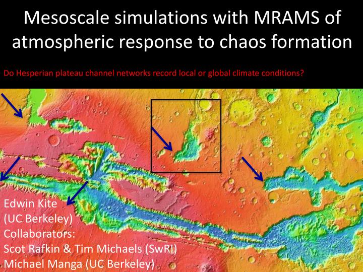
Do Hesperian plateau channel networks record local or global climate conditions?. Mesoscale simulations with MRAMS of atmospheric response to chaos formation. Edwin Kite (UC Berkeley) Collaborators: Scot Rafkin & Tim Michaels (SwRI) Michael Manga (UC Berkeley). Outline.

E N D
Do Hesperian plateau channel networks record local or global climate conditions? Mesoscale simulations with MRAMS of atmospheric response to chaos formation Edwin Kite (UC Berkeley) Collaborators: Scot Rafkin & Tim Michaels (SwRI) Michael Manga (UC Berkeley)
Outline Channels on the Valles Marineris plateau: formed by chaos storms? The Mars Regional Atmospheric Modeling System (MRAMS) Boundary conditions Results
Plateau channel networks 1.5km • Remarkably late in Martian history • Overlie Late Hesperian lavas • Main epoch of valley network formation tightly constrained to Late Noachian – Early Hesperian (Fassett & Head, JGR, 2008) • Associated with opal, ‘jarosite’ bearing light-toned layered deposits • Sometimes inverted relief • No HiRISE-resolved clasts • Multiple periods of flow; in places, flow direction changed over time • Strong evidence for precipitation, not groundwater • Drainage density, branching order, tributaries extend to near ridges • Phase (rain vs. snow) not clear • Local, regional or global climate change? MOC NA R08-021292 Williams et al., LPSC, 2005 Milliken et al., GRL, 2008; Weitz et al., GRL, 2008 Bishop et al., JGR, 2009; Weitz et al., Icarus, in press
MEGAOUTFLO hypothesis: Vapor release to atmosphere by chaos outflows produces transient global greenhouse. - Baker et al., Nature, 1991; Baker, Nature, 2001. But hydrologic models suggest individual chaos-forming events were small. - Andrews-Hanna & Phillips, JGR, 2007 Harrison & Grimm, JGR, 2008. Therefore, a localized response to chaos formation might be expected – mesoscale, not global. - e.g., Mangold et al., 2008. Localized, chaos-induced precipitation?
Area of inverted channels Area of LLD from Weitz et al., Icarus, in press OUTFLOW CHANNEL spillway Flooding level -1000 m contour Test location: Juventae crater Forced by present-day (Ames) GCM Pressure 2x present-day Fixed lake surface temperature and elevation Surface albedo -> 0.75 when water ice lands Flooded to -1000m, just below spillway elevation Grid resolution 8.33 km (finest grid) approx. 40 CPU-days 50km
Hypothesis: Given a chaos region filled to spillway with water at 5 deg C, • Precipitation location matches mapped light-toned layered deposits • Precipitation magnitude can move sediment through mapped inverted channels. Hypothesis test with MRAMS Mars Regional Atmospheric Modeling System (Rafkin et al., Icarus, 2001) Non-hydrostatic mesoscale model Used in landing-site downselect for MER, PHX, MSL Boundary conditions supplied by GCM Nested grids (8 km resolution on finest grid) Water vapor treated as a trace gas CARMA-derived ice and dust aerosol microphysics Monin-Obukhov surface flux parameterization Modified to include ITS-90 saturation vapor pressure
X-Z section peak ~ 1.4% 42 km Atmospheric response 460 km Observed layered deposits Flooded Juventae Chasma floor MGCM, 1.25 days water release: Ls = 270°, PCO2 = 2 x PAL ALL RESULTS ARE PRELIMINARY
640 km 1.25 days Steady state zone of precipitation has been established Rates in inverted- channel area are steady
Area of channels Area of LLD from Weitz et al., Icarus, in press Mean ice precip rate in mm/hr Precipitation W-directed winds + promontory effect + rapid rainout Snow Peak value: 3.96 g/cm^2 in 1.25 days In 1 Earth year, 1200 g/cm^2 Strong precip on chasm walls expected ALL RESULTS ARE PRELIMINARY
Max. air temp from control run Max. surface temp from control run (K) At 2 x PAL CO2, conditions on the plateau permit melting of precipitated water ice With albedo 0.7, temperatures are always less than 273.15K.
Modeled precipitation rates are sufficient to move gravel through mapped channels Perron et al., JGR, 2006 dd =1.33 km-1 PSP_003724_1755
1) Physics: • Sensitivity tests show a trend of reduced vapor release with reduced grid spacing in z; • The model has an inadequately-resolved water vapor concentration boundary layer. • Treat water vapor as a bulk constituent of the atmosphere • - Pressure & virtual temperature effects of H2Ov (pressure source; different molecular mass) • Self-consistent lake thermodynamics • Wind-dependent lake surface roughness parameterization from Shieh et al., 1979 • New locations: Echus & Ganges • 2) Geology: • Are modelled precipitation rates sufficient to initiate observed channel network? • Look for additional inverted channels/layered deposits around chaos rims. • Search for opal or jarosite bearing deposits on the plateau far from candidate paleolakes • (would disprove the localized-precipitation hypothesis). Outstanding issues / Next steps
Summary Atmospheric response is “hurricane-like” - Water vapor mass ratio reaches 0.3 (>> trace) Juventae channels correspond to a local maximum in water-ice precipitation - No channels in available (CTX) images of the south chasm wall Water-ice precipitation is highly localized - Inverted channels on the Valles Marineris plateau far from paleolakes would disprove the localized-precipitation hypothesis Chaos storms can mobilize sand and perhaps gravel but not boulders. - Detection of HiRISE-resolvable clasts would be a severe challenge for the localized-precipitation hypothesis
What is the range of acceptable lake surface temperatures? • Vapor -> atm. will be small unless freezing of top of lake can be delayed -- 4.18 K for fresh water • In model, evaporative cooling ~ 2 KW/m2 -- Sensible heat cooling < 1% of total cooling • Heat sources • fracturing mixes reservoirs that are isolated by low permeability • Shear heating • Clathrate decomposition (?) • Most important: volcanic heating • Warmest (deepest) water will arrive last (Andrews-Hanna & Phillips, 2007). McKenzie & Nimmo, Nature, 1999