Download
1 / 3
30 likes | 239 Views
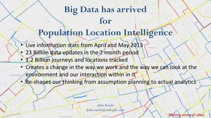
Big Data has arrived for Population Location Intelligence. Live information stats from April and May 2013 23 Billion data updates in the 2 month period 1.2 Billion journeys and locations tracked

E N D
Big Data has arrived for Population Location Intelligence • Live information stats from April and May 2013 • 23 Billion data updates in the 2 month period • 1.2 Billion journeys and locations tracked • Creates a change in the way we work and the way we can look at the environment and our interaction within in it • Re-shapes our thinking from assumption planning to actual analytics John Rands John.rands@citilogik.com Making sense of cities
Understanding traffic and Pedestrian movement Routes Transport Journeys Pedestrians • Ongoing trials with TfL with data from Mobile Operators TfL and SatNav • ESRI GIS – Geospatial Visualisation and information layering • Presenting complex data with logical views Making sense of cities
Identifying demand usage Hot-Spots Population Density • Provides a unique view of Citizen locations in London • Opens up many opportunities to combine with other data sets to improve the environment. E.g. • Combining environment sensors and hot-spot citizen locations • Property developers and transport assessment • Public services provisioning location planning • Environment Modelling with actual utilisation on 24 x 7 breakdown • Operational management….. etc. Making sense of cities