Download
1 / 28
280 likes | 285 Views
3D Elevation Program (3DEP). Vicki Lukas February 1, 2016. 3DEP Status and Plans. TOPICS. Data Acquisition Status Budget Outlook Unified Federal Approach and Best Practices Governance Structures Emerging Lidar Assessment. U.S. Interagency Elevation Inventory.

E N D
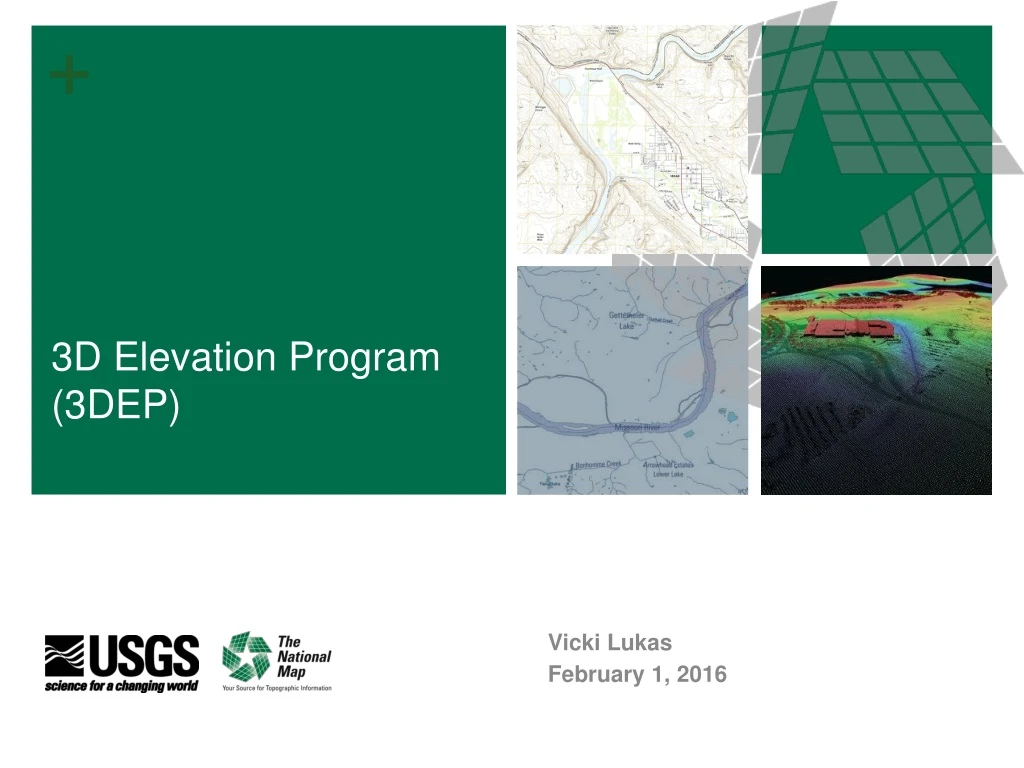
3D Elevation Program (3DEP) Vicki Lukas February 1, 2016
3DEP Status and Plans TOPICS Data Acquisition Status Budget Outlook Unified Federal Approach and Best Practices Governance Structures Emerging Lidar Assessment
U.S. Interagency Elevation Inventory Data Acquired through FY 2015 3.4% of entire US was acquiredto 3DEP quality inFY15 - includes complete, in progress, and planned/funded 13.9% of Lower 49 Meets 3DEP quality (2008-2015 only) 63.6% of AK Meets 3DEP quality (QL5 – ifsar)
FY15 3DEP Preliminary Summary Lidar Data Acquisition
FY15 3DEP Summary Alaska Ifsar • BLM, FWS, NPS, USFS and USGS provided ~$2.8M end-of-year to acquire ~25,000 square miles of ifsar in critical areas of Arctic Alaska, the Kenai Peninsula, and the Yukon Delta • Funding from all contributors totaled over $7.4M • Total square miles of ifsar acquired were 69,000, adding approximately 12% coverage, raising the State's overall coverage to 63.4% • Goal is to reach 70% coverage in FY16
FY16 Broad Agency Announcement (BAA)Project Selection In Progress • 41proposals submitted for projects in 29states + 1 territory • Total project value of $36M; $21M in partner contributions, requesting $15M3DEP funding • Coverage proposed 142,000sq mi • BAA remains open to new proposals through the year
FY16 BAA Summary to Date – Project Selection Ongoing • Additional FY16 3DEP acquisitions funded by 3DEP Federal partners are underway • FY16 increases will help increase overall totals for acquisition • BAA remains open to new proposals
3DEP Annual BAA Cycle National Public Webinars National Public Webinars Feedback provided on Pre-proposals Federal Areas of Interest Submitted BAA Released Submit Public Areas of Interest State/ Regional Public Workshops Submit Pre-proposals Submit Proposal Selections Announced BAA Contract and Grant Administration BAA Project Execution
FY16/17 Broad Agency Announcement (BAA)Potential Enhancements • Further develop the online requirements tools along with business rules to manage Federal and State/Local requirements, including definitions for requirements (prioritized), planned / funded acquisition and in-work projects • Develop a streamlined BAA option or other defined process specific to coordination and consideration of Federal-only projects • Develop a flow chart to communicate how and when Federal agencies can plug in, as well as a flow chart for other stakeholders • Online application process to streamline submittal, evaluation and application processing and servicing • Explore options to make funds available early in the fiscal year to enable the process to better meet spring acquisition deadlines • Revise BAA selection from single round to biannual or multiple selection periods to better reflect State and Local funding cycles and acquisition windows
Geospatial Products and Services Contract Summary of FY15 Funding $34.7M
3DEP Budget Outlook PRELIMINARY – Numbers to be refined Good progress, more work to do • FY16 increase: $3M for 3DEP and $1.3M for AK = $4.3M, total program $24.7M • Rough estimate - about $25M needed for an 8-year program (1/3 USGS, 1/3 other Federal, and 1/3 other partners costshare)
3DEP Unified Federal Plan and Best Practices Purpose • Best practices provide documentation and a mechanism for agencies to assess participation and to inspire further adoption of Federal enterprise practices that advance joint 3DEP coverage goals for the benefit of agency missions and the Nation as a whole Move from an opportunistic, ad hoc partnering process to a unified Federal multi-year plan for acquiring and disseminating data Attract increased participation of state, local and other stakeholders Aid the Federal community in reaching a higher level of coordinated implementation and to reduce the number of years it will take to complete national coverage
3DEP Unified Federal Plan What does it look like? • Known roles and responsibilities • Active participation in governance structure • Acquire data through the 3DEP data acquisition process (work through the 3DEP Working Group to submit areas of interest, and coordinate data acquisition throughout the year and EOY) • Agency commitment to ensure data investments support national goals • Agency enterprise coordination to participate in 3DEP • Active role in defining the acquisition process • Ensuring 3DEP-quality datasets acquired outside of the process for ingestion into national holdings • Joint funding and reporting on data investment • Help bring additional stakeholders into the plan
3DEP Federal Best Practices Benefits of a Unified Federal Plan for Investments • Reduced unit costs by pooling funding with other partners • Reduced unit costs through the economy of scale achieved through larger project sizes • Access to qualified and experienced mapping firms under contract to acquire and process data • USGS programmatic infrastructure that issues and manages data acquisition contracts, and inspects, accepts, and distributes point cloud and derived data products; reduced costs for not replicating the same infrastructure in multiple agencies • More consistent data from standardized acquisition and larger project areas • Increased state, local, tribal and other data acquisition partnerships through advance planning and earlier notification of opportunities enabled by a defined, stable Federal acquisition budget • The opportunity to “buy up” higher-quality data for specialized applications • The opportunity to receive 3DEP cost-share funding to acquire lidardata • Publicly accessible data
3DEP Federal Best Practices - DRAFT • Sign 3DEP governance memorandum of understanding (when available) • Assign agency representatives to 3DEP Executive Forum and Working Group • Acquire data through the 3DEP data acquisition process (work through the 3DEP Working Group to submit areas of interest, and coordinate data acquisition throughout the year and EOY) • Implement an agency policy to work within the Unified Federal 3DEP plan for data acquisition and sharing • Coordinate internally to link regional/field offices into 3DEP and data acquisition process • Provide input and support to improve the acquisition process • Share 3DEP-quality datasets acquired outside of the process for ingestion into national holdings • Participate in 3DEP Budget Initiatives • Report 3DEP investments to Flood Risk Budget Cross Cut (participating 9 agencies) • Promote 3DEP to agency constituents to participate in or support the national 3DEP effort
Elevation Theme Governance • 3DEP Working Group • Re-charter the NDEP committee to meet new 3DEP data acquisition approach • Formalize successful coordination group • 3DEP Executive Forum • Support A-16 coordination at executive level • Provide programmatic oversight to 3DEP Working Group • 3D Nation Elevation Subcommittee • Addresses the need for a formal A-16 theme subcommittee • Builds on existing successful coordination and establishes a formal linkage between 3DEP and IWG-OCM
Status • 3D Nation Elevation Subcommittee – Approved in December, 2015 by the FGDC Steering Committee • 3DEP Executive Forum and 3DEP Working Group Draft Charters– Next steps • Combine into one document • MOU instead of charter • Request each agency to name representatives to each group • Draft in progress • Benefit – provide more structure and accountability as we work towards unified Federal plan for 3DEP
Emerging 3D Technologies Working Group E3D-WG under the 3DEP Working Group Result of Emerging Lidar Technology Federal Roundtable meeting of 9/14 Members from USGS, NOAA, NGA, FWS, USACE, USFS, NRCS Coordination with NGA-led Lidar Interoperability Work Group (LIWG) Better understand emerging instruments: potential strengths and limitations Come to Federal consensus on whether these instruments can meet 3DEP requirements Current focus on high altitude and topobathylidar systems
Emerging 3D Technologies Working Group Emerging Lidar Technical Assessment • Study area (red outline) • 500 sq. mi. overlaps recently acquired Sandy QL2 data in Connecticut • Includes landcover and terrain variability, portions of Hartford including the main airport, and rivers and lakes to test hydro-flattening • Includes leaf-on QL2 linear lidar data acquisition (yellow outline) • Data collected in August • Study contracted through the USGS Geospatial Products and Services Contracts (GPSC) • Single Photon Lidar – Sigma Space, HRQLS • Geiger Mode Lidar – HARRIS Corp., Intelliearth
Independent Assessments Dewberry and Woolpert GPSC tasks Help acquire data Collect some leaf-on data using ‘status-quo’ system (Woolpert) Perform bare earth filtering of data and create DEMs for evaluation Perform independent evaluations of accuracy assessment Report findings and recommendations Present findings at ILMF 2016 (and follow on at ITGF 2016) Work with companies to help improve their methodologies, if data do not meet 3DEP requirements Not assessing cost in this evaluation - only performance
Vertical Accuracies A major objective of this evaluation is to assess absolute horizontal and vertical accuracy
Preliminary Observations Assessment is ongoing Point densities and relative accuracies more than adequate Non-vegetated vertical accuracies are within specification Concerns about point densities and vertical accuracies under dense vegetation Non-compliance of attributes for USGS Lidar Base Specification 1.2 - must be worked through the 3DEP-WG and the broader community to develop policy and adapt specification and file formats E3D-WG is conducting its independent review of the data to confirm this and/or to identify any additional issues – presenting results at ILMF Overall the technology shows potential - warrants additional testing and next steps – need to continue to learn about, adapt to, and help these systems come in to full compliance with our specifications
THANK YOU MAPPS Let’s Make 3DEP a Reality! • Guiding principles of the vision includethat we recognize and value: • The role of public/private partnerships • The inherently governmental responsibility of maintaining a lean core competency, while leveraging the expertise and capacity of the private industry • The essential USGS role in acquiring critical public domain data that can be accessed, value-added, and underpin a host of new and evolving uses and technologies • The role of the private industry in provisioning the data, maintaining the operational expertise and capacity, future sensor development, and increasing new applications • The USGS role as the lead Federal agency for elevation to create a National program that results in quality and consistency while reducing/eliminating duplication • Together we have crafted are and implementing a vision that is a model public/private partnership and good government story • We greatly appreciate MAPPS and its members for its role in getting us to this point • We look forward to your continued cooperation and mutual support as we work together to achieve the bold goals of the 3D Elevation Program